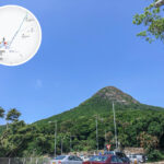
🛣️【Clear Water Bay Road (清水灣道)】 is a major road stretching around 14 km across Sai Kung District and East Kowloon. More than just a vital artery linking the city to the countryside, it’s a route steeped in Hong Kong’s urban development history. Starting from Choi Hung Interchange, it winds through hills and villages before finally reaching Tai Hang Tun. Along the way, the view gradually shifts from the bustling city into peaceful, lush greenery, perfectly showcasing Hong Kong’s unique blend of urban life and raw nature.
📌 Quick Facts
Item Details Name Clear Water Bay Road 📍 Location Spans across Sai Kung District, Kwun Tong District, and Wong Tai Sin District 📏 Length Around 14.2 km (8.8 miles) Speed Limit Generally 50 km/h, but goes up to 70 km/h on certain sections 🏗️ Year Built Opened to traffic in 1932 🔰 Start Point Tai Hang Tun, Clear Water Bay Peninsula 🛑 End Point Choi Hung Interchange, connecting to Kwun Tong Road, Lung Cheung Road, and Prince Edward Road East — Even though it’s called “Clear Water Bay Road”, it doesn’t actually take you straight to Clear Water Bay Beach—you actually have to turn off into a side road at Tai Au Mun to get there. This road is an absolute lifesaver for locals and tourists alike, making it super easy to head straight from the Kowloon urban area right into the mountains and coastal views of Sai Kung, where you can check out the epic coastline and country parks. It’s both a major traffic route and a must-drive road for Hongkongers heading out for a weekend getaway, carrying the city’s love for exploring the great outdoors. —
🌍 Geography & Road Features
Item Description 🏞️ Sai Kung Section Extends from Clear Water Bay Country Park, offering gorgeous views overlooking the bay along the way. 🏙️ Kowloon Section Nears Choi Hung Estate and San Po Kong, which are heavily populated urban areas. ⛰️ Super Steep Slopes The stretch from Choi Wan Estate up to Anderson Road has a killer incline of 1:8. Heavy vehicles really struggle here, so traffic jams are a common sight. 🚧 New Clear Water Bay Road The government built a completely separate new road near the Anderson Road junction to help divert traffic. 🚗 Key Connections Connects directly to Hang Hau Road and Ying Yip Road heading into Tseung Kwan O, as well as Hiram’s Highway leading towards Sai Kung Town Centre. —
🚗 Key Traffic Connections
- Hang Hau Road and Ying Yip Road → Heads straight into Tseung Kwan O
- Hiram’s Highway → Heads straight towards Sai Kung Town Centre
- Choi Hung Interchange → Connects directly to the main expressways across Kowloon
—
📜 Historical Background
Year Event 🏗️ 1932 Clear Water Bay Road opens, originally running all the way from Clear Water Bay straight to Kowloon City. ✈️ 1939 Kai Tak Airport builds its runway. When planes took off or landed, cars driving on Clear Water Bay Road actually had to be stopped at a crossing! 🔧 1950 Runway extension works force sections of the road to be rebuilt, which ended up covering parts of the Kai Tak Nullah. 🛫 1958 The new runway opens, and the old level crossing intersecting Clear Water Bay Road is finally shut down. 🏘️ 1963 Choi Hung Estate is completed. Certain sections of Clear Water Bay Road are renamed as Choi Hung Road and Prince Edward Road East. 🚧 Recent Years With massive population growth and tons of weekend visitors, the government built New Clear Water Bay Road to help handle the heavy traffic. —
📌 Major Landmarks
- Choi Hung Interchange: A major traffic hub in East Kowloon.
- Anderson Road: A crucial junction connecting directly to New Clear Water Bay Road.
- Tai Au Mun: The essential gateway you must pass through to get to Clear Water Bay Beach.
- Pik Uk Prison: A well-known correctional facility located right along Clear Water Bay Road.
- Good Hope School: A prestigious local school situated right on the Kowloon section of the road.