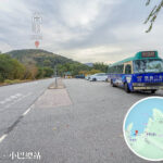
🛤️ 【Highways & Roads】Spanning around 2,248 kilometres, Hong Kong’s road network features 22 major traffic tunnels, over 1,400 flyovers and bridges, and more than 1,600 footbridges and subways. It is the perfect definition of “high density, cross-harbour connectivity, and challenging terrains.” Overcoming geographical limits through tunnels and bridges, and linking the entire city via a strategic route system, it serves as the lifeblood of urban transit and stands as one of the busiest and densest road networks in the world.
📌 Key Statistics
Item Figures & Details 🛤️ Total Length Approx. 2,248 km (HK Island 450 km, Kowloon 483 km, New Territories 1,315 km) 🚗 Registered Vehicles Over 800,000 vehicles, with private cars making up nearly 70% ↔️ Driving Direction Inherited from the British system → Left-hand traffic 📈 Road Density An average of 311 vehicles per kilometre of road, making it one of the busiest worldwide —
🛣️ Features of Road Infrastructure
- Strategic Routes: Hong Kong features 10 strategic routes connecting HK Island, Kowloon, and the New Territories, forming a highly efficient cross-district transport network.
- Tunnels (22 in total):
- Cross-Harbour Tunnel (Hunghom): Opened in 1972, it was the first underwater tunnel linking HK Island and Kowloon.
- Eastern Harbour Crossing: Opened in 1989, connecting Quarry Bay and Cha Kwo Ling.
- Western Harbour Crossing: Opened in 1997, connecting Sai Wan and West Kowloon.
- Lion Rock Tunnel: Opened in 1967, connecting Kowloon Tong and Sha Tin.
- Bridges (Over 1,476 structures):
- Tsing Ma Bridge: With a main span of 1,377 metres, it is one of the world’s longest dual-use (road and rail) suspension bridges.
- Ting Kau Bridge: A cable-stayed bridge with a total length of 923 metres.
- Stonecutters Bridge: Boasts a main span of 1,018 metres, linking Kwai Chung and Stonecutters Island.
- Pedestrian Facilities: There are 1,633 footbridges and subways across the city, making it easy for residents to cross busy roads safely.
—
🏙️ Urban Challenges & Management
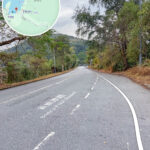
- Complex Terrain: With limited flat land and plenty of hills, Hong Kong’s roads are often built along mountain slopes, relying heavily on flyovers and tunnels.
- Traffic Congestion: Due to the high population density and huge volume of vehicles, the government implements one-way routing, parking controls, and actively encourages public transport use.
- Electronic Road Pricing (ERP): The government is studying the introduction of an ERP system to ease traffic pressure in bottleneck areas.
—
📌 Key Locations
- Central: The business core, connected to the Central–Wan Chai Bypass.
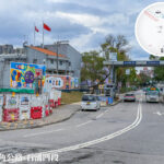
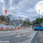
- Hung Hom: The exit of the Cross-Harbour Tunnel and a major Kowloon transport hub.
- Tsing Yi: The starting point of the Tsing Ma Bridge, leading to Lantau Island.
- Sha Tin: The exit of the Lion Rock Tunnel, connecting to the eastern New Territories.
- Stonecutters Island: The connection point for the Stonecutters Bridge and a vital artery for container terminal traffic.
—
📊 Landmark Highway & Tunnel Guide
Category Name Highlights Location Harbour Crossing Cross-Harbour Tunnel First cross-harbour tunnel HK Island North ↔ Hung Hom, Kowloon Harbour Crossing Eastern Harbour Crossing HK Island East ↔ Kowloon East Quarry Bay ↔ Cha Kwo Ling Harbour Crossing Western Harbour Crossing HK Island West ↔ Kowloon West Sai Wan ↔ Tsim Sha Tsui West Mountain Tunnel Lion Rock Tunnel Kowloon ↔ New Territories East Kowloon Tong ↔ Sha Tin Bridge Tsing Ma Bridge One of the world’s longest dual-use suspension bridges Tsing Yi ↔ Lantau Island Bridge Stonecutters Bridge Main span of 1,018 metres Kwai Chung ↔ Stonecutters Island —
🚦 Road System Characteristics
- High-Density Traffic: Hong Kong’s dense population means its road network operates under extremely high capacity.
- Challenging Terrains: Mountains, bays, and peninsulas cut across each other → calling for an extensive layout of tunnels and bridges.
- Cross-Harbour Links: Multiple subsea tunnels and cross-sea bridges keep HK Island, Kowloon, and the New Territories fully integrated.
- Strict Controls: With limited parking spaces, the government heavily promotes taking public transport.
- Smart Mobility: Looking into implementing Electronic Road Pricing to relieve urban gridlock.
—
🌉 Major Bridges & Tunnels
- Tsing Ma Bridge: The longest bridge in Hong Kong, with a main span of 1,377 metres, connecting Lantau Island to the urban areas.
- Ting Kau Bridge: A cable-stayed design with a main span of 923 metres, connecting Tsuen Wan and Tuen Mun.
- Cross-Harbour Tunnel: The busiest cross-harbour tunnel, linking Kowloon and HK Island.
- Eastern Harbour Crossing: Connecting Kwun Tong (Kowloon East) and Chai Wan.
- Western Harbour Crossing: Connecting West Kowloon and Sai Ying Pun.
—
🚗 Strategic Routes
Hong Kong’s highways are anchored by the “Strategic Route System,” which is broken down into 10 major routes:
- Route 1
- Aberdeen → Hung Hom
- Via Happy Valley and Central
- Route 2
- Kwun Tong → Sha Tin
- Via the Lion Rock Tunnel
- Route 3
- West Kowloon → Yuen Long
- Via the Tsing Sha Highway and Tai Lam Tunnel
- Route 4
- The corridor along the north shore of HK Island, connecting Kennedy Town → Chai Wan
- Route 5
- The Kowloon east-west corridor, connecting Kwun Tong → Lai Chi Kok
- Route 6
- Connecting West Kowloon → Tseung Kwan O
- Route 7
- The HK Island north-south corridor, connecting Aberdeen → Chai Wan
- Route 8
- Connecting Tsing Yi → Sha Tin
- Via the Tsing Sha Highway
- Route 9
- The New Territories Circular Road, looping around the northwest to the northeast New Territories
- Route 10
- Connecting Yuen Long → North Lantau
—
🏞️ Highways & Daily Life
- High Reliance on Public Transport: Franchised buses, green/red minibuses, and taxis all rely heavily on the highway network.
- Cross-Boundary Transit: The Hong Kong–Zhuhai–Macao Bridge links Lantau Island directly with Zhuhai and Macao.
- Scenic Drives: Some highways are built right along the coastline, like the Island Eastern Corridor, offering sweeping views of Victoria Harbour.