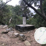
📍 【Trigonometrical Stations】 (commonly known as “Trig Pillars” or “標高柱”) are survey points established by the Survey and Mapping Office of the Lands Department. They are primarily used for geodetic surveying, topographic mapping, urban planning, land administration, and engineering construction. These survey stations are typically located at locations with broad visibility (such as mountain summits) and determine geographic coordinates and elevation through triangulation. These square or cylindrical stone pillars feature a cross marking on the top, with “Trigonometrical Station” engraved in both English and Chinese on the side, along with specific elevation figures (e.g., “Height 552m”). Built with sturdy, weather-resistant materials, they have become unique landmarks in the Hong Kong wilderness, serving both functional and historical purposes. —
🧭 What is a Trig Pillar? The Truth Behind Trigonometrical Stations
📐 Definition and Purpose
- Official Name: Trigonometrical Station
- Managing Authority: Survey and Mapping Office, Lands Department
- Main Functions:
- Serve as benchmark points for topographic surveys
- Assist in map production, urban planning, and land boundary demarcation
- Provide reference for elevation and horizontal positioning
- Historical Context:
- First appeared on Hong Kong maps: 1854
- Early methods relied on optical triangulation; now supplemented by GPS technology
—
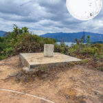
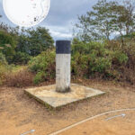
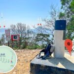
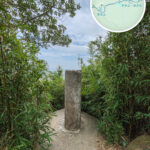
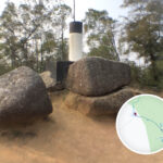
🧱 Anatomy of a Trig Pillar
🏗️ Structural Composition
- Pillar Body: Usually a concrete cylinder, about 1.2 meters high with a diameter of about 28 cm.
- Coating: White pillar body with a black top for easy long-distance identification.
- Top Metal Plate: Embedded with a circular or triangular metal plate for mounting surveying instruments (e.g., total stations).
- Base: A square or circular concrete base to prevent sinking or shifting.
- Direction Indicators: Some base designs indicate North or Northeast.
—
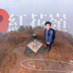
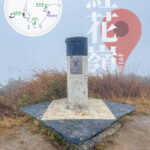
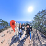
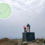
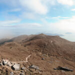
🥾 Hiking Culture and the “Trig Point Hunting” Phenomenon
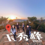
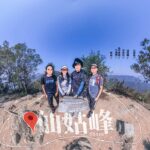
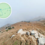
These trig pillars are not just survey benchmarks; they have become significant symbols in Hong Kong’s hiking culture. For instance, the pillar at Tai Mo Shan (958m)—the highest in Hong Kong—the one at Victoria Peak (552m), and the one at Lantau Peak (934m) are all “trophies” for hikers completing their challenges. Some pillars even witness history, such as the針山 (Needle Hill) pillar erected in 1952, which still retains the technical characteristics of colonial-era surveying.
- “Trig Point Hunting” (Kill 標): Hikers set conquering these pillars as goals and take photos for social media.
- Misconception: Trig pillars do not necessarily mark the absolute highest point of a mountain.
- Restricted Areas: Some pillars in areas like Port Island, radar stations, or inside St. Stephen’s College in Stanley cannot be freely accessed.
- Conservation Reminder: Please do not deface or damage these pillars; show respect for survey facilities.
—
📐 Functionality and Utility
With technological advancements, satellite surveying has gradually replaced traditional triangulation, yet these pillars are carefully preserved. They have transformed from professional surveying tools into trail navigation reference points, and their coordinate data is often integrated into mobile hiking apps. These silent stone pillars not only record the evolution of Hong Kong’s topographic mapping but also continue to lead countless hikers in exploring the city’s natural rhythm.
Function Description 📍 Topographic Mapping Acts as a benchmark for map production to ensure precise positioning. 🧭 GPS Calibration Provides a ground reference for Global Positioning Systems. 🧗 Hiking Goals Becomes a challenge target and popular photo spot for hikers. 🏗️ Engineering Surveys Supports topographic surveying and planning for major infrastructure projects. —
🌍 Geographic Extremes (Active Trig Pillars)
Category Location Number Notes 🧭 Easternmost Tung Ping Chau #536 Remote island, accessible by boat. 🧭 Southernmost Po Toi Island, Ngau Wu Teng #218 Southernmost land territory of Hong Kong. 🧭 Westernmost Yi O Kai Kung Shan #259 Located in western Lantau Island. 🧭 Northernmost Pak Fu Shan #424 Close to the Shenzhen border. ⛰️ Highest Tai Mo Shan #67.2 957 meters, the highest peak in Hong Kong. 🏖️ Lowest Cheung Sha Ha Tsuen #248 Near sea level, flat terrain. —
🔍 How to Find Trig Pillars
- 📱 Use the Lands Department’s “MyMapHK” mobile app.
- 🖥️ Refer to the Lands Department website.
- 📚 Consult trig station databases and data dictionaries to understand ID numbers, locations, and height information.
—
🧠 Trivia and Fun Facts
- 🧨 Some pillars have been struck by lightning (e.g., at Tai Lo Tin on Kai Kung Leng).
- 🧱 Some “pillars” are not pillars at all, but small brass studs on the ground (e.g., on the roof of Ka Wing Building, Nathan Road).
- 🧽 The Lands Department regularly maintains these pillars, including repainting and weeding around the sites.
- 📱 You can use the MyMapHK app to locate these markers easily.