🪨【Shek Lung Tsai (石壟仔)】 is a historic, abandoned Hakka village located south of Luk Chau Shan in the Sha Tin District of the New Territories, Hong Kong. Its name is said to come from the numerous natural stone caves behind the village (locally called “Shek Lung” or stone troughs). These caves vary in depth, with the deepest plunging some 50 to 60 feet underground, and served as hidden sanctuaries for guerrillas evading Japanese forces during the Japanese occupation of Hong Kong. The village was founded by Wu brothers who migrated here from Zijin, Guangdong, and the surviving Wu Ancestral Hall (with its lintel still inscribed as “Shek Lung Tsai Village” using the homophonic character for dragon) stands as a testament to the growth of the Hakka clan in this region.
📌 Basic Information
Item Details 🗺️ Location Situated south of Luk Chau Shan in the New Territories, bordering Mui Tsz Lim, Mau Ping, Ngong Ping, and Wong Chuk Shan. It forms part of the ancient Sai Sha Trail. 🏡 History Originally a Hakka settlement founded during the Qing Dynasty by the Wu family who migrated from Zijin, Guangdong. The name stems from the natural “Shek Lung” stone caves behind the village. 🧭 Terrain Undulating landscape featuring mountain streams, rocky slopes, boulder fields, and ancient paths. The stone caves behind the village hold historic weight as anti-Japanese guerrilla hideouts. 🏫 Education Formerly home to the Luen Tat Five Villages Public School. Demolished in 1984 as villagers relocated outward, a rain shelter now stands on the site for hikers to rest. 📜 Cultural Lore The Qing Dynasty Sai Kung Luk Yeuk Juk Jhi Chi (Bamboo Branch Ballads) captures the scenery: “Set your tracks through Shek Lung Tsai, and head straight up to Ngong Ping to catch earth dragons,” showcasing its ancient vibe. 🧱 Present Status The village is entirely abandoned, leaving behind crumbling stone walls and the Wu Ancestral Hall, making it a popular spot for hiking and heritage tracking. A separate Shek Lung Tsai New Village was established nearby. 🚶♂️ Hiking Route Chevalier Garden → Mui Tsz Lam Road → Shek Lung Tsai → Mau Ping Au → Tai Shui Hang → Sai Kung Highway (Approx. 7 km, taking around 2.5 hours). 🧭 Route Features Walking along ancient paths through stone-paved tracks, mountain streams, and open woods. Passing by the Wu Ancestral Hall and the Shek Lung Tsai Boulder Field, the scenery feels wonderfully ancient. 🚌 Transport Start: Chevalier Garden (Bus 289K, 43X, Minibus 805S)
End: Sai Kung Town (Bus 92, 96R, 299X, Minibus 1, 1A).⚠️ Warnings Sections of the trail can be overgrown with no replenishment points along the way; bring your own food and water. Hikers can leave by transport at Pak Kong Au or the Po Lo Che Road junction. — This area is a key section of the ancient Sai Sha Trail, which originally connected Lik Yuen (the ancient name for Sha Tin) with Sai Kung. Shek Lung Tsai maintained close ties with nearby villages like Mau Ping, Ngong Ping, Wong Chuk Shan, and Mui Tsz Lam. In the past, children from these five villages studied at the Luen Tat Five Villages Public School at Mau Ping Au. Following the outward migration of the villagers, the school was demolished in 1984, and a rain shelter was built on its foundations for hikers. Most of these settlements are now abandoned, and villagers later built Shek Lung Tsai New Village, Mau Ping New Village, and Wong Chuk Shan New Village around the Po Lo Che area in Sai Kung. —
🏡 Historical & Geographical Background of Shek Lung Tsai
Tucked between Ma On Shan and Sai Kung in the New Territories, Shek Lung Tsai was once a thriving Hakka village but has now fallen into ruin. The village owes its name to the natural stone cave formations behind it, which famously served as a hiding place for anti-Japanese guerrillas, earning them the name “Shek Lung” (stone troughs).
Village Evolution
- 📜 Old Name: “Shek Lung Tsai” (using the character for Dragon), a name still preserved on the lintel of the Wu Ancestral Hall.
- 🧬 Founding Clan: Opened and expanded by Wu brothers who journeyed here from Zijin, Guangdong.
- 🗺️ Cartographic Records: Shek Lung Tsai was already clearly marked on regional maps dating back to the 1930s.
- 🏫 Education: Local children used to attend the Luen Tat Five Villages Public School at Mau Ping Au. After its demolition in 1984, it was transformed into a pavilion for hikers.
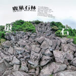
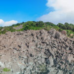
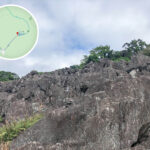
— The area surrounding Shek Lung Tsai boasts rich natural and geological wonders, including the largest boulder field in Hong Kong—the Luk Chau Boulder Field (also known as the Shek Lung Tsai Boulder Field). Covering about 0.07 square kilometers, it was formed by the weathering and erosion of coarse-grained crystal-bearing tuff, featuring bizarre rock formations like the “Dragon Boat Rock” and the “Gaping Crocodile Rock.” The region is a hotspot for hiking and exploration, with a common route kicking off from Chevalier Garden, heading along Mui Tsz Lam Road, and tracking up the Shek Lung Tsai Ancient Trail past abandoned ruins, ancestral temples, and spectacular boulder fields. —
—
🚶♂️ Hiking Route Breakdown
Shek Lung Tsai is a highly popular trekking destination. Here is a detailed breakdown of the recommended route and highlights:
🔁 Recommended Route: Chevalier Garden → Shek Lung Tsai → Lieutenant’s Rock Chamber → Mau Ping Au → Tai Shui Hang → Sai Kung Highway
Spot Highlights & Description Shek Lung Tsai Village An abandoned village preserving old stone houses and ancestral structures, oozing historical atmosphere. Wu Ancestral Hall The core structure of the village, featuring the inscription “Shek Lung Tsai Village” over its doorway. Shek Lung Tsai Boulder Field A vast field of towering boulders, famed as a wartime hideout, featuring steep and rugged terrain. Lieutenant’s Rock Chamber The wartime sanctuary of an American Lieutenant, forming a small chamber beneath massive stacked boulders. Mau Ping Au Rain Shelter The former site of the Luen Tat Five Villages Public School, now serving as a rest stop for hikers. Shek Lung Tsai Stream Waterfall Boasting impressive water flows in the wetter seasons across grand rock slopes, it is a hotspot for photography. ⏱️ Trail Info
- Time Required: Around 4 hours
- Distance: Approximately 9 km
- Difficulty: Moderate, with some heavily overgrown paths
- Supplies: Zero replenishment points along the route; bring your own food and water
—
🚌 Transport & Access
🔸 Getting to the Start (Chevalier Garden):
- Bus: 289K, 84M, 43X, 81C, 85K, 89C
- Minibus: 805S (Mong Kok to Kam Ying Court)
🔸 Departing from the End (Sai Kung Highway or Pak Kong Au):
- Minibus: 1, 1A, 1S (to Sai Kung Town)
- Bus: 92, 96R (Sundays & Public Holidays only), 792M, 299X (to Sai Kung Pier)
—
🧭 Hiking Tips
- 🥤 Supplies: There are absolutely no shops along the trail, so make sure to carry ample food and water.
- 🧢 Gear: Wearing hiking shoes with excellent traction is a must; bring a hat and sun protection.
- 📵 Signal: Mobile reception can get quite weak in certain valleys; downloading offline maps beforehand is highly recommended.
- 🚫 Conservation: Do not disturb or deface the historic ruins, carry your trash out, and respect both history and nature.
—
🪨 The Lieutenant’s Rock Chamber & Wartime Lore
One of the most historically gripping spots in Shek Lung Tsai is the “Lieutenant’s Rock Chamber,” which is deeply tied to anti-Japanese resistance during World War II.
Wartime Background
- ✈️ US fighter pilot Lieutenant Donald W. Kerr was shot down and injured by Japanese forces during a raid.
- 🆘 He was rescued by Li Shi, a member of the East River Guerrilla Column, and hidden safely within the Shek Lung Tsai boulder field and the old lime kilns of Kwun Yam Shan.
- 🪨 The “chamber” itself is a tiny, cramped space formed naturally under giant boulders, making his survival a testament to immense grit and hardship.
—
📜 Literary & Cultural Records
Shek Lung Tsai even found its way into the works of Qing Dynasty scholars, underscoring its cultural value.
Excerpt from Sai Kung Luk Yeuk Juk Jhi Chi
“Take another stroll through Mui Tsz Lam, and before you know it, you’ve arrived at Mau Ping. The winding paths are wrapped in towering greenery and endless wonders; there is no need to fear the heights of Wong Chuk Shan. Set your tracks through Shek Lung Tsai, and head straight up to Ngong Ping to catch earth dragons.”
- 🐛 “Earth dragons” refer to earthworms, a poetic symbol pointing to incredibly fertile and rich soil.
- 🏞️ The sister villages mentioned in the poem—Mui Tsz Lam, Mau Ping, Wong Chuk Shan, and Ngong Ping—all sit directly around Shek Lung Tsai.
—
🏚️ Present Day Atmosphere
Today, Shek Lung Tsai stands completely silent, leaving behind only crumbling stone walls and weathered abandoned homes. Wrapped in deep woodland shade, the stone-paved ancient paths carry a profound sense of nostalgia. While it draws many eager trekkers, it demands a quiet and respectful presence. 📌 Note: Hikers are kindly reminded to avoid playing loud music or disturbing the peace around the old ruins to ensure a serene experience for everyone. —