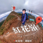
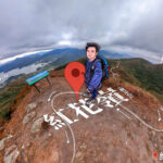
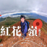
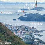
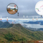
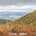
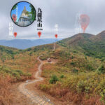
🌸 【Robin’s Nest Viewpoint (紅花嶺 觀景台)】 is a major attraction in the Northern District of the New Territories, serving as a key landmark of Hong Kong’s 25th country park. Standing at about 492 meters above sea level, the viewpoint offers a unique 360-degree look at the 『Hong Kong-Shenzhen border』. Here, you can look down at Starling Inlet, Luk Keng, and Nam Chung while enjoying views of the Shenzhen cityscape. It is a perfect spot to see the contrast between nature and modern cities, combining deep history with great scenery. For many years, this area was a closed border zone, which kept its natural ecology and military ruins well preserved. Since the border restrictions were lifted and new hiking trails were built along the ridge, this viewpoint has quickly become a popular destination for hikers.
📍 Quick Facts
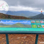
Facility / Item Description 📍 Location Along the Robin’s Nest ridge, between Sha Tau Kok and Ta Kwu Ling, Northern District ⛰️ Altitude Main peak is 498 meters high 🌟 Park Established March 1, 2024 📐 Size About 530 hectares 🪵 Hung Fa Chai Viewpoint Located along the trail with information boards. It offers great views of Double Haven and the Wong Leng mountains. 🎖️ Military Ruins WWII-era bunkers and trenches are preserved along the trail, showing its history as an old border defense site. 🏰 MacIntosh Forts A Grade 2 historic building nearby, used in the past by police to watch for illegal immigration across the border. ⛏️ Lin Ma Hang Mines One of Hong Kong’s largest old mining sites. It recently reopened after restoration, featuring a new viewpoint over a rocky slope. —
🗺️ Geographical Features
Robin’s Nest sits right on the edge of the Northern District, featuring three unique landscape highlights:
- 🇭🇰🇨🇳 Two Cities, One Border: The viewpoint sits right between Hong Kong and Shenzhen. Looking north, you see the modern skyscrapers of Liantang and Wutong Mountain in Shenzhen. Looking south and east, you enjoy the green countryside of Sha Tau Kok, Double Haven, and the Pat Sin Leng mountain range.
- 🌸 Azaleas & Silvergrass: The hill is named after the wild red azaleas that bloom across the mountains in spring. In autumn and winter, the slopes turn into a sea of golden silvergrass blowing in the wind.
- 🦇 Wildlife Corridor: Because it was isolated for a long time, the forests and grasslands here connect with Shenzhen’s Wutong Mountain. It creates an important path for wildlife and serves as a habitat for rare birds like the Chinese Grassbird and various bats.
—
🚶♂️ Trails & Transport Guide
There are two official trails leading to the viewpoint. Both are moderately difficult with many steps and little shade:
- Route A: Robin’s Nest Country Trail
- Distance: About 3.5 km
- Transport: Take Bus 78K or Minibus 55K from MTR Sheung Shui Station and get off at Tam Shui Hang Station. Walk 30 minutes along Shan Tsui Village Road to the trail start. Hike up past Yee Tung and Sam Tung to reach the peak.
- Route B: Lin Ma Hang Country Trail
- Distance: About 2.6 km
- Transport: Take Minibus 59K. ⚠️ Note: Parts of Lin Ma Hang Village are still inside the closed border zone. If you do not have a permit, you must get off before the zone and walk 20 minutes to the trail start inside the village./li>
⚠️ Hiker’s Tip: The trails are steep, and there are no shops or restrooms on the mountain. Bring plenty of water and sun protection. If you visit the Lin Ma Hang Lead Mines, stay safe and do not enter closed pits or vertical shafts!
—
📸 Quick Tips
- Bring enough water, snacks, and sun protection.
- Good fitness is required; the full hike takes about 5 hours.
- Spring and autumn offer the best views of flowers and silvergrass.
—