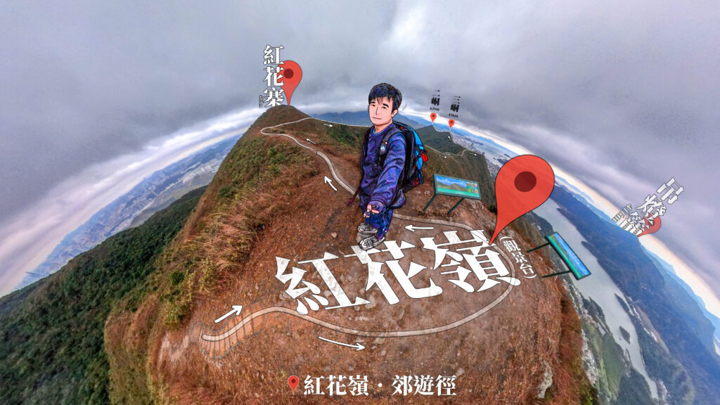
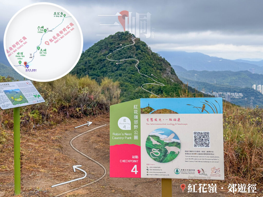
From the starting point of the Robin’s Nest Country Trail, hiking for about 1 kilometre will lead you to the Robin’s Nest Viewpoint. Standing here, an expansive view opens up, offering a distant gaze over the beautiful landscapes of Sha Tau Kok and Yantian, Shenzhen, as well as a panoramic and spectacular natural view of the surrounding mountain ranges of Tiu Tang Lung opposite. The scenery is especially captivating on clear days. (It was a pity there was light rain and cloudy skies that day, but it certainly didn’t get in the way of enjoying the spectacular views and the absolute joy of hiking and country outings😄)
📷 相片參數
Camera:
Lenses:
Keywords:
Subjects:
Location:
District:
Area:
香港地點:
Wong Nai Chung Reservoir - Park
Sai Kung Public Pier
小鳥回頭
Kau Ling Chung Campsite
Yi O Pier
陽元石
Kadoorie Farm and Botanic Garden
利東商場
大浪灣營地
Lugard Falls
Wong Tai Sin Temple Square
西貢碼頭
湛山寺
龍蝦灣石灘
Lung Ha Wan Stony Beach
Kowloon Pass Wind and Rain Pavilion
寶蓮禪寺
Ngong Ping Village
Sam A Chung Campsite
嘉瑜園
Ap Lei Pai Tombolo
清水灣騎術學校及教育中心
白沙澳青年旅舍
A Kung Kok Lookout
香港地方:
Fan Lau Village
Wilson Trail Section 10
Peak Road
榕樹凹
Victoria Road
玉秀峰
紅石門徑
撿豬灣
Lantau Trail – Section 7
龍蝦灣路
Pak Sha O
Nam Shan Ancient Trail
Yuk Sau Fung
Lin Ma Hang
High Island Geo Trail
West Buffalo Hill
Hong Kong Forest Track
Po Pin Chau
一線生機
Wu Tip Shan Path
大潭郊野公園
印洲塘郊遊徑
Mount Johnston / Yuk Kwai Shan
碧珊徑
Wilson Trail Section 10
Peak Road
榕樹凹
Victoria Road
玉秀峰
紅石門徑
撿豬灣
Lantau Trail – Section 7
龍蝦灣路
Pak Sha O
Nam Shan Ancient Trail
Yuk Sau Fung
Lin Ma Hang
High Island Geo Trail
West Buffalo Hill
Hong Kong Forest Track
Po Pin Chau
一線生機
Wu Tip Shan Path
大潭郊野公園
印洲塘郊遊徑
Mount Johnston / Yuk Kwai Shan
碧珊徑


