🐃 【Buffalo Hill (水牛山, 606m)】 is located on the border between Sha Tin and Sai Kung in eastern New Territories, sitting right within Ma On Shan Country Park. Standing side-by-side with the neighbouring West Buffalo Hill (604m), they form the iconic “Twin Buffaloes” landscape, a super popular landmark among local hikers. The mountain looks incredibly grand, and during autumn and winter, it’s famous for being covered in golden silvergrass—ranking right up there with Sunset Peak on Lantau Island as a top silvergrass hotspot.
📌 Quick Facts
Item Details 📍 Location Eastern Sha Tin, New Territories (east of Siu Lek Yuen, near western Sai Kung) 🏔️ Height 606 metres (1,988 feet) 📌 Coordinates 22°22′28.97″N, 114°14′3.22″E 🌳 Area Ma On Shan Country Park 🗻 Neighbouring Peak West Buffalo Hill (604m) —
— 🌄 Looking out from the summit, the northern view gives you a great look at the bustling Sha Tin Town, while the southeastern side opens up to a brilliant panoramic view of Sai Kung Bay and Pak Sha Wan. Along the way, you’ll pass the crazy rock formations of “Buffalo Stone City”, where the famous “Stone Window” is located—a natural gap between rocks that looks just like a window frame. With its stunning natural scenery and diverse terrain, Buffalo Hill makes for a hike that’s both challenging and incredibly beautiful. —
🏔️ Geographical Features
- Mountain Terrain: Buffalo Hill has a super distinct ridgeline that connects directly to West Buffalo Hill, making for an epic landscape.
- Sea of Silvergrass: In autumn and winter, the summit and slopes are completely blanketed in golden silvergrass, sharing the spotlight with Sunset Peak.
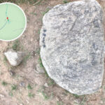
- Crazy Rock Formations: Buffalo Stone City is a massive cluster of stacked boulders. The absolute highlight is the Stone Window, where natural gaps create a perfect window frame view.
- Wide Open Views:
- Looking north: Sha Tin Town
- Looking southeast: Pak Sha Wan and Sai Kung Bay
- Looking west: Ma On Shan
—
🚶 Hiking Route
- Starting Point: Wong Nai Tau Bus Terminus
- Route: Wong Nai Tau ➔ Shek Nga Pei ➔ West Buffalo Hill ➔ Buffalo Hill ➔ Return to Wong Nai Tau
- Total Distance: Around 6.5 km
- Time Needed: 4–5 hours (including breaks and taking photos)
- Difficulty: Intermediate-Advanced (steep slopes and loose gravel, requires good stamina and proper hiking shoes)
- Transport:
- Bus: 83K (from Sha Tin Town Centre), 86 (from Mei Foo), or Minibus 65K (from Fo Tan Station)
- Toilets / Refreshments: Kwong Yuen Estate (your absolute last spot to gear up)
—
🌟 Highlights
- Natural Landscape: Stunning silvergrass fields in autumn/winter and the natural “Stone Window” rock feature.
- Cultural & Geological Value: The unique rock formations and twin peaks hold massive aesthetic and geological interest.
- A Good Challenge: The path is clear but quite steep—best for experienced hikers.
- Best Season: Autumn and winter (when the silvergrass is in full bloom and the weather is nice and cool).
—
⚠️ Things to Note
- Difficulty: This is an intermediate-to-advanced trail. Some sections are super steep and completely exposed to the sun, so you’ll need decent fitness.
- Supplies: There are zero replenishment points along the trail. The nearest shops and toilets are back down at Kwong Yuen Estate.
- Safety First: The paths can be quite narrow, so remember to share the trail when it gets crowded. Certain parts have loose sand and gravel, so wearing proper hiking shoes is highly recommended.
—
🐃 Buffalo Hill vs 🐂 West Buffalo Hill
Item Buffalo Hill West Buffalo Hill 📍 Location Eastern Sha Tin, New Territories (east of Siu Lek Yuen, near western Sai Kung) West side of Buffalo Hill, right on the border of Sha Tin and Sai Kung 🏔️ Height 606 metres (1,988 feet) 604 metres (1,982 feet) 🌳 Area Ma On Shan Country Park Ma On Shan Country Park 👀 Features Looks east toward Pak Sha Wan and Sai Kung Bay, and west toward Shing Mun River. Offers epic silvergrass views in autumn/winter. Slightly lower view but closer to Sha Tin, looking down at Siu Lek Yuen and Shing Mun River. Right next to “Buffalo Stone City”. 🚶 Trail Route MacLehose Trail Section 4 passes through its southern slope. Usual route: Wong Nai Tau ➔ West Buffalo Hill ➔ Buffalo Hill ➔ Return. Usually hiked together with Buffalo Hill. Can be accessed from Wong Nai Tau or Fa Sam Hang. ⚡ Difficulty Intermediate-Advanced. Steeper slopes with dense, thick brush near the summit—requires good stamina. Intermediate. The slopes are slightly gentler and the route is shorter, often acting as a warmup before hitting Buffalo Hill. 📌 Highlights Autumn/winter silvergrass fields and the amazing contrast between city and sea views. Super close to the unique rock landscapes of “Buffalo Stone City”, standing as part of the famous twin peaks.