🚶🏻➡️【Chek Keng (赤徑)】 is a tranquil village nestled within the eastern country park of the Sai Kung Peninsula in the New Territories. Located southwest of the famous Sharp Peak, the village is flanked by hills on three sides and faces the calm waters of Chek Keng Hau bay. It is not only a haven for hiking beginners but also an ideal spot for camping, stargazing, and photography. —
📍 Geography & Historical Background
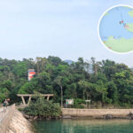
Item Details 📍 Location Inside Sai Kung East Country Park, close to Sharp Peak and Tai Long Au ⛰️ Terrain Coastal lowland enveloped by hills on three sides, facing Chek Keng Hau to the north, resting against Pai Ngak Shan to the south, with a distant view of Sharp Peak to the west 🏞 Landscape Mudflats, mangroves, and surrounding rolling hills with a mirror-calm sea 🕒 History Chek Keng Village was home to over a hundred residents in the 1960s, but villagers gradually moved out due to urbanization; most village dwellings are now abandoned stone houses 🛖 Youth Hostel YHA Bradbury Hall (Bradbury Hall Youth Hostel) is located near Chek Keng Pier — This traditional Hakka village boasts over a century of history. Although only a handful of residents remain today, it still preserves several abandoned village houses, a Catholic church, and school ruins—its weathered brick walls and rusted corrugated iron roofs quietly telling the story of rural change. Chek Keng Pier serves as the main gateway to the village; a kai-to ferry ride from Wong Shi Pier takes only about 15 minutes, offering gorgeous views of Sharp Peak along the way, making it a perfect pit stop for hikers heading towards Tai Long Wan or Sharp Peak.
What makes Chek Keng unique is its best-of-both-worlds geographical character: at low tide, the bay exposes a vast mudflat that draws mudskippers and fiddler crabs, while at high tide, the emerald waters beautifully reflect the mountain shadows like a secluded paradise. The surrounding mangroves and freshwater wetlands nurture a rich ecosystem, while the abandoned farmlands have been reclaimed by wild grass and reeds, creating a unique ruin landscape. In recent years, Chek Keng has attracted many photography enthusiasts and ecological researchers. Its Bradbury Hall youth hostel, converted from a defunct village school, has also become a popular choice for in-depth eco-travel, allowing this time-worn village to carry on its legacy in a whole new way. —
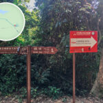
🚶♂️ Hiking Route
🔰 Starting Point: Pak Tam Au
- Transport: Take green minibus 7 or KMB bus 94 / 96R (holiday service only) and get off at Pak Tam Au station
- Trailhead: MacLehose Trail Section 2
🗺️ Route Overview
Section Highlights & Features Chek Keng Village Abandoned stone houses, the former settlement of local villagers Chek Keng Pier Catch a kai-to ferry back to Wong Shi Pier Chek Keng Mudflat Rich ecosystem featuring mangrove clusters and various clams Chek Keng Breakwater A highly popular Instagram spot where you feel like standing in the middle of the sea Chek Keng Campsite A wide, grassy meadow perfect for camping, though it is an unofficial site ⏱️ Time & Distance
- Total Distance: Around 3.5 km
- Walking Time: Approximately 45–60 minutes (one way)
—
🛶 Getting There
Transport Type Route Drop-off Point Minibus 7 Sai Kung Town → Hoi Ha Pak Tam Au Station Bus 94 Sai Kung Town → Wong Shi Pier Pak Tam Au Station Bus 96R Diamond Hill → Wong Shi Pier (Sundays & Public Holidays only) Pak Tam Au Station Kai-to / Speedboat Wong Shi Pier → Chek Keng Pier (Weekends & Holidays) Around 10-minute boat ride —
🏕️ Camping Info
Item Details Campsite Type Chek Keng grassy meadow, an unmanaged/unofficial campsite Facilities Self-contained (bring your own drinking water and gear; no local stores/supplies), public toilets and rubbish bins available nearby Civic Duty Not managed by the AFCD; please pack out your own trash and keep the site clean Reminders Feral cattle roam the area; do not feed or touch them Tide Warning The mudflat areas are prone to flooding during high tide; please check the lunar tide charts beforehand The flat lawns and adequate water sources make Chek Keng one of the most popular camping spots in the Sai Kung district. —
🌿 Ecological Highlights
- Mangrove: Perfect for spotting waterbirds and intertidal creatures
- Mudflat: Home to various clams and crabs, but please do not disturb or harvest them
- Stargazing: Remotely located with minimal light pollution, making it an excellent spot for night skies
—
📸 Photo Spots
Location Features Chek Keng Breakwater Calm waters that give the illusion of standing right in the center of the ocean Chek Keng Mudflat & Mangroves Beautiful coastal lines exposed during low tide, teeming with life Distant View of Sharp Peak A magnificent vista where dramatic mountains meet the sea Abandoned Stone Houses Steeped in history, ideal for rustic and cultural photography Starry Night Skies An absolute hotspot for capturing the night sky and stars —
🌟 Fun Fact / Side Story
Chek Keng is not just a paradise for nature buffs, but also a popular spot for local celebrities. Hong Kong movie icon Chow Yun-fat has been spotted hiking here, happily taking “wild capture” selfies with fellow hikers. This trail is also widely recommended as a “must-go route for hiking beginners.” —
🧭 Extended Routes
- Ham Tin Wan: You can continue from Chek Keng up to Tai Long Au and then hike down to the stunning beach at Ham Tin Wan.
- Tai Long Sai Wan (Sai Wan): After passing Tai Long Au, you can branch off to Sai Wan to enjoy its white sands and natural rock pools.
—