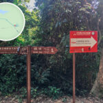
🥾 【MacLehose Trail – Section 2 (麥理浩徑第2段)】 is widely considered the most popular and scenic highlight of the entire 100-kilometer MacLehose Trail. Spanning roughly 13.5 to 14 km and taking about 5 to 6 hours to complete, it is world-renowned for its breathtaking coastal vistas and pristine beaches. The journey kicks off at Long Ke Wan, where hikers immediately tackle a climb up the 314-metre Sai Wan Shan. Along the ridge, you can look down at Long Ke Wan—frequently crowned “Hong Kong’s most beautiful beach”—and the brilliant turquoise waters of High Island Reservoir. The trail then drops down through Chui Tung Au to Sai Wan, before traversing Ham Tin Wan, Tai Long Au, and finally finishing at Pak Tam Au. The magnificent Big Wave Bay quad of beaches (Sai Wan, Ham Tin Wan, Tai Wan, and Tung Wan) boasts fine white sand and crystal-clear water. Framed by the jagged, imposing silhouette of Sharp Peak in the distance, they form the spectacular “One Peak, Four Bays” panorama that has earned this area the title of “Hong Kong’s Back Garden.” —
📌 MacLehose Trail • Section 2 Overview
Item Details 🚩 Starting Point Long Ke Wan 🏁 Ending Point Pak Tam Au 📏 Distance Approx. 13.5–14 km ⏱️ Duration Around 4.5–6 hours (depending on fitness and breaks) ⚡ Difficulty Intermediate (with some steep climbs) 🛒 Supply Points Sai Wan, Ham Tin Wan, Chek Keng 🚌 Transport Start: Take a taxi or green minibus to High Island Reservoir • East Dam; End: Catch a bus or minibus from Pak Tam Au. — 【MacLehose Trail • Section 2】 offers far more than just natural landscapes; it seamlessly blends history and ecology along the way. Highlights include the century-old Hakka villages and an abandoned Catholic church in Chek Keng, alongside the traditional fishing village culture of Sai Wan. The deserted Hakka houses and old church in Chek Keng, paired with the 600-year history of the Lai clan in Sai Wan Village, add an incredible layer of cultural depth to the trek. The route features multiple supply options (like the local stores at Sai Wan and Ham Tin Wan) and convenient escape routes (such as the ferry kaito from Chek Keng Pier). However, the stretch over Sai Wan Shan is incredibly steep and completely exposed to the sun; it is notorious as a heatstroke hotspot during the summer, so packing plenty of water is absolutely crucial. Overall, this is a moderately challenging trail tailored for hikers with decent fitness, standing as a true classic for experiencing Hong Kong’s stunning mountain-and-sea scenery. —
1️⃣ High Island Reservoir • East Dam
- Accessible via taxi or the weekend green minibus 9A.
- Before hitting the trail, take some time to marvel at the world-class geological wonder of the hexagonal rock columns.
- You can also take a quick side trip to the Biu Tsim Kok viewing platform to enjoy sweeping views of Po Pin Chau and Fa Shan.
2️⃣ Long Ke Wan
- Boasting powdery white sand and stunning azure waters, it is widely celebrated as one of the most beautiful beaches in Hong Kong.
- An ideal spot for a quick dip or water activities, though it lacks public facilities, so you must bring your own supplies.
- The trail kicks off along the coastline, offering wide-open vistas before plunging straight into a grueling 1.6-kilometer climb up the 314-metre Sai Wan Shan.
3️⃣ Sai Wan Shan (Elevation: 314m)
- The most grueling stretch of the entire section, lined with steep steps that turn it into a major heatstroke risk in summer. An early morning start is highly recommended.
- The summit features a pavilion and a trigonometrical station, offering a spectacular bird’s-eye view of the “One Peak, Four Bays” panorama: Sharp Peak, Ham Tin Wan, Tai Wan, Tung Wan, and Sai Wan.
4️⃣ Chui Tung Au
- A mountain pass that serves as a key junction, with a path branching off directly toward Sai Wan Village.
- A steady 15-minute descent from here will bring you right into Sai Wan.
5️⃣ Sai Wan
- Supply Point: Local village stores offer plenty of cold drinks and simple hot meals.
- The beach is wide and flat with crystal-clear water, earning it the nickname “Hong Kong’s Maldives.”
- Features a dedicated stargazing platform and colourful village murals.
- Deeply historical, the local Lai clan lineage dates back over 600 years, with ancestors traditionally making a living through fishing and salt production.
6️⃣ Ham Tin Wan
- Hikers can choose to walk straight across the soft beach or follow the village trail behind it.
- Iconic Photo Spot: The rustic wooden bridge at the far end of the beach, perfect for capturing “Mirror of the Sky” reflections.
- Local village stores and campsites sit nearby, offering hot food and drinks—an ideal spot for a proper rest.
7️⃣ Tai Long Au
- A steep, 20-minute climb brings you up to this high mountain pass, which serves as the entry point for the southern ridge of Sharp Peak.
- A clear junction branches off toward the Sharp Peak Southern Ridge (climbing this is definitely not recommended without serious scrambling experience).
8️⃣ Chek Keng
- The final inlet along the route, featuring rich mangrove clusters and a Hakka village with over 200 years of history.
- Key sights include the peaceful mangroves and Holy Family Chapel, built in 1866 and recognized as a Grade 2 Historic Building.
- From here, you can choose to catch a kaito ferry to Wong Shek Pier as an early exit, or push through the final stretch to Pak Tam Au.
9️⃣ Pak Tam Au
- The end of Section 2, fully equipped with public toilets, a water filling station, and vending machines.
- You can catch bus 94, 96R, or 289R straight back to urban areas, or jump right into Section 3 of the MacLehose Trail.
—
🧭 Elevation Profile & Terrain Features
Location Elevation Terrain Features Sai Wan Shan 314 metres A steep, grueling climb that requires decent physical endurance. Tai Long Au Approx. 160 metres A gentle incline that brings you to the Sharp Peak junction. Chek Keng to Pak Tam Au Rises approx. 150 metres The final stretch of the hike, where fatigue easily sets in. —
🚍 Transport Info
Location Mode of Transport Remarks Start (East Dam) Green Minibus 9A (Sundays & Public Holidays only) / New Territories Taxi (approx. $120) Departing from Sai Kung Town Centre. End (Pak Tam Au) KMB Bus 94, 96R, 289R / Green Minibus 7 (More frequent services on holidays; checking schedules is advised) Connects back to Sai Kung, Diamond Hill, or Sha Tin. Exit Point (Chek Keng) Kaito Ferry / Speedboat to Wong Shek Pier Approx. $20 per person; checking the ferry schedule in advance is highly recommended. —
🧭 Supplies & Facilities
Location Supplies Toilets Sai Wan ✅ ✅ Ham Tin Wan ✅ ❌ Tai Long Village ✅ ❌ Chek Keng ✅ ✅ (Though hygiene can be basic) Pak Tam Au ✅ ✅ —
🧭 Hiking Tips
- 🧴 Always pack plenty of drinking water, sun cream, and a wide-brimmed hat.
- 📱 Downloading offline maps is highly recommended since mobile signals drop completely in certain valleys.
- 🥤 Supply Points: Sai Wan, Ham Tin Wan, Tai Long Village, and Chek Keng all feature local village stores (note that some open on weekends and holidays only).
- 🚻 Public Restrooms: Available at Sai Wan, Chek Keng, and Pak Tam Au.
- 📶 Signal Note: Mobile coverage can be non-existent around Long Ke and Sai Wan Shan; keep your offline maps handy.
- ☀️ Beat the Heat: The Sai Wan Shan stretch offers zero shade, making it a high-risk zone for heat exhaustion. Hydrate constantly!
- 🗑️ Pack it In, Pack it Out: Keep the environment pristine by bagging and carrying away all your own rubbish; open fires are strictly prohibited.
- 🧭 Early Exit: If you run out of steam, you can easily pull out at Chek Keng and hop on a boat to leave.
- 🔦 Bring a Headlamp: Always carry a headlamp or flashlight just in case your hike runs into the evening.
—
🌊 Why Is It Worth It?
- Offers an incredible, diverse mix of coastlines, sandy beaches, rolling ridges, and deeply historic villages.
- Proudly celebrated as both “Hong Kong’s Back Garden” and “Hong Kong’s Maldives.”
- Stands out as the absolute crown jewel section of the entire 100-kilometer MacLehose Trail.
—