🏞️ 【Ha Tam Shui Hang (下担水坑)】 is a traditional Hakka village located in Sha Tau Kok, North District, New Territories, Hong Kong. Situated right next to the Shek Chung Au section of Sha Tau Kok Road, it forms Tam Shui Hang Village alongside Sheung Tam Shui Hang and Middle Tam Shui Hang. The village was opened to the public in February 2012 following the reduction of the Frontier Closed Area. The village’s history dates back to the Kangxi reign of the Qing Dynasty when it was founded by three brothers of the Wan clan. Today, it still preserves several century-old buildings, including the Wan Ancestral Hall, the Wan Family Shrine, and the Tse Ancestral Hall. Every year on the second day of the Lunar New Year, villagers gather in front of the ancestral halls for the traditional custom of pork sharing. The village was also home to Kwan Ngai School, which was built through villager donations in 1930. Due to a declining student population, it ceased operations in 2006, and the school building now preserves old classrooms and cultural artifacts, opening occasionally for visitors. —
📍 Geographic Location & Historical Background
- Location: Sha Tau Kok, North District, New Territories, Hong Kong; formerly part of the Frontier Closed Area until restrictions were lifted in 2012.
- Origin of the Village Name: The name “Tam Shui Hang” stems from a mountain stream, as villagers in the old days had to carry water on shoulder poles to irrigate their farmlands.
- Historical Alliance: It is the fifth alliance of the Sha Tau Kok “Ten Alliances”, forming a rural alliance with villages like San Tsuen and Muk Min Tau.
- Qing Dynasty Hakka Settlement: The Sha Tau Kok region has been a major settlement area for Hakka people since the Qing Dynasty.
— Ha Tam Shui Hang stands as a witness to the changing history of the Hong Kong border. During the 1967 Sha Tau Kok incident, a curfew was imposed on the villagers. When the restrictions were first lifted in 2012, it briefly became a tourist hotspot before returning to tranquility during the pandemic. Today, the villagers adopt a strategy of opening up the periphery while keeping residential areas private. They welcome visitors to tour the ancestral halls and natural scenery but restrict entry into residential zones to balance tourism development with local privacy. Blending Hakka history with border characteristics, this village stands at the crossroads of traditional conservation and modern development. —
📌 Key Information
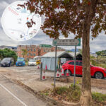
Item Details 🏠 Chinese Name 下擔水坑 (Ha Tam Shui Hang) 📍 District Sha Tau Kok, North District, New Territories, Hong Kong 🗺️ Geographic Location Located right next to Sha Tau Kok Road; formerly part of the Frontier Closed Area until the border restrictions were lifted in 2012 🌳 Natural Scenery Robin’s Nest Country Park, Lin Ma Hang Lead Mine, terraced fields, and Feng Shui woods 🏫 School Net Primary: 83; Secondary: North District 👨 Demographics The Ta Kwu Ling sub-district has a population of approximately 10,973, with a median monthly domestic household income of around HK$19,410 🏘️ Property Information Address: Nos. 51–300 Ha Tam Shui Hang; Number of blocks: 1; Total number of units: 3 🧭 Tourism Potential Combines history, culture, and natural resources, showing high potential for ecotourism development 🚻 Public Facilities Equipped with the Tam Shui Hang Village Public Toilet (open 24 hours) — The primary economic activity of Ha Tam Shui Hang used to be agriculture. In the past, villagers grew peanuts and sweet potatoes on terraced fields, trading their crops with nearby Tanka fishermen to form a mutually supportive rural ecosystem. Following the opening of the border, some agricultural lands were redeveloped into small houses (Ding houses). However, the bamboo-lined paths and abandoned terraces at the village entrance remain intact. In spring, blooming cogon grass turns the fields into a magnificent sea of white flowers, drawing many photography enthusiasts. For transport, KMB routes 78K, 277A, and green minibus 55K all stop at the “Tam Shui Hang” station, making it a key transit point for visitors heading to Robin’s Nest Country Park or Sha Tau Kok Pier. —
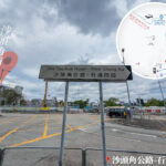
🚍 Transport
Method of Transport Description KMB 78K / Minibus 55K Depart from Sheung Shui or Fanling and get off at the Tam Shui Hang stop. Facilities Bus stops and passenger shelters are available in the village; visitors are advised to bring their own water and food. —
🏯 Hakka Culture & Architectural Features
🏠 Traditional Ancestral Halls
- Chung Ancestral Hall: Built in 1874, designated as a Grade 3 historic building.
- Wan Ancestral Hall: An important gathering place for villagers to worship their ancestors.
🏫 Educational Heritage
- Kwan Ngai School: Founded in 1930; it has ceased operations but the school building is preserved.
🧱 Architectural Style
- Cloud-shaped gables
- Vase-shaped balustrades
- Grey-tiled roofs and granite walls
—
🌳 Natural Ecology & Tourism Resources
- Robin’s Nest Country Park: Features military relics and magnificent mountain vistas.
- Lin Ma Hang Lead Mine: An early mining site that now serves as an open-air museum.
- Terraced Fields & Fung Shui Woods: Terraced fields and Feng Shui woods run through the village, attracting hiking enthusiasts.
- Rare Flora and Fauna: Includes lycaenid butterflies, incense trees (Aquilaria sinensis), and the banded krait.
—
🥾 Exploration Tips
- Wear hiking shoes with good grip.
- Bring mosquito repellent.
- Pack your own drinking water and dry rations.
- Respect local culture and the environment; leave no trace of trash.
- Plan a full-day itinerary combining Robin’s Nest and Lin Ma Hang.
- Explore Japanese wartime pillboxes, ancient Hakka houses, ancestral halls, and abandoned village dwellings.
—