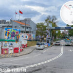
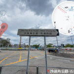
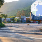
🛣️【Sha Tau Kok Road (沙頭角公路)】 is a major arterial road in the North District of the New Territories. Spanning approximately 12 kilometers, it connects Luen Wo Hui in Fanling with the Sha Tau Kok Frontier Closed Area, making it one of the northernmost highways in Hong Kong. Originally constructed in the 1950s for military use, the road passes through various villages such as Ta Kwu Ling and Lin Ma Hang, cutting across the farmlands and wetlands of northeast New Territories. Due to its proximity to the Mainland border, sections of Sha Tau Kok Road were long designated as part of the Frontier Closed Area. Following the reduction of the closed area boundaries in 2012, the road has been gradually opened to the public, though a Closed Area Permit (CAP) is still required to enter Sha Tau Kok Town. —
📌 Quick Facts
Item Details 🛣️ Road Name Sha Tau Kok Road (沙頭角公路) 📍 Location Northeast New Territories, Hong Kong, connecting Fanling and Sha Tau Kok 📅 Year Opened 1927 📏 Total Length Approx. 10.5 km 🚗 Lane Configuration Jockey Club Road to Heung Yuen Wai Highway: Dual 4-lane divided carriageway
Remaining sections: Dual 2-lane road🚦 Speed Limit Generally 50 km/h, with some sections previously at 70 km/h 🧭 Starting Point San Wan Road, Fanling 🧭 Ending Point Shun Lung Street, Sha Tau Kok 🧱 Sections Lung Yeuk Tau Section, Ma Mei Ha Section, Wo Hang Section, Shek Chung Au Section 🚌 Major Bus Routes KMB 78K, 277A, N78; New Territories Green Minibus 55K, etc. 🌉 Intersecting Roads Jockey Club Road, Ping Che Road, Heung Yuen Wai Highway, San Wan Road, etc. 🌄 Scenery along the way Beautiful natural landscape, passing through villages, valleys, and the Frontier Closed Area 🏞️ Geographical Features Certain sections are within the Frontier Closed Area, requiring a permit for entry 🏗️ Widening History Multiple expansion and widening works carried out between 1995–1999 and 2013–2018 🚉 Related Railway History Its commissioning led to the closure of the Kowloon-Canton Railway Sha Tau Kok Branch Line in 1928 due to a sharp decline in ridership —
📜 Historical Background
Sha Tau Kok Road was the third major highway built by the Hong Kong Government, following Castle Peak Road and Tai Po Road. After it opened, the Kowloon-Canton Railway (KCR) Sha Tau Kok Branch Line suffered a massive drop in passenger numbers and ceased operations in 1928. Having started out as a cross-border trading route, the highway has today transformed into a vital transport hub for travel between Hong Kong and Shenzhen. —
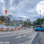
🧭 Road Sections
Section Name English Name From – To Approx. Length 龍躍頭段 Lung Yeuk Tau Section Fanling Roundabout to Kwan Tei River Bridge No. 2 2.74 km 馬尾下段 Ma Mei Ha Section Kwan Tei River Bridge No. 2 to Tai Tong Wu Military Road 1.84 km Wo Hang段 Wo Hang Section Tai Tong Wu Military Road to Mu Tin 3.08 km 石涌凹段 Shek Chung Au Section Mu Tin to Shun Lung Street, Sha Tau Kok Market Town 2.25 km — Sha Tau Kok Road is more than just a traffic artery; it is steeped in rich historical and ecological value. The Lin Ma Hang Mines along the route serve as a military relic from World War II, while the egretries near Luk Keng are crucial habitats for migratory birds in Hong Kong. Traditional Hakka villages like Tam Shui Hang and Shan Tsui are preserved on both sides of the road, showcasing local culture and rural lifestyle. In recent years, eco-tourism routes such as the Sha Tau Kok Cultural Trail and Robin’s Nest Country Park have been developed. Furthermore, Sha Tau Kok Road is the only gateway to remote villages like Lai Chi Wo and Kat O, as well as the Yan Chau Tong Marine Park, seamlessly blending transport convenience with sightseeing. —
🚧 Frontier Closed Area
The area east of the Shek Chung Au Section falls within the Frontier Closed Area. Entry requires a “Closed Area Permit” (CAP). This area borders Shenzhen and houses the Sha Tau Kok Control Point, making it a key node for cross-border travel between Hong Kong and Shenzhen.
—
🚧 Sha Tau Kok Closed Area Opening Scheme
- Phased Opening: Opened in phases since 2022, with all areas except Chung Ying Street fully opened in 2024
- Daily Quota: 3,000 visitors (300 individual travelers, 2,700 tour group visitors)
- Application Method: Free of charge via the Hong Kong Police Force online platform
—In terms of public transport, Sha Tau Kok Road relies heavily on KMB Route 78K and Green Minibus Route 55K, which run on relatively infrequent schedules. As the Phase 2 opening plan for the Sha Tau Kok Port progresses, limited tourism in Sha Tau Kok Town is expected in 2024. This will present new challenges in balancing development and conservation along the road. Blending border history, village culture, and natural ecology, this highway offers a unique window into exploring the distinct character of the northeast New Territories.—
🚌 Public Transport
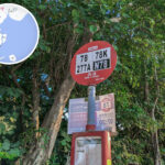
Operator Route No. Via KMB 78K, 277A, N78 Fanling to Sha Tau Kok NT Green Minibus 55K Sha Tau Kok to Luen Wo Hui —
🕰️ Historical Background
Year Event 1924 The Hong Kong Government decides to construct Sha Tau Kok Road. 1927 The road officially opens to traffic, replacing the Kowloon-Canton Railway Sha Tau Kok Branch Line. 1928 The Sha Tau Kok Branch Line ceases operation due to a sharp drop in ridership. 1970 The Hong Kong Government divides the road into four sections and officially gazettes their names. 1995–1999 Sections of the road are widened into a dual 4-lane divided carriageway. 2013–2018 Connection works with the Heung Yuen Wai Highway are completed. 🧭 Road Sections
Section Name Length From To Key Features Lung Yeuk Tau Section Approx. 2.74 km Fanling Roundabout Kwan Tei River Bridge No. 2 Starts at Fanling Roundabout and passes San Wai Barracks. Ma Mei Ha Section Approx. 1.84 km Kwan Tei River Bridge No. 2 Wo Keng Shan Road Close to Ping Che Road; leads towards Lau Shui Heung. Wo Hang Section Approx. 3.08 km Wo Keng Shan Road Mu Tin Covers Loi Tung Village and Tai Long Village. Shek Chung Au Section Approx. 2.25 km Mu Tin Shun Lung Street, Sha Tau Kok Near the Sha Tau Kok Border Checkpoint; sits inside the Frontier Closed Area. —
🚧 Road Conditions & Facilities
- Lane Configuration: Partially dual 4-lane divided carriageway; the rest is dual 2-lane road
- Speed Limit: Mostly 50 km/h, though the Wo Hang Section previously saw limits of up to 70 km/h
- Major Intersecting Roads: Jockey Club Road, Ping Che Road, Heung Yuen Wai Highway
- Closed Area Restrictions: The area east of Shek Chung Au Section is a Frontier Closed Area, requiring a permit
—
🌄 Surrounding Areas & Attractions
- Ma Tso Lung
- Shek Kiu Tau Village
- Sha Tau Kok War Memorial Hall
- Nam Chung and Luk Keng
- Sha Tau Kok Clinic
- Sha Tau Kok Market Town
—
🏞️ Culture & Tourism Potential
- Sha Tau Kok Story House: Preserves local historical artifacts and residents’ stories
- Sha Tau Kok Public Pier: Gateway to Ap Chau and Kat O
- Land Dragon Dance: A traditional folk performance of the Hoklo people
—
🌿 Sha Tau Kok Tourism & Ecological Development
- Tourism Positioning: Creating a “Blue-Green Recreation and Eco-tourism Circle” that fuses natural landscapes with cultural history
- Facilities Planning: Rebuilding the public market, revitalizing San Lau Street, and introducing drone sightseeing tours
—
🌉 Modern Development & Cross-Boundary Functions
- Heung Yuen Wai Control Point: Intersects with Heung Yuen Wai Highway to form a crucial cross-boundary transport hub for eastern Hong Kong and Shenzhen
- Connection works with Liantang Port were completed in 2018, strengthening eastern cross-boundary transport capabilities
- Traffic Efficiency: Travel time between Sha Tau Kok and Fanling has been shortened to roughly 8 minutes
- Future Planning: Proposals are underway to further widen the highway to support the development of the Shenzhen-Hong Kong Cooperation Zone
—