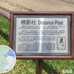
🫚【Keung Shan Road (羗山道)】 is a winding mountainous road in western Lantau Island, Hong Kong, connecting Tai O with the Shek Pik Reservoir area, spanning a total length of about 6 kilometres. Initially carved out in the 1960s to facilitate the construction of the Shek Pik Reservoir, the route cuts through dense secondary forests and valleys. It owes its name to the famous Buddhist sanctuary mountain “Keung Shan” through which it passes; the name itself stems from the local Hakka pronunciation of “Keung Shan” (Ginger Mountain), reflecting the unique linguistic and cultural heritage of Lantau Island. —
📌 Fast Facts
Item Details 🛣️ Road Name Keung Shan Road (羗山道), also written as “羌山道” 📍 District Islands District, New Territories, Hong Kong; Southwestern Lantau Island 📏 Length Approx. 4.6 km (13,200 feet) 🚗 Lane Configuration Single track two-way (two-way traffic); some sections lack pedestrian pavements ⏱️ Speed Limit 50 km/h 🗓️ Year Opened July 1966 🧭 Starting Point Tai O Road (near Hang Back Village, Ling Yan Monastery, and Lung Ngam Monastery) 🧭 Ending Point South Lantau Road / Shek Pik Reservoir Road (near Shek Pik Reservoir and Shek Pik Prison) 🧱 Topography Rugged terrain; some sections feature steep gradients up to 1:10 🚌 Main Transport Connections New Lantao Bus Routes: 1, 2, 11, 21, 23 🧭 Intersecting Roads South Lantau Road, Shek Pik Reservoir Road, Wang Pui Road, Sham Wat Road, Tai O Road ⚠️ Historical Incidents 1973 bus plunge accident, resulting in 17 deaths and 23 injuries 📢 Community Incidents 2016 villager road blockage protesting the “Driving on Lantau Island” scheme 🏞️ Points of Interest Shek Pik Reservoir, Sha Tsui Correctional Institution, Kwun Yam Monastery, Fat Wah Yuen, Sam Yin Ching She, Shing Fai Orchard 🏗️ Construction History Originally only extended to Sham Wat Road; extended to Tai O Road in 1971 🧾 Gazettal Date Gazetted and officially named on 5 June 1970 —
📜 Historical Background and Development
- 1950s : The Hong Kong Government commenced construction of the Shek Pik Reservoir, building Keung Shan Road as a supporting infrastructure project to link Shek Pik and Keung Shan.
- July 1966 : Keung Shan Road officially opened to traffic, initially terminating at Sham Wat Road.
- 5 June 1970 : The road was officially gazetted and named “Keung Shan Road”.
- 1971 : The road was extended to Tai O Road, becoming a primary artery for areas like Tai O, Sham Wat, and Ngong Ping.
- Topographical Challenges : Due to the rugged terrain, some road sections feature steep gradients reaching 1:10, requiring extra caution while driving.
— Keung Shan Road has now become a vital gateway for exploring western Lantau Island, with New Lantao Bus Routes 11 and 21 operating daily to ferry passengers between Tai O and Tung Chung. Cyclists and hikers frequently take on this challenging route, and during autumn, migratory raptors can often be seen circling above the peaks. Given the basic engineering standards and lack of safety barriers on certain stretches, motorists must drive with extreme care, while hikers can detour from the middle section to reach Ngong Ping Campsite or the Keung Shan Country Trail. Beyond serving as a route for religious pilgrimages, this road offers a quiet path to experiencing Lantau’s rural tranquility and rich ecological biodiversity. —
🚌 Public Transport and Bus Stops
Keung Shan Road is a crucial transport artery for the western Lantau region. Below are the primary bus routes and stops along the road:
🚍 Main Bus Routes
Route No. Service Termini 1 Tai O ⇄ Mui Wo Ferry Pier 2 Ngong Ping ⇄ Mui Wo Ferry Pier 11 Tung Chung Station ⇄ Tai O 21 Ngong Ping ⇄ Tai O 23 Tung Chung ⇄ Ngong Ping N1 Mui Wo → Tai O (Overnight service) 🛑 Bus Stops (East to West)
- South Lantau Road / Shek Pik Reservoir Road
- Shek Pik Police Post
- Sha Tsui (near the disused Shek Pik Bus Terminus)
- Wang Pui Road (leading to Tai Long Wan Village)
- Sham Wat Road (leading to Ngong Ping)
- Fat Wah Yuen, Sam Yin Ching She, Shing Fai Orchard
- Kwun Yam Monastery
- Tai O Road
— The road’s most notable characteristic is its deep religious and cultural atmosphere. It is dotted with several temples and monasteries—such as the Ng Yuen (a branch of Po Lin Monastery), Tsz Hing Monastery, and Ling Yan Monastery. Among them, the highly revered Kwun Yam Monastery features Hong Kong’s tallest outdoor bronze statue of the Kwun Yam deity. Monks and pilgrims are a common sight walking along the roadside, while feral cattle roaming free and swarms of dancing butterflies lend the route a unique spiritual and natural charm. The narrow two-lane road is filled with sharp bends and steep slopes, including a famous landmark stretch known as the “Keung Shan Road Big Bend”—a series of consecutive hairpin turns that climb sharply from 200 metres to 400 metres above sea level. Additionally, a roadside lookout point offers a stunning panoramic view of the Tai O fishing village and the vast waters of the Pearl River Estuary. —
🧭 Roadside Landmarks and Community Profile
Location Features and Description Shek Pik Reservoir Completed in the 1950s, it supplies fresh drinking water to Lantau Island and the Outlying Islands Shek Pik Prison A maximum-security facility under the Hong Kong Correctional Services Department, located along the southeastern stretch Sha Tsui Correctional Institution Situated near Shek Pik Reservoir; some adjacent road sections lack pedestrian walkways Sham Wat Village A traditional Hakka village that well preserves a wealth of indigenous resident culture Fat Wah Yuen, Sam Yin Ching She Buddhist monasteries providing tranquil spaces for meditation and religious activities Kwun Yam Monastery A renowned Buddhist temple that draws large crowds of devotees for worship Ling Yan Monastery Located near Tai O Road, connecting to the western terminus of Keung Shan Road —
⚠️ Major Incident: The 1973 Bus Plunge Accident
- 🗓️ Date: 22 July 1973
- 🚌 Incident: A New Lantao Bus lost control and plunged down a cliff near the junction of Keung Shan Road and Sham Wat Road.
- 📉 Consequences: Resulted in 17 fatalities and 23 injuries.
- 📌 Status: It remains the third-deadliest traffic accident in Hong Kong’s history.
—
📣 Community Controversy and Traffic Planning
- February 2016 : The government rolled out the “Driving on Lantau Island” scheme, drawing widespread dissatisfaction from local residents.
- 8 May 2016 : Residents staged a protest by blocking Keung Shan Road, demanding immediate upgrades to road safety and better transport management.
- Core Issues : The narrow lanes, steep inclines, and inadequate pedestrian pavements continue to pose safety hazards to both residents and visitors.
—