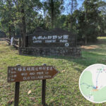
🛣️【South Lantau Road (嶼南道)】 is the first major road in the southern part of Lantau Island, Hong Kong, and was formerly known as “Lantau Island Highway”. It was originally built in the 1950s to support the construction of Shek Pik Reservoir, making it easier to transport construction workers and materials by land. The road starts in the east at Mui Wo (Silver Mine Bay) and extends west to the junction of Shek Pik Reservoir Road and Keung Shan Road. Spanning approximately 14.5 km, it runs through several coastal villages including Pui O, Cheung Sha, Tong Fuk, and Shui Hau. —
📌 Quick Facts
Item Details 🏞️ District Southern part of Lantau Island, New Territories, Hong Kong (Islands District) Chinese Name South Lantau Road (嶼南道) 📏 Road Length Approx. 14.5 km 🚗 Traffic Direction Eastbound and westbound (two-lane, two-way undivided road) 🛣️ Start Point Mui Wo (Junction of Ngan Kwong Wan Road / Mui Wo Ferry Pier Road) 🛤️ End Point Junction of Shek Pik Reservoir Road / Keung Shan Road 🕰️ Year Opened Opened in phases from 1957 to 1963 🐄 Special Traffic Signs Features “Cattle ahead” warning signs due to frequent cattle sightings in the area 🚧 Road Conditions Winding and narrow with steep inclines up to 1:8 in some sections; requires regular maintenance 🚦 Speed Limit Generally 50 km/h, but restricted to 30 km/h through village sections like Pui O and Tong Fuk 🚫 Control Measures Classified as a closed road; a Lantau Closed Road Permit is required for entry, otherwise visitors must use public transport 🚌 Public Transport Served by New Lantau Bus (NLB) routes including 1, 2, 3M, 4, 11, 23, etc. 🥾 Hiking Routes Forms the core sections of Sections 1, 11, and 12 of the Lantau Trail 🌊 Places En Route Coastal villages and beaches including Mui Wo, Pui O, Cheung Sha, Tong Fuk, Shui Hau, and Shek Pik 🌿 Surrounding Nature Close to South Lantau Country Park, ecological beaches, and countryside campsites; falls within a nature conservation zone — The design of this road is deeply etched with historical marks. Initially, all sections were single-lane for two-way traffic, before being expanded in phases into a two-lane, two-way undivided road starting from 1976. Because parts of the route are twisty, narrow, and rugged (for example, the incline from Mui Wo Ferry Pier to Yuen Yuen Tsuen hits a steep 1:8 gradient), the speed limit is kept between 30 and 50 km/h, and the entire line runs without traffic light controls. One major feature is that the whole stretch of South Lantau Road is a closed road. Vehicles from outside without a valid permit are strictly banned from driving in, meaning visitors have to rely on public transport like New Lantau Buses or Lantau taxis to get around. —
🏗️ Historical Evolution
- Early 1950s: To build the Shek Pik Reservoir, the government decided to plan and construct a land route (South Lantau Road) to transport workers and building materials.
- 1954: The Heung Yee Kuk Proposed Lantau Highway plan was put forward, and the colonial government appointed a rural development committee to study the road construction.
- 3 August 1957: The first section (Mui Wo to Cheung Sha) opened to traffic, with the opening ceremony officiated by the Director of Public Works, Mr. Inglis.
- 1963: The entire line was opened through to Shek Pik, becoming the very first major road on Lantau Island.
- 5 December 1969: Formally gazetted and named “South Lantau Road”.
- From 1976 Onwards: Expanded into a two-lane, two-way road.
—
🧭 Places En Route and Intersecting Roads
South Lantau Road passes through: Mui Wo, Pui O, Cheung Sha, Tong Fuk, Shui Hau, and Shek Pik.
Road Name Function & Location Description Keung Shan Road Leads to Tai O; serves as the westernmost connection point of South Lantau Road Shek Pik Reservoir Road Leads to the top of the Shek Pik Reservoir dam Tung Chung Road Connects the north and south sides of Lantau Island Chi Ma Wan Road Leads into Pui O Village Ngan Kwong Wan Road Leads towards Mui Wo Ferry Pier South Lantau Road runs eastbound and westbound, cutting across the southern coast of Lantau Island. It offers scenic views along the way, though the terrain undulates noticeably:
🌄 Main Places En Route (From East to West):
- Mui Wo
- Nam Shan
- Pui O (equipped with a petrol station and holiday homes)
- Cheung Sha (famous beach)
- Tong Fuk (home to the Correctional Institution and submarine cable station)
- Shui Hau (equipped with a helipad and pumping station)
- Shek Pik Reservoir
Key Intersections:
Road Name Function & Location Description Keung Shan Road Leads to Tai O; serves as the westernmost connection point of South Lantau Road Shek Pik Reservoir Road Leads to the top of the Shek Pik Reservoir dam Tung Chung Road Connects the north and south sides of Lantau Island Chi Ma Wan Road Leads into Pui O Village Ngan Kwong Wan Road Leads towards Mui Wo Ferry Pier ⛰️ Topographical Features:
- Highest Elevation Point: The northern foothills of Sunset Peak (approx. 220 metres)
- Lowest Point: Tong Fuk Beach (approx. 3 metres)
- Road Incline: Reaches steep gradients of 1:8 to 1:10, making it completely unsuitable for high-speed driving
—
🚦 Traffic Functions and Control Measures
South Lantau Road is the only land-based trunk road in South Lantau, but strict traffic controls are enforced to protect the local ecosystem:
- 🚫 Closed Road: All non-resident vehicles must apply for a permit from the Transport Department, or face prosecution.
- 🚌 Public Transport: NLB routes 1, 2, 3M, 4, 11, and 23 run along the entire line; the general public must catch an NLB bus or a Lantau taxi to visit.
- 🐄 Animal Alerts: Cattle are a common sight along the road, which is why “Cattle ahead” signs are set up.
- 📉 Traffic Flow: Designed for a capacity of 8,000 vehicles per day, the actual flow sits at just around 3,200 vehicles.
— South Lantau Road is more than just a transport artery; it links up the natural beauty and cultural heritage of southern Lantau. It intersects with Tung Chung Road at San Shek Wan in Cheung Sha, making it the primary road connecting Tung Chung, Tai O, and Mui Wo. Along the route, you’ll not only find the beautiful Cheung Sha Beach and Tong Fuk Beach, but it also serves as the core stretch for Section 1 and Sections 11 to 12 of the Lantau Trail. It is worth noting that because cattle frequently wander onto the road, the Transport Department has specially installed “Cattle ahead” traffic signs to remind drivers to watch out for safety. While fulfilling its transport duties, this road is heavily geared towards balancing the ecological conservation of Lantau Island. —
🌿 Surrounding Ecosystem & Tourism Resources
The area along South Lantau Road is packed with rich natural resources and tourist hotspots, making it a go-to place for outings and hiking:
- 🏖️ Eco-Beaches: Natural beaches are located at Pui O, Cheung Sha, and Tong Fuk.
- 🏕️ Countryside Campsites: 6 camping spots, including Nam Shan Campsite and Pak Fu Tin, are scattered along the route.
- 🚶♂️ Hiking Trails: South Lantau Road overlaps directly with Sections 1, 11, and 12 of the Lantau Trail.
- 🛑 Conservation Zones: 162 hectares on both sides of the road are designated as a Coastal Protection Area.
- Warning Signs: “Cattle ahead” signs are installed as cattle regularly roam along the tracks.
—
🛠️ Planning and Future Development
Although South Lantau Road is long-established, the government keeps rolling out improvements and conservation work:
- 📊 2021 Statistics: Traffic volume sits at just 50% of its designed capacity.
- 🧱 Surface Improvements: Several winding corners near villages have undergone widening and safety upgrades.
- 📡 Monitoring Systems: Equipped with infrared and positioning devices to stop illegal fly-tipping of waste.
- 🚧 Future Planning: The current road width will be maintained to align with the overall “Two Tunnels and One Bridge” transport scheme.
—
🚍 Public Transport and Bus Routes
South Lantau Road serves as the main trunk route for multiple lines run by the New Lantau Bus (NLB):
Route No. Main Itinerary Route 1 Mui Wo ↔ 大澳 (Runs along South Lantau Road for the entire journey) Route 2 Mui Wo ↔ Ngong Ping (Runs along South Lantau Road for the entire journey) Routes 3M, 4, 11, 23 Pass through parts of South Lantau Road 📌 This road features 30 bidirectional stops and 4 unidirectional stops, making it one of the roads with the most bus stops in Hong Kong. —
🌧️ Notable Incidents & Safety Tips
- Landslides: During the heavy rainstorms of 2021, South Lantau Road was completely closed due to a landslide.
- Cattle Accidents: A car crash involving cattle occurred in 2013, tragically resulting in the deaths of 6 cows.
—