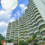
🛣️【Mount Davis Road (摩星嶺道)】 is a major thoroughfare in the western part of Hong Kong Island, stretching approximately 1.6–1.7 km. It connects Victoria Road in Pok Fu Lam to Pok Fu Lam Road, winding through the hillsides of Mount Davis with terrain that slopes from west to east. This road is not only the main access route to Mount Davis, but also serves as the boundary between the Central and Western District and the Southern District. Along the way, you can enjoy magnificent views of the Sulphur Channel, Green Island and Little Green Island, as well as sweeping vistas of Lantau Island and Lamma Island. —
📌 Quick Facts
Item Details Location Western Hong Kong Island, south of Mount Davis Length Approx. 1.6–1.7 km Naming Date January 18, 1924, named after the second Governor of Hong Kong, Sir John Francis Davis Road Characteristics Dual-lane, two-way traffic, speed limit of 50 km/h Start Point Victoria Road, Pok Fu Lam End Point Sandy Bay, connecting to Pok Fu Lam Road and Smithfield Road Regional Boundary North belongs to the Central and Western District; south belongs to the Southern District — Beyond its unique geographical location, Mount Davis Road is lined with diverse architectural and cultural landmarks. From St. Clare’s Girls’ School to the Victoria Road Detention Centre (also known as the “White House”), and the Canossian Retreat House, the area weaves together education, religion, and political history. Coupled with luxury residential estates such as Greenfield Court and Ocean Court, Mount Davis Road offers a unique cultural and social snapshot of the western part of Hong Kong Island. —
🏞️ Geographical Environment
- Terrain: Low in the west and high in the east, with many slopes along the way.
- Regional Boundary: North belongs to the Central and Western District; south belongs to the Southern District.
- Views: North looks over the Sulphur Channel; west looks towards Green Island and Little Green Island; overlooks Lantau Island and Lamma Island in the distance.
- Mount Davis Summit: Elevation of approx. 260 metres, home to a communication station and a youth hostel.
—
🏫 Key Landmarks and Buildings
Location English Name Features St. Clare’s Girls’ School St. Clare’s Girls’ School A well-known school located in the middle of the road Mount Davis Bus Terminus Mount Davis Bus Terminus Near the western end at Victoria Road Victoria Road Detention Centre Victoria Road Detention Centre / White House Former political detention centre Canossian Retreat House Canossian Retreat House Place for religious retreats Chiu Yuen Cemetery Chiu Yuen Cemetery Burial ground for descendants of the Ho Tung family Qi Ming Temple Qi Ming Temple Buddhist temple Luxury Residential Area Ocean Court / Greenfield Court High-end residential area, including Villa Felice, Seaview Garden, Seaview Villa, and Tsui Fai Terrace —
🚍 Transportation
- Bus: Only Route 3A (peak-hour school bus) and A10 (Airport Express) serve the area.
- Green Minibus: The main mode of public transport.
- Mount Davis Bus Terminus: Currently served only by Route 5B.
—
⚠️ Important Notes
- June 2021 Rainstorm: A landslide occurred on Mount Davis Road near Greenfield Court, causing the entire road to be closed.
- Mount Davis Summit: Features a Police Communication Station, the Jockey Club Mount Davis Youth Hostel, and remaining WWII battery relics.
—
🌄 Mount Davis Background
- Elevation: Approx. 260 metres
- Origin of Name: Named after the second Governor of Hong Kong, Sir John Francis Davis
- Views: Offers views of Green Island and Little Green Island, Lamma Island, Cheung Chau, and Lantau Island
- History: Site of British military forts, batteries, and relics from the Battle of Hong Kong; formerly home to resettlement villages and squatter areas; now hosts a police communication station and the Jockey Club Mount Davis Youth Hostel