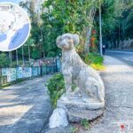
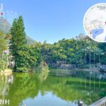
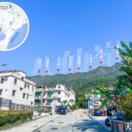
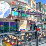
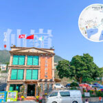
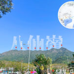
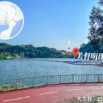
🌿【Tai Mei Tuk Tsuen (大美督村)】 is located in the Tai Po District of the New Territories, Hong Kong. As one of the villages situated at the northern end of the Shuen Wan Plover Cove Reservoir Main Dam, it is backed by Pat Sin Leng, adjacent to Tolo Harbour, and faces Ma Shi Chau from afar. The village was originally named “Tai Mei Tuk” (大尾篤), literally meaning “the very end”, as it sits at the tail end of the Pat Sin Leng dragon vein. In 2007, the Lands Department officially changed the Chinese name to “大美督” (meaning “Great Beauty”) following requests from villagers who felt the original name carried inauspicious connotations. Blessed with scenic surroundings, the village is bordered by settlements like Lung Mei Village and Ng Uk Village. Renowned for its stunning views of the Plover Cove Reservoir Main Dam, it is a popular weekend hotspot for locals to enjoy cycling, barbecues, and sunset watching. —
🗺️ Location
- Location: Tai Po District, New Territories; near the northern end of the Plover Cove Reservoir Main Dam.
- Geographical Features:
- North: Pat Sin Leng mountain range
- South: Tolo Harbour
- West: Lam Tsuen River
- East: Plover Cove Country Park
🏘 Evolution of the Place Name
- Originally named “Tai Mei Tuk” (大尾篤), symbolizing the tail end of the Pat Sin Leng dragon vein. Both “尾” and “篤” mean “the very end” in Cantonese.
- Villagers later pushed for a name change to “Tai Mei Tuk” (大美督), which carries the meaning of “the beautiful end”.
- In 2007, the villagers’ request was officially adopted by the government, and the Lands Department formally gazetted the name as “Tai Mei Tuk” (大美督).
—
🏘️ Villages and Historical Background
Village Layout
Village Name (Chinese) English Name Key Features 大美督村 Tai Mei Tuk Village The main village, housing the village office and local temples. 吳屋村 Ng Uk Village A traditional Hakka village that preserves its ancestral hall culture. 龍尾村 Lung Mei Village Located close to Lung Mei Beach. 黃竹村 Wong Chuk Village Nestled near the woods, offering a peaceful environment. — Tai Mei Tuk Village is not just a leisure hotspot; it seamlessly blends natural beauty with rich cultural heritage, boasting features like a mangrove eco-zone and traditional temples. The village is packed with bicycle rental shops, allowing visitors to ride along the reservoir’s main dam while soaking in the breathtaking lake and mountain views. Alternatively, you can head to the nearby barbecue sites and water sports centres for some outdoor fun. In terms of transport, it is highly accessible via bus 75K or green minibus 20C from Tai Po Market Station, making it an absolute classic for a Hong Kong day trip. —
🚌 Transport
Route No. Origin & Destination Remarks 72C Tai Mei Tuk → Tai Po Market Station Mon-Fri morning peak hours only 73P Tai Mei Tuk ⇄ Nina Tower, Tsuen Wan Mon-Fri peak hours only 74E Tai Mei Tuk ⇄ Kwun Tong Ferry Pier Mon-Fri peak hours only 75K Tai Mei Tuk ⇄ Tai Po Market Station Regular daily service 275R Tai Po Market Station ⇄ 烏蛟騰 Saturdays, Sundays & Public Holidays only —
🎯 Key Attractions & Activities
🚴♀️ Cycling Track
Rent a bike from Tai Po town centre and head out along the Lam Tsuen River all the way to Tai Mei Tuk. The scenic route is well-equipped with bike rental kiosks and rest pavilions.
🌊 Water Sports Centres
Centre Name Managing Organisation Activities Offered Tai Mei Tuk Water Sports Centre Leisure and Cultural Services Department Kayaking, dinghy sailing, windsurfing HKFYG Tai Mei Tuk Outdoor Activities Centre Hong Kong Federation of Youth Groups Youth training, group activities HKGGA Sea Activity Centre Hong Kong Girl Guides Association Nautical skills training Scout Association of HK Tai Mei Tuk Sea Activity Centre Scout Association of Hong Kong Seamanship and camping 🔥 Public Barbecue Site
Free to use and equipped with numerous BBQ pits and benches. It overlooks Tolo Harbour, making it an incredible spot for sunset views.
🥾 Family Walk
Starting from the small hill next to Tai Mei Tuk Village, this trail leads towards Plover Cove Country Park or Bride’s Pool Waterfall. It is beginner-friendly and perfect for families. —
☕ Dining & Leisure
- Sam Wo Road: Packed with alfresco restaurants and cosy cafes.
- Pimary Café: A peaceful lifestyle concept store combined with a cafe.
- BBQ Areas: Free public pits, with nearby kiosks selling all your charcoal, food, and grilling essentials.
—
🏞 Local Culture & Architecture
- The village features local temples and ancestral halls, retaining a strong Hakka heritage.
- Most village houses are typical 2 to 3-story buildings, with some still retaining traditional brick-and-tile structures.
—
🌤️ Climate & Best Time to Visit
- Subtropical climate with hot summers and mild winters.
- Best time to visit: Autumn (October to December), when the weather is perfectly breezy and the views are clear.
—
🧑🤝🧑 Community Culture & Preservation
- The residents are predominantly Hakka, preserving traditional ancestral halls and festivals.
- Annual events include temple fairs, dragon dances, and lion dances.
- The community actively drives environmental conservation and cultural heritage preservation.
—
📌 Fun Facts
- The character “篤” (tuk) was originally “䐁”, referring to the bottom or the very end of the body, which later evolved to mean “the final stop” or “the end”.
- The Guan Yin statue nearby stands at a towering 76 meters, making it the second tallest Guan Yin statue in the world—even taller than the Tian Tan Buddha.
—
🧭 Nearby Attractions
- Butterfly Reserve: Home to over 200 butterfly species, hosting a “Butterfly Festival” every month.
- White Guan Yin Statue (Tsz Shan Monastery): Standing at 76 meters tall, it symbolizes compassion and protection.
—