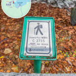
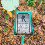
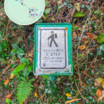
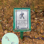
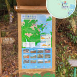
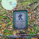
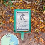
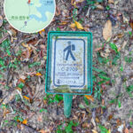
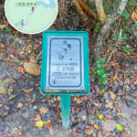
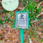
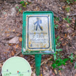
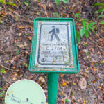
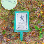
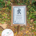
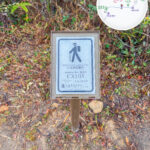
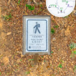
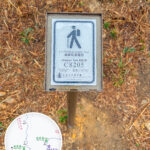
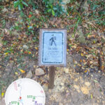
📍 【Distance Posts】 are a distance marking system installed across Hong Kong’s country parks and long-distance hiking trails, managed by the Agriculture, Fisheries and Conservation Department. These numbered posts are typically made of concrete or metal, displaying an English code (such as M for the MacLehose Trail) and numbers on the post body. They are placed every 500 meters to indicate the hiker’s current location and distance from the trail’s starting point. For instance, “M001” represents 500 meters after the start of the MacLehose Trail, “M002” represents 1 kilometer, and so on, covering the four major long-distance trails: the MacLehose Trail, Wilson Trail, Lantau Trail, and Hong Kong Trail. —
📌 Basic Information
Item Detailed Content 🗓️ Year Established 1994, first established on the MacLehose Trail by the Agriculture, Fisheries and Conservation Department 🎯 Objective To provide location reference for hikers, assist in emergency rescue and search operations, and enhance hiking safety 📍 Distribution Range All long-distance hiking trails (such as the MacLehose Trail, Lantau Trail, Hong Kong Trail, and Wilson Trail), country trails, and tree walks 🔢 Quantity Over 900 posts (as of 2024; note: over 3,000 across all trail types combined) 🔤 Numbering Format Letter + Number, for example: M101 (M = MacLehose Trail, H = Hong Kong Trail, etc.) 🧭 Geographic Positioning Distance post locations and coordinates can be queried via the Lands Department’s “GeoInfo Map” or “Spatial Data Sharing Platform” 🗺️ Coordinate System The Hong Kong 1980 Grid System and the WGS84 Global Positioning System are used in tandem 📱 Digital Application Supports GPS navigation and emergency reporting; distance post positions can be viewed in hiking apps (such as “Enjoy Hiking”) 🧠 Additional Features Provides distance references, confirms whether one has veered off the main trail, serves as hiking photo-taking hotspots, and helps rescue teams position quickly 🧭 Query Method Inputting a distance post number (such as M101) into the Lands Department’s map platform will display its location and coordinates —
🧱 What is a Distance Post?
Distance posts are positioning devices installed in Hong Kong’s country parks and hiking trails. Set up by the Agriculture, Fisheries and Conservation Department, their purposes are:
- 📍 Positioning Support: Allowing hikers to clearly know their current location
- 🚨 Emergency Rescue: Reporting the distance post number to the police in the event of an accident or getting lost to facilitate search and rescue
- 🧭 Trail Navigation: Assisting in identifying route sections and distances
Each distance post is spaced approximately 500 meters apart, with over 3,000 posts currently installed throughout Hong Kong, spanning all major hiking and country trails. — The core function of a distance post is to safeguard hiking safety. Hikers can precisely report their location using the number on the post, making it easier for emergency personnel to locate them. Furthermore, the post code helps in trip planning and calculating energy expenditure; for example, walking from M010 to M015 means completing a 2.5-kilometer distance. The system also aids in topographical navigation, providing directional references especially during foggy conditions or at junctions, reducing the risk of getting lost. —
🔤 Coding Structure Breakdown
Each distance post is printed with a unique set of numbers, usually composed of an English letter, a number, and coordinates:
1. Trail Code (English Letter)
Code Route Name (English) Route Type M MacLehose Trail MacLehose Trail W Wilson Trail Wilson Trail L Lantau Trail Lantau Trail H Hong Kong Trail Hong Kong Trail C Country Trail Country Trails (all country trails share the letter C) 2. Number
- Three Digits: Represents the sequence number of the distance post on that specific trail; for example, M045 is the 45th post on the MacLehose Trail
- Four Digits (Exclusive to Country Trails): The first two digits represent the country trail prefix code, and the last two digits are the post sequence
For example, C3301 indicates the 1st distance post of the Ma On Shan Country Trail (code 33)📚 Country Trail Prefix Codes (Selected List)
Code Country Trail Name 11 South Lantau Country Trail 22 Lau Shui Heung Country Trail 33 Ma On Shan Country Trail 41 Tai Tam Country Trail 61 Yuen Tsuen Ancient Trail Country Trail 71 Lo Fu Tau Country Trail A complete list can be found at the Agriculture, Fisheries and Conservation Department Official Introduction
3. Six-Digit Grid Reference
- For example: 810456 is the grid coordinate on the map
- In an emergency, providing this coordinate when calling for help allows rescue workers to locate you rapidly
— Having been in use since the 1970s, distance posts have become an important symbol of Hong Kong’s hiking culture. Their design balances durability and legibility, and distance posts on several popular routes have been upgraded with QR codes that provide information on local ecology and history. This system not only reflects the meticulous nature of Hong Kong’s countryside management, but is also a rare example globally of a comprehensive hiking marker network covering an entire territory, deeply trusted by local hikers and international tourists alike. —
🔢 Number Interpretation Methods
- M001: Indicates the 1st distance post on the “MacLehose Trail”
- C3301: Indicates the 1st distance post on section 33 of the “Ma On Shan Country Trail”
- Coordinate Digits: For example, “812345” represents the precise position on the map
—
🧱 Appearance and Structure of Distance Posts
Each distance post stands roughly 1 meter tall, usually constructed from metal or plastic, and is placed at prominent spots or trail junctions. The post body features the following information:
Item Description Trail Code An English letter representing the route, such as M (MacLehose Trail) Number The trail code followed by a number, where M001 indicates the 1st distance post Grid Coordinate A six-digit number (such as 812345) for rescue teams to pinpoint positions precisely Route Name The Chinese route name, occasionally with English included (on official markers only) —
📍 Distribution and Quantities of Distance Posts
As of 2024, there are more than 3,000 distance posts set up throughout Hong Kong, distributed across the following major routes:
- 🥾 MacLehose Trail
- 🥾 Wilson Trail
- 🥾 Lantau Trail
- 🥾 Hong Kong Trail
- 🌳 Various Country Trails
—
🧑🚒 Emergency Uses and Safety Recommendations
- 📱 Note down the starting and ending distance post numbers before heading out
- 🗺️ Use the Lands Department’s “GeoInfo Map” to search for distance post locations
- 📞 Call for help in an emergency and provide the distance post number and coordinates
- 🧢 Bring sufficient water, food, sun protection, and a simple first-aid kit
—
📷 Distance Post Photo-Taking Culture
Many hiking enthusiasts treat distance posts as landmarks to take photos with, capturing their journey and challenge milestones. Some popular distance posts include:
- M001: The starting point of the MacLehose Trail
- L001: The starting point of the Lantau Trail
- H100: The middle section of the Hong Kong Trail, offering beautiful scenery
—
🧠 Fun Fact: Design Details of Distance Posts
- Standing about 1 meter high, they are mostly made of metal or stone pillars
- The top features an angled nameplate for easy reading
- On certain sections (such as rocky slopes), the nameplate is nailed directly onto the wall surface or rock face
- An “Introduction to Distance Posts” board is typically placed at the starting and ending points, explaining the post sequence and distances of the entire route
—
🔍 How to Find Distance Post Locations?
- 📱 Lands Department GeoInfo Map
- 🗂️ Spatial Data Sharing Platform
- 🧭 Agriculture, Fisheries and Conservation Department Official Introduction
—
🔗 For more information, please refer to:
Agriculture, Fisheries and Conservation Department Official Introduction —