Skip to content
Home
Journal
About
Contact
中文 (香港)
English
Home
/
【Hiking • 021】Lin Ma Hang Lead Mine . Robin’s Nest . Sha Tau Kok
/
Distance Post C8101
Robin’s Nest Country Trail, Distance Post: C8102, Grid Reference: KK 128 964
其他圖片:
Distance Post C8107
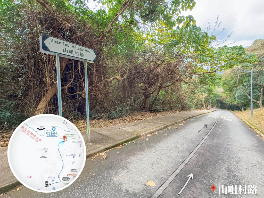
Shan Tsui Village Road 《I》
Distant View of Yantian Port 《I》
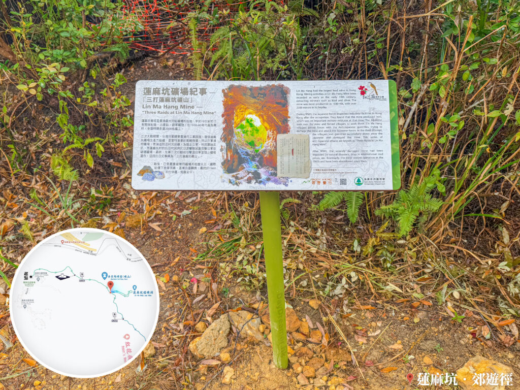
Chronicle of Lin Ma Hang Mine 《Information Board》
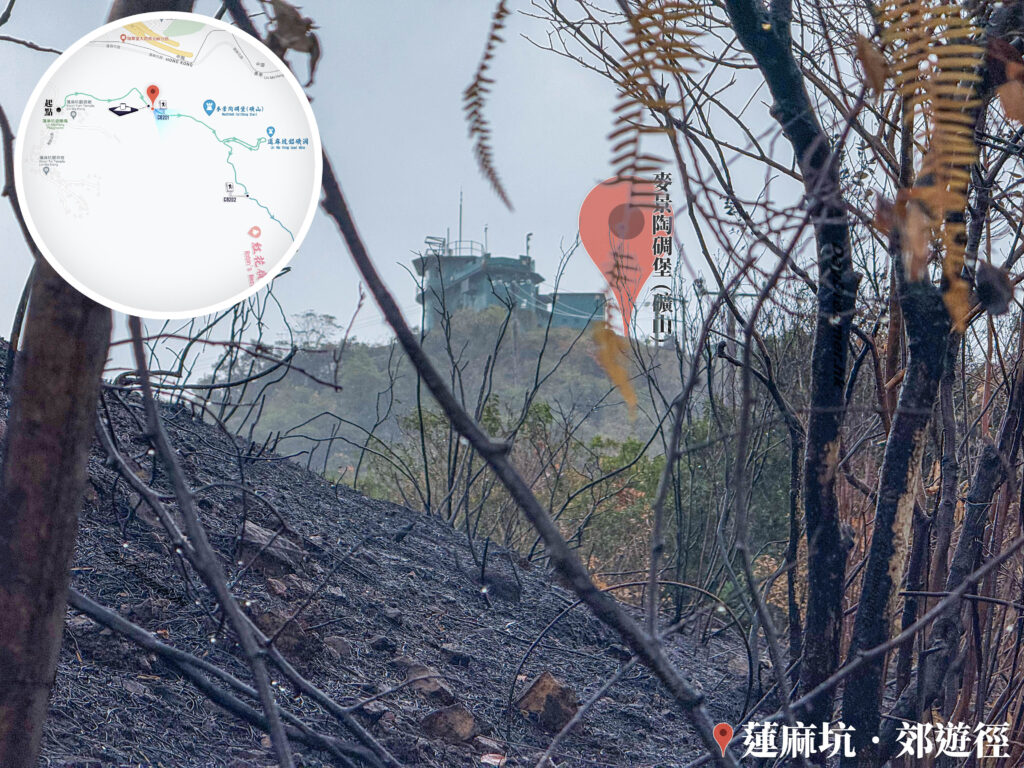
WWII Military Installations 《IV》
Charred Hillsides 《II》
📷 相片參數
Camera:
Lenses:
Keywords:
Distance Point
Subjects:
Location:
Place:
Robin's Nest Country Park
,
Robin's Nest Country Trail
,
Sheung Tam Shui Hang
District:
Sha Tau Kok
Area:
New Territories
📸 此圖片拍攝自:
【Hiking • 021】Lin Ma Hang Lead Mine . Robin’s Nest . Sha Tau Kok
📍 經緯度:
,
|
⛰️ 高度:
香港地點:
Yeung Sam College
Ap Lei Pai Tombolo
黃石碼頭
港鐵大埔墟站
Shui Long Wo Star Lookout
Penis Rock
深涌農莊
Pak Sha O Youth Hostel
Fat Jong Temple
Chek Keng Pier
Temple Mall North
Kau Ling Chung View Compass
鴨脷排連島沙洲
白沙澳青年旅舍
水浪窩觀星台
The Peak Lions Pavilion
春風亭
福利茶室
大埔墟專線小巴總站
大埔墟巴士總站
Loi Kee Store
Mount Johnston Lighthouse
大浪灣營地
Lin Ma Hang Mine
香港地方:
碧珊徑
Lantau Trail – Section 2
梅窩市中心
石壁水塘道
Mount Davis Path
So Lo Pun
Kei Lak Tsai
Lam Kam Road
Lantau Trail – Section 1
Lin Ma Hang Village
Peak Road
鍾離峰
宏貝道
黃牛山
蚺蛇坳
鹽田壆
Bride's Pool Road
分流西灣
番鬼塘
Kau Ling Chung
Tai Tung
Ngong Ping Fun Walk
Cheung Pai Tau Path
Lion Rock
香港景物:
Stone Wall Tree
配水庫
Taxi
Shopping Centre
健身徑
Map
越野電單車
Rock Forest
樓宇
村落
雕塑
公廁
Signboard
Sea
Enkianthus Quinqueflorus
單車
港鐵東鐵綫
堤壩/水壩
Shingle Beach
馬路
Service Reservoir
Wilson Trail
船
Cityscape
←
Previous:
【Hiking • 021】Lin Ma Hang Lead Mine . Robin’s Nest . Sha Tau Kok