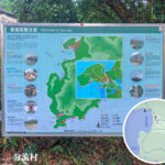
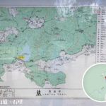
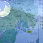
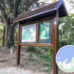
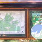
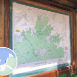
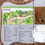
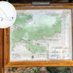
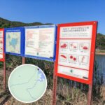
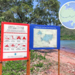
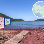
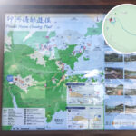
🖼️ 【Information Boards】When hiking along Hong Kong’s country trails, these information boards established by the Agriculture, Fisheries and Conservation Department (AFCD) serve as far more than mere directional signs—they are a visitor’s gateway to exploring nature. Designed bilingually (Chinese + English), complete with clear maps, distance indicators, and “You are here” markers, they allow hikers to trek with peace of mind even along winding mountain paths. Mostly constructed from weather-resistant timber or metal, they can withstand heavy humidity and intense sunlight, ensuring durability across long years of outdoor exposure.
🎯 Purpose of Establishment
Function Details 🧭 Navigation Clearly marks the starting points, endpoints, and junctions of country trails to prevent hikers from getting lost 📖 Education Provides background insights into natural ecology, geological landscapes, and cultural history ⚠️ Safety Reminds hikers to stay alert to weather conditions and trail terrain, while providing emergency contact details 🌱 Conservation Promotes the critical importance of environmental protection and ecological conservation —Beyond basic routing info, these information boards carry a wealth of natural education and cultural interpretation. Along different trails, hikers can read about geology, local flora, wildlife ecology, and even historical ruins—such as the commentaries on Buddhist heritage and natural scenery found at Ngong Ping along the Lantau Trail. Simultaneously, the boards warn hikers about hillfire risks and remind them to carry sufficient drinking water, wear sun protection, and practice eco-preservation. Acting as an “outdoor classroom + safety guardian,” they ensure every hike is a journey of both exploration and learning.—
🖼️ Design Features
Feature Details 🌐 Bilingual Format Presented in both Chinese and English to cater to local citizens and overseas tourists alike 🗺️ Visual-Rich Integrates maps, illustrations, and real photographs to make information highly intuitive ☀️ Weatherproof Materials Utilizes waterproof and sun-resistant metal or plastic panels suitable for long-term outdoor environments 🎨 Unified Visual Identity Features clean typography and simple color palettes, keeping consistent with the overall Country Parks branding 🔍 Iconography Support Employs common symbols like hiking boots, binoculars, and first-aid kits to enhance instant readability —
🗺️ Standard Content on Information Boards
Category Details 🟢 Trail Names For example: Dragon’s Back, MacLehose Trail 📍 Location Overviews Briefly introduces the geography and features, such as: Tai Mo Shan — the highest peak in Hong Kong 🌿 Natural Ecology Introduces flora, fauna, and landforms along the way (e.g., Stone River, Hexagonal Columns) 🏰 History & Culture Explains ancient paths, historical villages, and wartime relics (e.g., Shing Mun Redoubt) ⚠️ Safety Advice Provides emergency hotlines, distances, estimated hiking times, and difficulty ratings 🌱 Green Reminders Reminds hikers to “Take Your Litter Home” and “Protect Wildlife” —
🌟 Notable Locations & Board Examples
- 🏞️ Tai Mo Shan
- Boards introduce unique climatic traits, sea of clouds phenomena, and the distribution of alpine plants.
- 🌊 High Island Reservoir East Dam
- Offers detailed breakdowns of the hexagonal columns, a geological marvel formed by ancient volcanic eruptions.
- 🐉 Dragon’s Back
- Highlights prime vantage points alongside ecological profiles of birds and flora found along the ridge.
- 🏰 Shing Mun Redoubt
- Shares historical context on World War II defensive fortifications, complete with simplified tactical maps.
- 🌾 Grassy Hill (Tsa Shan)
- Descriptions detail the rolling grassy slopes and Hong Kong’s distinctive subtropical savanna vegetation.
—
📊 Difficulty & Trail Info
Information boards typically classify trail difficulty using a color-coded or symbolic system:
- 🟢 Easy: Perfect for family outings; characterized by short distances and gentle gradients.
- 🟡 Moderate: Requires a baseline of physical fitness; features longer distances and sections with steep slopes.
- 🔴 Difficult: Highly challenging; tailored strictly for experienced hikers.
—
✅ Summary
The country trail information boards by Hong Kong’s AFCD serve as a multi-functional platform:
- They are not just directional guides, but a medium for interpreting nature and culture.
- Through clear bilingual text and graphic design, they equip hikers with knowledge while ensuring their safety.
- At the same time, they champion Hong Kong’s core values of nature conservation, reminding everyone to cherish our environment.
—