Skip to content
Home
Journal
About
Contact
中文 (香港)
English
Home
/
【Hiking • 013】Roaring Tiger Rock River . Middle Kau Nga Hang . Kau Nga Ling
/
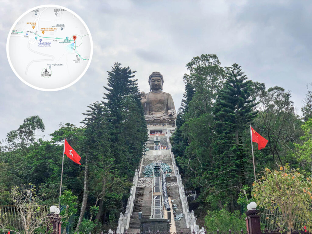
Ngong Ping Village – Map & Information Board
The map highlights the specialty shops here alongside the main attractions of
Ngong Ping
.
其他圖片:
Mobile Information Board
Looking Up – The Big Buddha 《II》
Ngong Ping Bus Terminus 《II》
The Big Buddha – At the Base 《II》
Di Tan and Po Lin Monastery – Archway
The Big Buddha – At the Base 《I》
📷 相片參數
Camera:
Lenses:
Keywords:
Information Board
,
Map
Subjects:
Location:
Ngong Ping Village
Place:
Ngong Ping Road
District:
Ngong Ping
Area:
Islands District
📸 此圖片拍攝自:
【Hiking • 013】Roaring Tiger Rock River . Middle Kau Nga Hang . Kau Nga Ling
📍 經緯度:
,
|
⛰️ 高度:
香港地點:
Mui Wo Ferry Pier
Ma On Shan Country Park - BBQ Site
Biu Tsim Kok Viewing Platform
美督明珠
昂坪廣場
A Kung Kok Lookout
The Big Buddha / Tian Tan Buddha
鴨脷排連島沙洲
養心書院
赤徑碼頭
黃大仙祠前廣場
小鳥回頭
陽元石
煎魚灣營地
The Bird Rock
大埔墟巴士總站
士美菲路街市及熟食中心
Sam A Chung Campsite
法藏寺
嘉瑜園
Lin Ma Hang Mine
Uptown Plaza
梅窩碼頭
新達廣場
香港地方:
Three Fathoms Cove
獅子山
Harlech Road Fitness Trail
萬宜水庫-東壩
Pak Sha O
新屋下
Kowloon Pass
馬己仙峽
Tung Chung Road
閻王壁
東涌市中心
Cape Collinson Road
大美督村
小瀝源路
Tsiu Keng
苗三古道
Sir Cecil's Ride
玉桂山
Victoria Peak
So Lo Pun
Ping Fung Shan
亞公角
Silver Mine Bay
西沙路
香港景物:
衛奕信徑
MacLehose Trail
屋
Campsite
Shingle Beach
Village
Highway
Water
碼頭
Agricultural Land
家樂徑
Bamboo Grove
Mariculture Raft
MacIntosh Forts
Store
Pavilion
石灘
觀星台
地質路線
Reservoir
碉堡
文化遺產
植物
礦場 / 礦洞
←
Previous:
【Hiking • 013】Roaring Tiger Rock River . Middle Kau Nga Hang . Kau Nga Ling