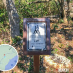
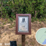
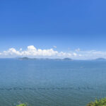
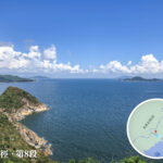
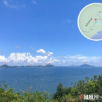
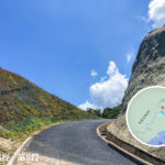
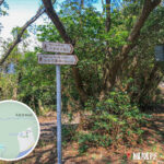
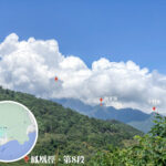
🐦🔥 【Lantau Trail】is a long-distance hiking trail that loops around Lantau Island. Spanning approximately 70 kilometres and divided into 12 sections, the trail starts and ends at Mui Wo Ferry Pier, making it the third longest hiking trail in Hong Kong. Opened in 1984, the trail features 140 distance posts to provide clear guidance for hikers. The Lantau Trail is renowned for its magnificent mountain peaks, dramatic coastlines, and traditional fishing village culture. It passes through notable landmarks such as Lantau Peak (Hong Kong’s second-highest peak), Sunset Peak (the third-highest peak), Tai O Fishing Village, and Shek Pik Reservoir. The landscape along the way is incredibly diverse: from the silvergrass-covered slopes of Sunset Peak to the misty sunrise atop Lantau Peak; from the Tian Tan Buddha and Wisdom Path in Ngong Ping to the stilt houses and coastal charm of Tai O Fishing Village.
📍 Basic Information
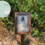
Item Description 📍 Location Lantau Island, the largest island in Hong Kong 📏 Total Length Approx. 70 km 🔢 Sections 12 sections in total, equipped with 140 distance posts (one post every 500 metres, with IDs starting with “L”) 🗓️ Official Opening 4 December 1984 🌟 Key Features A loop route starting and ending at Mui Wo Ferry Pier; scales Lantau Peak, Hong Kong’s second-highest peak; passes through Sunset Peak, Shek Pik Reservoir, Tai O, and more 💪 Difficulty A challenging long-distance trail —
🏞️ Major Sections & Highlights
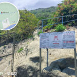
- Mui Wo → The starting and finishing point with convenient transport links near the ferry pier.
- Sunset Peak → Magnificent views with golden silvergrass in full bloom during autumn and winter.
- Lantau Peak → Hong Kong’s second-highest peak, a legendary sunrise spot surrounded by sea of clouds.
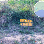
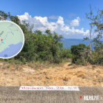
- Ngong Ping → Home to the Tian Tan Buddha and Wisdom Path.
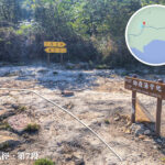
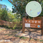
- Tai O → Famous for its stilt house culture and local salted fish specialities.
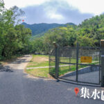
- Shek Pik Reservoir → A vital water source for Lantau Island featuring a spectacular main dam.
- Pui O → A renowned beach perfect for camping and water sports.
—
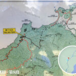
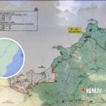
🗺️ Route Details (12 Sections)
The Lantau Trail traverses both South Lantau Country Park and North Lantau Country Park, offering a diverse landscape of mountains, hills, and seascapes:
Section Route (Start → End) Length Time Difficulty Highlights & Landscape 1 Mui Wo → Nam Shan 2 km 0.5 hr ⭐️ A short warm-up walk 2 Nam Shan → Pak Kung Au 6 km 4 hr ⭐️⭐️⭐️ Climbing over Sunset Peak, where golden silvergrass shines in autumn and winter. 3 Pak Kung Au → Ngong Ping 4.5 km 5 hr ⭐️⭐️⭐️⭐️ Scaling Lantau Peak, Hong Kong’s second-highest peak and a premier sunrise spot. 4 Ngong Ping → Sham Wat Road 5 km 2 hr ⭐️ Passing by the Tian Tan Buddha and Wisdom Path. 5 Sham Wat Road → Man Cheung Po 8 km 4 hr ⭐️⭐️⭐️ Kwun Yam Shan mountain peaks, valley streams, and an ancient trail atmosphere. 6 Man Cheung Po → Tai O 2 km 1.5 hr ⭐️⭐️⭐️ Arriving at the fishing village to experience stilt house culture. 7 Tai O → Kau Ling Chung 10 km 3.5 hr ⭐️⭐️⭐️ Passing by the historical Fan Lau Fort with magnificent coastlines. 8 Kau Ling Chung → Shek Pik Reservoir 5 km 2 hr ⭐️ Looping around the reservoir’s main dam. 9 Shek Pik Reservoir → Shui Hau 6.5 km 2.5 hr ⭐️⭐️⭐️ Mountain paths and stream valleys 10 Shui Hau → Tung Chung Road 6 km 2 hr ⭐️⭐️ A forested path following along the catchwater. 11 Tung Chung Road → Pui O 4 km 1.5 hr ⭐️ A renowned beach and a popular camping hotspot. 12 Pui O → Mui Wo 9 km 4 hr ⭐️⭐️⭐️ Finishing off along the beautiful coastline —
🌄 Lantau Trail Key Features
- Natural Scenery: Mountain peaks, coastlines, stream valleys, and beaches offering distinctive seasonal views year-round.
- Cultural Exploration: Tai O fishing village, Ngong Ping Buddhist culture, and the traditional Lung Tsai Ng Yuen Garden.
- Challenging Trek: Combining alpine climbs and long-distance trekking, perfect for experienced hikers.