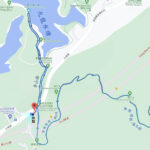
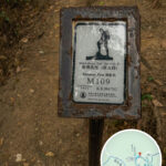
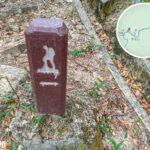
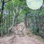
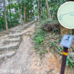
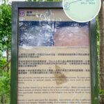
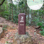
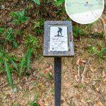
🗺️ 【MacLehose Trail】is the first long-distance hiking trail in Hong Kong. Opened on 26 October 1979, it was named after the then Governor of Hong Kong, Sir Murray MacLehose[cite: 1]. This 100-kilometre trail is divided into 10 sections and runs generally from east to west[cite: 1]. It starts at Pak Tam Chung in Sai Kung and traverses several country parks, including Sai Kung East, Sai Kung West, Ma On Shan, Lion Rock, Kam Shan, Shing Mun, Tai Mo Shan, and Tai Lam, before finishing in Tuen Mun[cite: 1]. The MacLehose Trail features 200 distance posts, spaced approximately 500 metres apart[cite: 1]. Boasting ever-changing scenery that showcases majestic peaks, spectacular bays, and serene reservoirs, it was named one of the world’s 20 best hikes by National Geographic Channel[cite: 1].—
📌 Basic Information
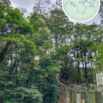
Item Description 🏞️ Name MacLehose Trail[cite: 1] 📅 Year of Opening 26 October 1979[cite: 1] 📏 Total Length Approx. 100 km[cite: 1] 🧭 Direction East to west across the New Territories[cite: 1] 🗂️ Number of Sections 10 sections in total[cite: 1] 🧗♂️ Total Ascent / Descent Approx. 6,189 m[cite: 1] 🚩 Starting Point Pak Tam Chung, Sai Kung[cite: 1] 🏁 Finishing Point Castle Peak Road, Tuen Mun (near Hoh Fuk Tong College)[cite: 1] 🪧 Number of Distance Posts Approx. 200 posts (one post every 500 metres)[cite: 1] 🏞️ Country Parks Crossed Sai Kung East, Sai Kung West, Ma On Shan, Lion Rock, Shing Mun, Tai Mo Shan, Tai Lam, etc.[cite: 1] 🌍 Landscape Features High peaks, bays, reservoirs, sandy beaches, mountain ridges, woodlands[cite: 1] 🌟 International Acclaim Named one of the world’s 20 best hikes by National Geographic[cite: 1] 🥾 Hiking & Trail Uses Hiking, trail running, and the Trailwalker event[cite: 1] 🍁 Best Seasons Autumn (October–December) and Spring (March–April)[cite: 1] —The sections of the 【MacLehose Trail】vary in difficulty, seamlessly blending diverse natural scenery with cultural landscapes[cite: 1]. The route links together rugged mountain paths, stone steps, ancient trails, concrete pathways, and public roads, allowing hikers to scale high peaks, admire stunning bays, stroll past reservoirs, and tread on historic pathways[cite: 1]. For instance, Section 1 passes by High Island Reservoir and the iconic hexagonal rock columns of the Hong Kong UNESCO Global Geopark; Section 2 cuts through Sai Wan and Ham Tin Wan, which are hailed as some of Hong Kong’s most beautiful beaches; while Section 5 offers panoramic views overlooking urban Kowloon[cite: 1].—
🥾 Trail & Section Information
Section Route (Start → End) Distance Time Difficulty Highlights & Features Section 1 Pak Tam Chung → Long Ke Wan 10.6 km Approx. 3 hrs ⭐️⭐️☆☆☆ High Island Reservoir East Dam, Hexagonal Rock Columns, Long Ke Beach[cite: 1] Section 2 Long Ke Wan → Pak Tam Au 13.5 km Approx. 5 hrs ⭐️⭐️⭐️⭐️☆ Sai Wan, Ham Tin Wan, Tai Long Village, Chek Keng Pier, Coastal Landforms[cite: 1] Section 3 Pak Tam Au → Kei Ling Ha 10.2 km Approx. 4 hrs ⭐️⭐️⭐️⭐️☆ Ngau Yee Shek Shan, Cheung Sheung Plateau, Lui Ta Shek, Kai Kung Shan[cite: 1] Section 4 Kei Ling Ha → Tai Lo Shan 12.7 km Approx. 5 hrs ⭐️⭐️⭐️⭐️⭐️ Ma On Shan Ridgeline, Ngong Ping Viewing Point, Mau Ping Highlands[cite: 1] Section 5 Tai Lo Shan → Tai Po Road 10.6 km Approx. 3 hrs ⭐️⭐️⭐️☆☆ Shatin Pass Kiosk, Beacon Hill, Eagle’s Nest, Kowloon Reservoirs[cite: 1] Section 6 Tai Po Road → Shing Mun 4.6 km Approx. 1.5 hrs ⭐️⭐️☆☆☆ Shing Mun Reservoir, Pine Woods, War Relics & Trenches[cite: 1] Section 7 Shing Mun → Lead Mine Pass 6.2 km Approx. 2.5 hrs ⭐️⭐️⭐️☆☆ Needle Hill, Grassy Hill, Panoramic Views of Tsuen Wan Town[cite: 1] Section 8 Lead Mine Pass → Route Twisk 9.7 km Approx. 4 hrs ⭐️⭐️⭐️⭐️☆ Tai Mo Shan (Hong Kong’s Highest Peak), Sea of Clouds, Sze Fong Shan Grassland[cite: 1] Section 9 Route Twisk → Tin Fu Tsai 6.3 km Approx. 2.5 hrs ⭐️⭐️☆☆☆ Tai Lam Chung Reservoir, Lin Fa Shan Abandoned Village, Shaded Paths[cite: 1] Section 10 Tin Fu Tsai → Tuen Mun 15.6 km Approx. 5 hrs ⭐️⭐️☆☆☆ Thousand Islands Landscape, So Kwun Wat Beach, Catchwater Scenery[cite: 1] —The 【MacLehose Trail】is not only a definitive bucket-list challenge for hiking enthusiasts but also an invaluable natural heritage and tourism asset for Hong Kong[cite: 1]. Every November, Oxfam organises its flagship “Trailwalker” charity fundraising event here, where participants must complete the entire 100-kilometre course within 48 hours[cite: 1]. This trail beautifully captures the breathtaking wilderness of Hong Kong, stretching from the dramatic coastal vistas in the east to the rolling mountain ridges in the west, offering an incredibly diverse outdoor experience[cite: 1].—
🧭 In-Depth Guide to the MacLehose Trail Sections
🔹 Section 1: Pak Tam Chung → Long Ke Wan (10.6km | Approx. 3 hours)
- Terrain & Geomorphology: Walk along the East Dam of High Island Reservoir to marvel at the 140-million-year-old hexagonal rock columns, a signature attraction of the Hong Kong Geopark[cite: 1].
- Highlights:
- High Island Reservoir dolos breakwater and sea cave[cite: 1]
- The pristine white sands of Long Ke Wan, perfect for designated camping[cite: 1]
- Replenishment: Store at Pak Tam Chung (Starting Point)[cite: 1]
- Transport: Take bus 96R on Sundays/public holidays to Pak Tam Chung, or bus 94 on weekdays[cite: 1].
—
🔹 Section 2: Long Ke Wan → Pak Tam Au (13.5km | Approx. 5 hours)
- Terrain & Geomorphology: Traverse four legendary beaches (Long Ke, Sai Wan, Ham Tin, Tai Long Wan), taking you up over coastal hills and down to pristine sands through a highly dynamic landscape[cite: 1].
- Highlights:
- The Ham Tin Wan wooden bridge (a legendary tide-dependent photo hotspot)[cite: 1]
- Sunset silhouettes at Chek Keng Pier[cite: 1]
- The century-old Hakka settlement at Sai Wan Village[cite: 1]
- Replenishment: Sai Wan Cafe, Ham Tin Wan Hoi Fung Store[cite: 1]
- Transport: Take bus 94 or 96R from Pak Tam Au back to Sai Kung town centre[cite: 1].
—
🔹 Section 3: Pak Tam Au → Kei Ling Ha (10.2km | Approx. 4 hours)
- Terrain & Geomorphology: Highly challenging section requiring consecutive ascents over Ngau Yee Shek Shan, Cheung Sheung Plateau, and Lui Ta Shek[cite: 1].
- Highlights:
- Cheung Sheung Campsite (ideal for camping; famous for its local bean curd pudding)[cite: 1]
- The loose gravel slopes of Kai Kung Shan, testing your footwork and leg endurance[cite: 1]
- Replenishment: Cheung Sheung Hui Lam Store (open on weekends only)[cite: 1]
- Transport: Buses are available on Sai Sha Road at the finishing point at Kei Ling Ha[cite: 1].
—
🔹 Section 4: Kei Ling Ha → Tai Lo Shan (12.7km | Approx. 5 hours)
- Terrain & Geomorphology: A high-difficulty section that crosses the rugged Ma On Shan ridgeline and opens up into the expansive Ngong Ping Plateau[cite: 1].
- Highlights:
- Ngong Ping Viewing Point (a renowned hotspot for paragliding)[cite: 1]
- Stunning panoramas of Inner Port Shelter and Sai Kung islands from the Ma On Shan ridgeline[cite: 1]
- Replenishment: None (self-sufficiency in food and water is essential)[cite: 1]
- Transport: Exit via Fei Ngo Shan Road (Fei Ngo Shan Road) at the finishing point at Tai Lo Shan[cite: 1].
—
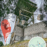
🔹 Section 5: Tai Lo Shan → Tai Po Road (10.6km | Approx. 3 hours)
- Terrain & Geomorphology: Passes through Lion Rock Country Park; located close to urban areas and packed with rich historical relics[cite: 1].
- Highlights:
- The Beacon Hill Radar Station[cite: 1]
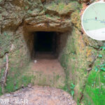
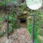
- Eagle’s Nest defensive fortifications (WWII relics)[cite: 1]
- Replenishment: Shatin Pass Store[cite: 1]
- Transport: Catch bus 72 or 81 on Tai Po Road[cite: 1].
—
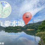
🔹 Section 6: Tai Po Road → Shing Mun (4.6km | Approx. 1.5 hours)
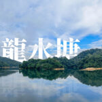
- Terrain & Geomorphology: An easy, beginner-friendly section that winds along the historic Kowloon Reservoirs and Shing Mun Reservoir[cite: 1].
- Highlights:
- Kowloon Reservoir Main Dam (a declared monument)[cite: 1]
- The ruins of the Shing Mun Redoubt[cite: 1]
- Replenishment: Kiosk at Shing Mun Barbecue Site[cite: 1]
- Transport: Take a green minibus from Shing Mun Road back to Tsuen Wan[cite: 1].
—
🔹 Section 7: Shing Mun → Lead Mine Pass (6.2km | Approx. 2.5 hours)
- Terrain & Geomorphology: Scales the steep slopes of Needle Hill and Grassy Hill, offering commanding panoramas over Tsuen Wan town centre[cite: 1].
- Highlights:
- The “infinite steps” of Needle Hill (a legendary training ground for trail runners)[cite: 1]
- The sea of silvergrass on Grassy Hill (an autumn photo favourite)[cite: 1]
- Replenishment: None (self-contained replenishment needed)[cite: 1]
- Transport: Lead Mine Pass connects down towards Route Twisk[cite: 1].
—
🔹 Section 8: Lead Mine Pass → Route Twisk (9.7km | Approx. 4 hours)
- Terrain & Geomorphology: Scales Tai Mo Shan, Hong Kong’s highest peak, where magnificent seas of clouds are a frequent sight[cite: 1].
- Highlights:
- The Tai Mo Shan Weather Radar Station[cite: 1]
- The bizarre rock formations of Sze Fong Shan[cite: 1]
- Replenishment: Kiosk at Rotary Club Campsite[cite: 1]
- Transport: Take bus 51 on Route Twisk back to Tsuen Wan[cite: 1].
—
🔹 Section 9: Route Twisk → Tin Fu Tsai (6.3km | Approx. 2.5 hours)
- Terrain & Geomorphology: A shaded, paved asphalt road that is mostly downhill, making it perfect for a relaxed jog or stroll[cite: 1].
- Highlights:
- Views of Tai Lam Chung Reservoir[cite: 1]
- The abandoned village of Lin Fa Shan (a hidden heritage gem)[cite: 1]
- Replenishment: Tin Fu Tsai Campsite Store (intermittent opening hours)[cite: 1]
- Transport: Can exit towards Tai Tong or So Kwun Wat into Tuen Mun[cite: 1].
—
🔹 Section 10: Tin Fu Tsai → Tuen Mun (15.6km | Approx. 5 hours)
- Terrain & Geomorphology: Traces the scenic catchment area of the Thousand Islands (Tai Lam Chung Reservoir) and concludes in urban Tuen Mun[cite: 1].
- Highlights:
- So Kwun Wat Beach view[cite: 1]
- Pak Kung Au Viewing Point[cite: 1]
- Replenishment: Shopping malls in Tuen Mun Town Centre[cite: 1]
- Transport: Light Rail or MTR Tuen Ma Line[cite: 1].
—
🏕 Designated Campsites At a Glance
Campsite Corresponding Section Facilities Key Features Long Ke Wan End of Section 1 Dry toilets, water source Zero light-pollution starlight, beachfront camping[cite: 1] Sai Wan Village Mid-Section 2 Local cafes / village restaurants Hakka village heritage, famous for local “ham and egg” instant noodles[cite: 1] Cheung Sheung Campsite Mid-Section 3 Dry toilets Highland alpine grassland, coexisting with feral cattle herds[cite: 1] Rotary Club Campsite Start of Section 8 Food kiosk, proper toilets The definitive replenishment hub before conquering Tai Mo Shan[cite: 1] —
📸 Recommended Photo Hotspots
- 📍 Long Ke Wan Aerial Shoot: Capture the crescent-moon curve of the white sandy beach from above at sunrise[cite: 1].
- 🌉 Ham Tin Wooden Bridge: Use a low-angle wide lens to frame the rustic bridge against the mountain silhouettes[cite: 1].
- 🌾 Sai Wan Shan Silvergrass: Golden fields of silvergrass framed beautifully against the vast ocean backdrop in autumn[cite: 1].
- ⛪ Chek Keng Ruined Chapel: Perfect for capturing moody, vintage, and industrial-decay aesthetics in the late afternoon[cite: 1].
—