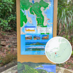
🚶【Hong Kong • Forest Track (港島 • 林道 – often referred to as the Hong Kong Island Forest Track)】 is a famous long-distance hiking trail on Hong Kong Island. Stretching for about 50 km, it traverses multiple country parks and nature reserves. The trail is divided into eight distinct stages, winding all the way from Victoria Peak in the west to Big Wave Bay in the east. Each stage features its own unique scenery and characteristics, with major highlights along the way including Mount Parker and the historic Tai Tam Reservoir. Boasting incredible landscapes, the trail is highly accessible, offering ideal sections for everyone from complete beginners to experienced trekkers. —
1. Natural Scenery & Ecological Value
The Hong Kong Trail offers incredibly diverse landscapes and rich biodiversity:
- Natural Landscapes: Winding from dense, lush forests to wide-open mountain ridges, hikers can take in magnificent panoramic views of Victoria Harbour as well as the peaceful coastal scenery of Tai Tam Bay.
- Ecological Value: The trail is home to a wide variety of native wildlife and flora, including numerous species of butterflies, wild birds, and black-faced macaques, making it an absolute paradise for nature lovers.
—
2. Hiking Stages & Trail Overview
The Hong Kong Trail is divided into 8 distinct stages. The length, estimated completion time, and difficulty for each stage are outlined below:
Stage Route (Start – End) Length (km) Time (Hours) Difficulty Stage 1 Peak Tram Terminus (Lugard Road) – Pok Fu Lam Reservoir 7.0 2.0 ⭐ Stage 2 Pok Fu Lam Reservoir – Peel Rise (Beilu Road) 4.5 1.5 ⭐ Stage 3 Peel Rise (Beilu Road) – Wan Chai Gap 6.5 1.75 ⭐ Stage 4 Wan Chai Gap – Wong Nai Chung Gap 7.5 2.0 ⭐⭐ Stage 5 Wong Nai Chung Gap – Mount Parker Road 4.0 1.5 ⭐⭐⭐ Stage 6 Mount Parker Road – Tai Tam Road 4.5 1.5 ⭐ Stage 7 Tai Tam Road – To Tei Wan 7.5 2.0 ⭐⭐ Stage 8 To Tei Wan – Big Wave Bay 8.5 2.75 ⭐⭐⭐ Difficulty Scale: ⭐ (Easy), ⭐⭐ (Moderate), ⭐⭐⭐ (Strenuous/Demanding)
Stage 1: Victoria Peak to Pok Fu Lam Reservoir
- Starting Point: Victoria Peak (The Peak / Lugard Road).
- End Point: Pok Fu Lam Reservoir.
- Distance: Around 7 km.
- Features: Offers jaw-dropping, postcard-perfect lookouts over Victoria Harbour. The trail winds past historic lookouts and the iconic Peak Tram station.
Stage 2: Pok Fu Lam Reservoir to Wan Chai Gap
- Starting Point: Pok Fu Lam Reservoir.
- End Point: Wan Chai Gap.
- Distance: Around 4.5 km.
- Features: Hikers walk through peaceful, shady woodland paths, passing several excellent country park picnic sites.
Stage 3: Wan Chai Gap to Wong Nai Chung Gap
- Starting Point: Wan Chai Gap (Peel Rise).
- End Point: Wong Nai Chung Gap.
- Distance: Around 6.5 km.
- Features: Offers brilliant elevated views down over Causeway Bay and Happy Valley, making it a favorite spot for landscape photographers.
Stage 4: Wong Nai Chung Gap to Mount Parker Road
- Starting Point: Wong Nai Chung Gap.
- End Point: Mount Parker Road (Jardine’s Lookout area).
- Distance: Around 7.5 km.
- Features: Climbs up across Jardine’s Lookout and Mount Butler, offering dramatic mountain vistas alongside sweeping city backdrops.
Stage 5: Mount Parker Road to Tai Tam Road
- Starting Point: Mount Parker Road.
- End Point: Tai Tam Road (near the Tai Tam Reservoir).
- Distance: Around 4 km.
- Features: Drops right down into the magnificent Tai Tam Reservoir Group, taking you past historic stone bridges and waterworks heritage sites.
Stage 6: Mount Parker Road to Tai Tam Road (Waterworks Section)
- Starting Point: Mount Parker Road / Tai Tam Upper Reservoir.
- End Point: Tai Tam Road.
- Distance: Around 4.5 km.
- Features: A very easy, flat walk that hugs the calm waters of the reservoirs, complete with plenty of pavilions and scenic rest spots.
Stage 7: Tai Tam Road to To Tei Wan
- Starting Point: Tai Tam Road.
- End Point: To Tei Wan (the foot of Dragon’s Back).
- Distance: Around 7.5 km.
- Features: A peaceful catchwater walk that looks over Tai Tam Harbour, serving as the calm prelude right before the big climb.
Stage 8: To Tei Wan to Big Wave Bay (The Dragon’s Back)
- Starting Point: To Tei Wan.
- End Point: Big Wave Bay.
- Distance: Around 8.5 km.
- Features: Features the world-famous “Dragon’s Back” ridge line—widely considered one of Hong Kong’s most spectacular coastal hikes—before descending directly onto the sandy beach of Big Wave Bay, a popular spot for a refreshing swim or surf to finish the journey.
Hiking Safety & Preparation
- Proper Gear: Always wear sturdy hiking shoes and lightweight, breathable clothing. Pack plenty of sunscreen, a hat, and more than enough drinking water.
- Navigation Tools: Keep a physical map or compass handy, or use a reliable offline GPS hiking app on your phone to make sure you stay on track.
- Trail Awareness: Keep an eye on trail markers and warning signs. If you start feeling unwell or exhausted, stop immediately at the nearest exit point and call for assistance.
- Leave No Trace: Help keep Hong Kong’s trails beautiful. Pack out all your trash and discard it properly once you get back to the city.
Transportation Guide
- MTR (Subway): Take the MTR to Central Station, where you can easily catch a bus, minibus, or the Peak Tram up to the Stage 1 trailhead.
- Public Buses: Regular bus lines run directly to and from the start and end points of almost every single stage across Hong Kong Island.
- Urban Taxis: Red urban taxis are readily available throughout the city and can drop you off directly at any chosen trailhead quickly and easily.
—
3. Cultural & Historical Significance
The Hong Kong Trail is much more than just a scenic walk; it is a rich journey through the island’s unique history:
- Wartime Heritage: The paths cross straight through several key World War II military sites, including old pillboxes, ammunition bunkers, and defensive fortifications around Wong Nai Chung Gap and Mount Parker.
- Cultural Footprints: Certain sections trace the old pathways used by historical Hakka villages, offering a firsthand look into how rural island life transformed into a modern metropolis over the decades.
—
4. Future Development & Conservation
Large sections of the trail wind through highly protected ecological areas, such as Tai Tam Country Park and Aberdeen Country Park. In recent years, the Hong Kong government and local green groups have continually ramped up conservation efforts to maintain the trail’s pathways sustainably while protecting the rich local biodiversity. — The Hong Kong Trail is a magnificent route that packs natural beauty, wartime history, and rewarding physical challenges into one epic journey. Whether you are looking to capture stunning mountain-meets-city photos or dive deep into Hong Kong’s hidden heritage, this trail delivers an unforgettable experience. As local conservation projects continue to preserve these green lungs, this iconic trail remains a shining jewel of Hong Kong’s natural and cultural inheritance.