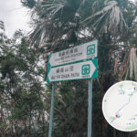
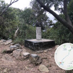
🏔️【Kei Lak Tsai (箕勒仔)】 is a mountain peak in the northern part of the New Territories, Hong Kong, standing at an elevation of 256 metres. Situated between Wo Hop Shek and Tai Lung, it forms part of a mountain range that runs from northeast to southwest. The summit features a viewing platform that offers panoramic views of the surrounding landscape and connects hiking routes such as North Tai To Yan and Wu Tip Shan Path. There are two main trails to ascend Kei Lak Tsai: one via a paved concrete path from Wu Tip Shan, and another from Cheong Shing Court up via Wa Mei Path. These routes are relatively gentle, making them suitable for hikers of different fitness levels.
📍 Fast Facts
Item Details 🌄 Mountain Name Kei Lak Tsai 🐤 Alternative Name Wa Mei Shan (now universally referred to as Kei Lak Tsai) 📍 Location Fanling, New Territories, located between Wo Hop Shek and Tai Lung 🗻 Elevation Approx. 256 metres 🧭 Ridge Alignment Part of a mountain range running northeast to southwest 🛣️ Mountain Range Tai To Yan Mountain Range 👀 Views Features a viewing platform at the summit overlooking the surrounding areas —
👶🏻 Origin of the Name
“Kei Lak Tsai” was originally a place name before it became the name of the peak. As it shared the exact same name with “Wa Mei Shan” in Sai Kung, it is now mostly referred to as “Kei Lak Tsai” to avoid confusion. This name has gradually gained popularity on maps and within the hiking community, making it one of the popular countryside destinations in North District.
- The origin of the name “Kei Lak Tsai” remains unclear, but “Lak Tsai” may refer to a small hill in Hakka dialect.
- It was formerly known as “Wa Mei Shan”. Due to confusion with the peak of the same name in Sai Kung, it is now mostly called “Kei Lak Tsai”.
- Local birds like the Hwamei (melodious laughingthrush) are commonly seen along the trail, which explains the alternative name.
— 【Kei Lak Tsai】is frequently included as part of the Tai To Yan hiking route, forming a continuous trail with Pak Tai To Yan and South Tai To Yan. The entire route covers about 9 kilometres and takes 4 to 5 hours to complete. The peak offers open, unobstructed views, allowing hikers to look out towards Pat Heung plains, Kai Kung Leng, and Tai Mo Shan. However, as it sits close to Wo Hop Shek Cemetery, some hikers choose to bypass this section. With its well-defined paths and plenty of tree shade, Kei Lak Tsai is an ideal choice for intermediate hikers and a popular spot for exploring the nature and topography of Northeast New Territories. —
🗺️ Hiking Routes
Starting Point Trail Name Features & Trail Conditions 🦋 Wu Tip Shan Paved concrete trail Gentle and easy to walk with good shade along the way, ideal for beginners 🏘️ Cheong Shing Court Wa Mei Path Shady and scenic, mostly concrete paths with clear signage and easy navigation 🌳 Kadoorie Farm Tai To Yan Main Trail Allows a continuous hike across Tai To Yan and Pak Tai To Yan 📌 Tip: Kei Lak Tsai serves as the middle peak connecting Pak Tai To Yan and Wu Tip Shan (Butterfly Hill), making it perfect for a half-day hike. —
🌄 Geography and Features
- 🧱 Ridge Connection: Located on the northern section of the Tai To Yan Mountain Range, Kei Lak Tsai connects to Pak Tai To Yan, serving as a key node along the entire range.
- 🪟 Viewing Platform: There is a small viewing platform at the summit, offering distant views of Shek Kong Airfield and the Fanling town centre.
- 🌳 Vegetation and Environment: The trail is well-shaded by trees along the way, with vegetation consisting mostly of shrubs and native tree species, boasting a rich ecosystem.
—
🥾 Hiking Tips
- 🧴 Bring enough water: Though the route is not overly strenuous, summer days can be scorching, so staying hydrated is crucial.
- 🧢 Sun protection gear: Hats and sunscreen are a must, as some sections have high sun exposure.
- 🗺️ Keep an eye on signage: There are many forks along the path, so using a GPS or a hiking map is highly recommended.
- 🧘♂️ Rest stops: Benches and pavilions are available along the trail for short breaks.
—
🧭 Nearby Landmarks and Peaks
Name Elevation Remarks Tai To Yan 566 m The main peak, shaped like a knife edge, located within Lam Tsuen Country Park North Tai To Yan 480 m The secondary peak, which connects to Kei Lak Tsai Ngau Ku Ling 106 m A small hill, often used as a starting point Shek Kong Airfield – Can be seen from afar; a military airfield —