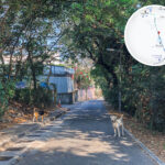
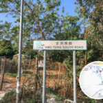
🏞️ 【Kwu Tung (古洞)】is located in the western part of Sheung Shui in the North District of the New Territories, Hong Kong. It is an area where the Sheung Yue River (River Beas) flows through. Flanked by hills like Ki Lun Shan to the south and Tai Shek Mo to the north, it features a unique rural landscape. The history of Kwu Tung dates back to the time of the ancient Baiyue tribes, as the word “Tung” or “Dung” in ancient texts refers to the places where these tribes lived. After 1945, it became a settlement for Weitou, Hakka, and a small number of Teochew people, eventually developing into several squatter villages as refugees flooded south from the Mainland. The Kwu Tung section of Castle Peak Road even grew into a major market street resembling a bustling market town back in the day.
📌 Basic Information
Item Details 🏞️ Location Located in the western part of Sheung Shui in the North District, New Territories; southeast of Lok Ma Chau and on the west bank of the Sheung Yue River, with the Fanling Highway cutting straight through it 🗺️ District North District, New Territories, Hong Kong 🏘️ Zoning Structure The Fanling Highway splits Kwu Tung into North and South zones: 🔹 Kwu Tung South: Kam Tsin Village, Hang Hau Village, Europa Garden, Valais, etc. 🔹 Kwu Tung North: Long Valley, Ho Sheung Heung, Ma Tso Lung, etc. 🏞️ Name Origin “Kwu Tung” comes from the ancient Baiyue term for a tribal settlement, with “Tung” or “Dung” being a common character for ancient place names in southern China 🏡 Historical Background Kwu Tung Village was established in 1900 and grew into one of the largest agricultural communities in the New Territories after WWII 🏘️ Village Origins Kwu Tung Village was founded in 1900, attracting a wave of post-war immigrants from Dongguan, Huizhou, Teochew, and other areas 🧭 Main Roads Kwu Tung Road, Castle Peak Road (Kwu Tung section), Ho Sheung Heung Road, Ma Tso Lung Road 🏞️ Topography Flanked by hills to the north and south: Ki Lun Shan and Tai Shek Mo, with Kwu Tung Reservoir tucked away inside Ki Lun Shan 🏗️ Development Project Kwu Tung North New Development Area project: expected to house 120,000 people and supply about 60,000 residential flats 🏫 Community Facilities Kwu Tung Market Shopping Centre, grass football pitch, Kwu Tung North Multi-welfare Services Complex, temporary ambulance post, etc. 🏯 Historic Buildings Lady Ho Tung Welfare Centre (built in 1934), Yan Wah Lo (study hall), Oi Yuen Villa, etc. 🚍 Transport Links KMB route 76K, green minibuses 50K and 51K connect the area to Sheung Shui, Yuen Long, and beyond — Kwu Tung boasts a rich industrial history and a wealth of cultural heritage sites. In the past, the Sir Robert Ho Tung family ran a tobacco processing business here, and the squatter settlements built by tobacco workers led to the name “Yin Liu Area” (Tobacco Shed District). The area was also home to over 10 soy sauce distilleries, producing soy sauce and all kinds of condiments for local use and export overseas. Chi Kee Sawmill, one of Hong Kong’s very last remaining sawmills, also operated here for many years. On top of that, Kwu Tung Reservoir (lovingly nicknamed the “Heart-shaped Lake”) and its surrounding hiking trails, like the route leading up to Ki Lun Shan, are big hotspots for hikers looking to soak in the natural scenery. —
🕰️ History & Origin of the Name
📜 Ancient Baiyue Tribes & the Term “Tung”
- The characters “Tung” or “Dung” were historically used to name settlements of ethnic minority groups in southern China.
- According to the ancient rhyme dictionary Ji Yun: “Dung is where the southern tribes live,” suggesting Kwu Tung was once an ancient Baiyue settlement.
📖 Documented History
- The name first popped up in the 1819 edition of the Xin’an County Gazetteer under the jurisdiction of the Guanfu Division.
- By 1934, the name “Kwu Tung Village” was already appearing in the Kung Sheung Daily News.
🧭 Village Formation
- After WWII, a massive influx of mainland immigrants settled here, forming numerous squatter villages.
- From the 1960s onwards, as the population boomed, the District Office split the villages into 15 zones to streamline management and resource planning.
—
🌿 Nature, Ecology & Hiking Trails
💧 Kwu Tung Reservoir
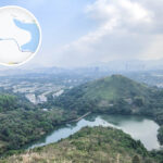
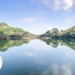
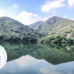
Kwu Tung Reservoir is a small irrigation reservoir tucked inside Ki Lun Shan, widely known as Hong Kong’s version of the “Heart-shaped Lake” or the “Mirror of the Sky”.
- Located within Ki Lun Shan, this heart-shaped reservoir was built for agricultural irrigation.
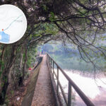
- Hikers can start from the Kwu Tung Market and follow Kwu Tung South Road to get there.
🏔️ Ki Lun Shan (Maureen Hill)
- One of the major hills in the area, connecting Kwu Tung to Kam Tin, Pat Heung, San Tin, Mai Po, and beyond.
- Its extensive network of trails makes it a popular spot for outdoor enthusiasts.
—
—
🚍 Transport & Community Facilities
🚉 Transport Links 🏫 Community Facilities 🏞️ Hiking Routes KMB route 76K, green minibuses 50K and 51K link the area to Sheung Shui, Yuen Long, etc. Kwu Tung Market, grass football pitch, Kwu Tung North Multi-welfare Services Complex, temporary ambulance post Trails around Ki Lun Shan, Tai Shek Mo, and Kwu Tung Reservoir connect all the way to Kam Tin, Mai Po, Fung Ying Seen Koon, etc. Kwu Tung transport relies mainly on buses and minibuses:
Route No. Termini KMB 76K Sheung Shui ↔ Yuen Long Green Minibus 50K Sheung Shui ↔ Hang Tau Green Minibus 51K Sheung Shui ↔ Ho Sheung Heung Green Minibus 50A Sheung Shui ↔ Kwu Tung New Market The main thoroughfares include Kwu Tung Road, Castle Peak Road (Kwu Tung section), Ma Tso Lung Road, and Ho Sheung Heung Road. —
🏛️ Historic Buildings & Landmarks
🏛️ Building Name 📜 Background & Features 🏥 Lady Ho Tung Welfare Centre Built in 1934 and donated by the Sir Robert Ho Tung family, this Declared Monument has now been revitalized into an eco-learning centre 📚 Yan Wah Lo A traditional study hall that once housed the Oi Wah School. Built by the Yeung family, who were Indonesian Chinese, it holds massive Hakka cultural value 🏡 Oi Yuen Villa A historic residential property showcasing a unique blend of Chinese and Western architectural styles 🌳 Ho Sheung Heung Feng Shui Wood Part of the traditional walled village heritage, carrying significant ecological and cultural conservation value — Right now, Kwu Tung is going through a massive development transformation. The Hong Kong Government’s Kwu Tung North New Town development project kicked off back in 2019. Spanning roughly 447 hectares, this new development area is expected to home around 114,300 people and create some 33,300 jobs once fully developed. Moving forward, the area will be built up as a multi-development hub, blending residential, commercial, R&D, and agricultural uses, backed by a robust transport network including the proposed Kwu Tung MTR Station. At the same time, the project puts a big focus on green conservation, such as turning the high-ecological-value Long Valley area into a nature park. While this development brings tons of new opportunities, it also means some of Kwu Tung’s original villages, farmland, and signature local heritage (like Chi Kee Sawmill and certain soy sauce distilleries) are facing clearance or relocation. —
🏗️ Kwu Tung North New Town Master Plan
🏙️ Planning Item 📋 Details 🏘️ Housing Scale Expected to roll out around 60,000 residential flats, housing a population of roughly 120,000 🏢 Commercial & Jobs Zoned land for business, retail, government, and community facilities to generate a massive number of local jobs 🏞️ Regional Open Space Features green corridors, town plazas, and parks that double as breezeways and pedestrian walkways 🏥 Public Amenities Equipped with community essentials like a hospital, clinic, swimming pool complex, and schools 🚧 Development Constraints Influenced by the nearby Sheung Shui Water Treatment Works, slaughterhouse, and sewage treatment works, requiring extra planning for environmental safety and air quality —
🏗️ Modern Planning & Future Development
🏙️ Kwu Tung North New Development Area (Kwu Tung North NDA)
- First proposed in the 2010s, construction started in 2019.
- Planned population: 100,000 people, covering 498 hectares.
- Includes a mix of residential, commercial, leisure, and community spaces.
🚉 Kwu Tung Station
- The future interchange station between the Northern Link and the East Rail Line.
- The East Rail Line section is scheduled for completion around 2027, followed by the Northern Link section around 2034.
🌱 Kwu Tung South Agricultural Park
- A major push to boost local farming and eco-education.
- Features community BioBlitz activities to track species distribution and map ecological changes.
—
🏘️ Neighborhoods & Cultural Circles
Kwu Tung is not just a single village, but a community woven together by multiple settlements. Residents from different backgrounds have shaped a highly diverse cultural circle:
Area Name Features & Background Yin Liu Area (Tobacco Shed District) One of the earliest squatter areas, where most residents originally came from Zengcheng, Guangdong Tong Kok Area Traditionally focused on farming, it used to be packed with vegetable fields Luen Wo Area Located near Castle Peak Road, it used to house several small-scale factories Fung Kong Area A tight-knit Hakka settlement Oriental Area Once a farmland area, it is now mostly made up of squatter dwellings Italian Farm Cleared back in the 1970s, it has now become the core of the Kwu Tung North development area Hang Keng Village An indigenous Lee clan village with over a century of history 🗣️ Language & Culture
- Languages spoken by locals include Cantonese, Hakka, and Hokkien (Fulaohua).
- This mix has fostered a diverse, tight-knit community where neighbors traditionally looked out for one another.
—
🏭 Economic & Industrial Heritage
Kwu Tung was once one of the few rural industrial hubs in Hong Kong:
- Chi Kee Sawmill: Boasting over 70 years of history, it even served as a filming location for the movie Cold War 2.
- Kwong Tak Lung Food Manufactory: A sauce factory that is still up and running, standing as a living witness to Kwu Tung’s historic soy sauce distillery culture.
—
🧠 Fun Fact: Kwu Tung’s Alternative Names
- Dill’s Corner: Its pre-war English name, which came from the military quarters in the area.
- Seven Villages: A collective name used in the early days to describe the cluster of settlements in Kwu Tung.
—