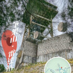
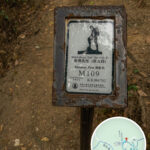
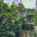
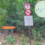
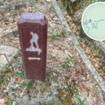
🐉 【Lung Yan Road (龍欣道)】 is a winding hillside road in the Sham Shui Po District of Kowloon, Hong Kong, which was officially named on June 15, 2001. Stretching around 3 kilometers, this road begins at Lung Cheung Road and snakes its way up to the summit of Beacon Hill. It was originally built to give Civil Aviation Department personnel easy access to the top for maintaining and managing vital facilities like the radar station. The road is a single-lane track with a strict speed limit of 50 km/h. —
📌 Quick Facts
Category Details 🏞️ Street Name Lung Yan Road 📍 Location Shek Kip Mei, Sham Shui Po District, Kowloon, Hong Kong 🗓️ Official Naming June 15, 2001 📏 Total Length Approx. 3 kilometers (1.9 miles) 🚗 Speed Limit 50 km/h 🛣️ Lane Configuration Single-lane road 🚶♂️ Primary Uses Vehicular access, hiking trail, maintenance corridor 🚩 Starting Point Lung Cheung Road 🏁 Ending Point Beacon Hill Summit 🧗♂️ Intersecting Trails MacLehose Trail Section 5, Eagle’s Nest Nature Trail 🏞️ Key Highlights Offers stunning bird’s-eye views over the Kowloon Peninsula, making it a hotspot for photographers 🚌 Getting There By bus (multiple routes stop at the ‘Phoenix House’ station) or by driving 🏕️ Facilities Pavailions, resting areas (though restroom facilities are very basic) 📡 Special Facilities Civil Aviation Department’s Beacon Hill Radar Station (air traffic monitoring) ⚠️ Important Notes The service reservoir section is clearly marked with ‘No Entry’ signs; some stretches are incredibly steep, so watch your footing — More than just a service road, Lung Yan Road seamlessly links up with Section 5 of the famous MacLehose Trail and the Eagle’s Nest Nature Trail, turning it into a massive favorite among hikers. Cozy pavilions dot the roadside for quick breaks, and the sweeping, unobstructed vistas of the Kowloon Peninsula are a huge magnet for local shutterbugs. Near the peak sits the Civil Aviation Department’s Beacon Hill Radar Station—a crucial piece of infrastructure for Hong Kong’s air traffic control. Do keep in mind, though, that certain sections (especially around the service reservoir) are strictly marked as restricted ‘No Entry’ zones. —
🗺️ Geography & Trail Links
- Start: Lung Cheung Road
- End: Beacon Hill Summit
- Connecting Trails:
- MacLehose Trail • Section 5
- Eagle’s Nest Nature Trail
Winding up along the mountainside, Lung Yan Road cuts right through multiple nature conservation zones and hiking pathways, serving as a classic example of where the urban jungle meets raw nature. — Getting to Lung Yan Road is a breeze. A wide array of bus routes (including the 33, 38, 40, 42C, 61X, 62X, 86, 86A, 87B, 214, 258D, 259D, 268C, 269C, 290, and 290A) stop right at the ‘Phoenix House’ bus stop, and you can easily walk to the entrance from there. Depending on the weather and your stamina, you can choose to stick to the paved road or jump onto the MacLehose Trail. Hikers can easily extend or shorten their trip by tackling Beacon Hill or heading towards Lion Rock, catching gorgeous views of Sha Tin, the Shing Mun River, and Tai Wai along the way. —
🚍 Transport Options
Get off at the ‘Phoenix House’ stop and take a short walk to step onto Lung Yan Road:
Mode of Transport Details Remarks Bus Routes 33, 38, 40, 42C, 61X, 86, 86A, 87B, 214, 258D, 259D, 268C, 269C, 290, 290A, etc. Get off at ‘Phoenix House’ station; the entrance is just a short walk away Driving Single-lane driving with a strict 50 km/h speed limit Pavilions and rest spots are available, but public toilets are bare-bones and rustic —
🏗️ Background & Purpose
- Primary Function: Originally paved out by the government to give Civil Aviation Department staff a direct route to the Beacon Hill Radar Station for maintenance and operations.
- Beacon Hill Radar Station: Houses a critical Approach Landing Secondary Surveillance Radar system, making it an essential hub for Hong Kong’s aviation management.
- Service Reservoir Section: Certain areas are technically off-limits with clear ‘No Entry’ warnings, though they still draw adventurous landscape photographers.
—
🌄 Landscape & Cultural Appeal
Lung Yan Road is far more than just asphalt; it’s a beloved sanctuary for photography, hiking, and wildlife watching:
- Scenic Views:
- Offers a stunning birds-eye panorama over the entire Kowloon Peninsula, stretching across Shek Kip Mei, Wong Tai Sin, and Kwun Tong.
- The night views are legendary, drawing crowds of night-scape photography enthusiasts.
- Cultural Vibe:
- Serves as a perfect urban “back garden” for city dwellers looking to escape the noise and clear their heads.
- Regularly featured in numerous local hiking guides and photography lookbooks, including Running Around Hong Kong.
—
🏗 Facilities & Highlights
Spot Name Description Beacon Hill Radar Station A dedicated Civil Aviation Department facility tasked with monitoring air traffic control MacLehose Trail • Section 5 One of Hong Kong’s most famous long-distance trekking paths Eagle’s Nest Nature Trail A family-friendly path perfect for beginners, showcasing local plants and wildlife —
⚠️ Safety Tips & Warnings
Area What to Keep in Mind 🛑 Reservoir Restricted Area The water reservoir section has strict ‘Civil Aviation Department No Entry’ signs; trespassers are warned, though photographers occasionally venture near. 🌧️ Steep Inclines Certain mountain paths are incredibly steep and can get slick on rainy days. Make sure to wear shoes with excellent grip. Night Activities Always carry a reliable headlamp and wear non-slip shoes to stay safe after dark. —
🛰️ Beacon Hill Radar Station
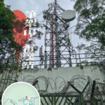
One of the core reasons Lung Yan Road exists is to connect the city to the Civil Aviation Department’s radar base on Beacon Hill. Operating an Approach Landing Secondary Surveillance Radar system, this station acts as a vital nerve center for Hong Kong’s skies.
- 🚧 The access road was purposefully built to allow regular maintenance crews through.
- 📡 While the facility itself is completely closed to the general public, its unique futuristic dome is a favorite subject for local photographers.
- 📷 Snapping the view of the glowing sea of city lights right beneath the radar station captures that iconic, raw Hong Kong city aesthetic.
—