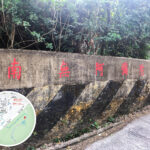
🛣️ 【Ma On Shan Tsuen Road】 is a crucial road linking the Ma On Shan urban area with the country park. Stretching for about 4 kilometers, it winds along the fringes of Ma On Shan Country Park. The northern end of the road kicks off at the junction of Ma On Shan Road and Hang Hong Street, while the southern end extends all the way up to the hilltop public toilet in Ma On Shan Village. Along the way, it passes under the Ma On Shan Bypass flyover, goes past the unnamed junction near Ma On Shan Service Reservoir, and runs through Lutheran New Village. —
📍 Quick Facts
Item Details Chinese Name 馬鞍山村路 Official Naming Date August 11, 2006 Alias Leung Yau Road (良友路) District Ma On Shan, Shatin, New Territories Road Length Approx. 3.47 km Traffic Direction Two-way (Eastbound and Westbound) Starting Point Ma On Shan Village Ending Point The roundabout at the junction of Ma On Shan Road and Hang Hong Street —
🏞️ Historical Background & Etymology
Ma On Shan Village was originally a bustling miners’ settlement, flourishing into a full-scale community during the mining boom of the 1950s to 1970s. When the mine shut down in 1976, residents hit hard times, and getting around became an absolute nightmare due to the lack of transport links.
- Villagers used to rely on battered old trucks to navigate the rugged, bumpy mountain paths.
- In 1979, the Hong Kong Jockey Club stepped up and donated a converted shuttle bus.
- During the 1980s, British American Tobacco stepped in to repave the road.
- To show their gratitude for the massive generosity of the company’s chairman, Mr. Ho Ying-kit, the villagers named that stretch of the road “Leung Yau Road” (meaning “Good Companion Road” after the iconic cigarette brand).
- The road was officially gazetted as “Ma On Shan Tsuen Road” in 2006.
— Today, this road is not just the main gateway to epic hiking hotspots like the Ngong Ping Plateau and Tai Kam Chung (Pyramid Hill); it also carries the deep industrial history of the Ma On Shan iron mine. Along the way, you can spot the revitalized Ma On Shan Mining Heritage Centre and the old abandoned mine adits, all serving as living proof of the rise and fall of the iron ore era. Because the road is pretty narrow and has some seriously steep inclines, public transport is limited to the infrequent NR84 village bus route and local taxis, so hikers often choose to just trek up on foot. — Sitting right on the boundary of the country park, this stretch of road has also become a major flashpoint for clashes between eco-conservation and urban development. For instance, back in 2021, villagers successfully put the brakes on a government plan to rezone the green belt into residential land, but ongoing works after 2024 have once again sparked heavy concern over the conservation of this historic mining village. —
🚍 Transport Info & Bus Services
Ma On Shan Tsuen Road is currently serviced primarily by Resident Bus Route NR84.
Bus Stop Nearby Amenities Remarks Ma On Shan Village Village entrance car park Bus Terminus Ma On Shan Village Elderly Association Opposite the Co-operative Store No physical bus stop sign Ma On Bridge Mailbox pavilion at Lower Village squatter area No physical bus stop sign Ma On Shan Country Park BBQ Site, Country Trail trailhead Major country excursion hotspot Upper Mid-Levels Outside Village House No. 12A No physical bus stop sign Lower Mid-Levels Outside Village House No. 26 No physical bus stop sign Lutheran New Village New Village entrance No physical bus stop sign —
🚶♂️ Walking Route Recommendations
- From Heng On Station: It’s a solid 4km uphill trek, taking about 1 hour.
- From Kam Ying Court: Around a 3km walk, which also takes close to an hour.
—
🏕️ Excursions & Hiking Trails
- Ma On Shan Country Trail: Links Ma On Shan Village straight to Ngong Ping—perfect for beginners and family outings.
- Ngong Ping Plateau: Sitting at 400m above sea level, it offers absolutely jaw-dropping views overlooking the Sai Kung waters.
—
🏘️ Ma On Shan Village Overview
- Split into Upper Village and Lower Village.
- Nestled right next to Ma On Shan Country Park with stunning natural surroundings.
- Locals originally relied on subsistence farming and chopping firewood before transitioning entirely to mining.
- During its absolute peak, it was home to over 5,000 residents.
- Once a tightly-knit miners’ community, only a few dozen households remain today as it faces heavy pressure from urban development.
—
⛪ Community Culture & Religious Landmarks
- St. Joseph’s Church: Completed in 1952, this Gothic-style church once featured an attached primary school and a convent.
- Grace Lutheran Church: Completed in 1952, this was the Evangelical Lutheran Church of Hong Kong’s very first self-built chapel. It used to house a primary school and kindergarten and now serves as a retreat centre.
- Ma On Shan Mining Heritage Centre: Packed with fascinating iron mining history exhibitions and serves up light snacks and refreshments.
—
⛏️ Mining History
- Primarily focused on extracting iron and tungsten ore.
- Operated by Mutual Trust Company with technical support flown in from Japan’s Kamaishi Mining.
- Operations wrapped up in 1976, and the official mining license finally expired in 1981.
— blockquote>