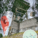
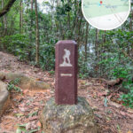
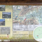
🥾 【MacLehose Trail – Section 5 (麥理浩徑第5段)】 is the closest mountain trail to the urban area. Spanning approximately 10.6 km, it starts from Tate’s Cairn and passes through Shatin Pass, Lion Rock, and Beacon Hill before finally reaching Tai Po Road. This route allows hikers to gaze down at the bustling cityscapes of Kowloon while soaking in the tranquility of the New Territories’ rolling ridges, creating a truly unique “where city meets nature” vibe.
📌 Quick Info
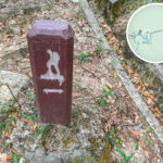
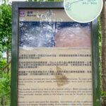
Item Details Starting Point Tate’s Cairn Ending Point Tai Po Road Distance Approx. 10.6–10.7 km Duration 3.5–4 hours Difficulty ⭐️⭐️⭐️☆☆ to ⭐️⭐️⭐️⭐️☆ (Moderate to Moderately Hard, due to significant elevation changes) Trail Conditions A mix of dirt mountain paths and concrete roads, with decent tree canopy and shade along certain stretches. Distance Posts M094 ➝ M115/M116 — Alongside its breathtaking panoramas, Section 5 is heavily steeped in precious World War II relics. Dotted along the trail are old trenches, pillboxes, and ruins of military defense networks. These are all historical pieces of the famous Gin Drinkers Line, standing as a silent testament to the intense fighting and sacrifices made during the Battle of Hong Kong. Walking this path today lets you appreciate the iconic symbol of the “Lion Rock Spirit” while looking back at the footprints of history, transforming this hike into a journey that beautifully blends natural beauty with cultural memory. —
🗺️ Route & Geographical Highlights
1. Tate’s Cairn
- Standing at an elevation of 583 metres, it is a prominent peak in the eastern New Territories.
- The starting point offers wide-open vistas, looking straight down at Sha Tin’s cityscape and Tolo Harbour.
2. Shatin Pass
- A major intersection where multiple hiking trails meet, featuring the famous Lion Pavilion.
- Offers great views across to Fei Ngo Shan (Kowloon Peak) and houses local village stores for supplies (a piping hot bowl of instant noodles here is an absolute classic for hikers!).
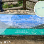
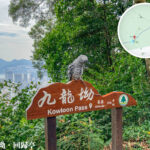
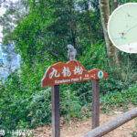
3. Reunification Pavilion (Kowloon Pass)
- This scenic pavilion looks out over East Kowloon, the Kai Tak Cruise Terminal, and stretches all the way across Victoria Harbour.
- It stands out as one of the absolute best vantage points for capturing a panoramic shot of Kowloon.
4. Lion Rock
- The ultimate symbol of the Hong Kong spirit, standing proud at an elevation of 495 metres.
- Hikers can choose to take a side trail to scramble up to the summit for a jaw-dropping, bird’s-eye view of the Kowloon Peninsula and Victoria Harbour.
5. Beacon Hill
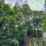
- Standing at 457 metres, its summit houses a distinctive aviation radar station.
- The viewing platform here offers an even more wide-open panorama than Lion Rock, looking south toward Kowloon and north across Sha Tin.
6. Eagle’s Nest
- Home to the lush Eagle’s Nest Nature Trail.
—
🌄 Landscape Highlights
- Urban Proximity: Easily the closest section to the city center, allowing you to peek at Kowloon’s concrete jungle and the New Territories’ ridges all in one go.
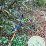
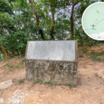
- WWII Relics: Old trenches and military dugouts are still clearly visible along the trail, with some measuring up to a metre deep.
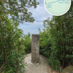
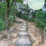
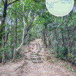
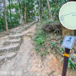
- Diverse Terrain: Winds through a dynamic mix of open ridgelines, shaded woodland paths, and country park landscapes that offer both natural and cultural appeal.
- Convenient Supplies: Local stores at Shatin Pass make it incredibly easy to take a break and refuel mid-hike.
—
📊 Quick Reference Guide
Location Elevation Key Features English Name Tate’s Cairn 583m Starting point; wide-open panoramas Tate’s Cairn Shatin Pass Approx. 400m Lion Pavilion; local store supplies Shatin Pass Reunification Pavilion Approx. 430m Panoramic views of Kowloon Reunification Pavilion Lion Rock 495m The symbol of the Hong Kong spirit Lion Rock Beacon Hill 457m Radar station; open viewing platform Beacon Hill Eagle’s Nest Approx. 300m Nature trail stretch Eagle’s Nest Tai Po Road Approx. 100m Ending point; convenient transport links Tai Po Road —
⚔️ Special Feature: WWII Military Relics
Beyond its urban panoramas and natural paths, MacLehose Trail Section 4 and Section 5 hold a wealth of World War II military relics. Deeply tied to the Battle of Hong Kong, these ruins have become a profound way for modern hikers to step straight through a window between nature and history.
1. The Gin Drinkers Line
- Background: Engineered by the British military in the 1930s as the primary defensive line against a Japanese invasion, this massive defensive network spanned roughly 18 km across multiple mountain ridges in the New Territories.
- Section 5 Relics: Walking along the old trails from Tate’s Cairn toward Shatin Pass reveals a string of defensive structures, including:
- Trenches: Winding across the hillsides, some remain up to a metre deep.
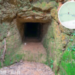
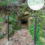
- Military Bunkers / Caves: Defensive shelters and dugouts that were heavily defended or breached during the conflict.
- Pillboxes / Machine Gun Posts: Small stone-and-concrete fortifications built to guard strategic mountain passes.
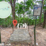
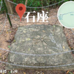
- Coordinate Stones: Historical military artifacts once used for artillery surveying and targeting.
- These relics sit right beside the main trail, allowing hikers to explore them up close and understand the wartime defensive layout.
2. Wartime Memory & Cultural Meaning
- The Battle of Hong Kong: In December 1941, Japanese forces breached the Gin Drinkers Line, leading to the rapid fall of Hong Kong. These ruins serve as a powerful monument to the resistance and sacrifices of that era.
- Cultural Value:
- Historical Education: A stark reminder for future generations to cherish peace and understand Hong Kong’s place in global wartime history.
- City Spirit: Echoing the resilience of the Lion Rock Spirit, these relics symbolize the grit and determination to protect one’s home.
- Eco-Tourism: Merging rugged natural scenery with military history creates a truly unique “historical hiking trail” experience.
- Preservation Challenges: Due to natural weathering and thick overgrowth, some structures are getting harder to spot, highlighting the urgent need for better conservation and educational signage.
—
🗺️ MacLehose Trail • Section 5 “WWII Relics” Guide
Trail Location Key Military Relics Geographical Features Cultural & Historical Meaning Tate’s Cairn Trenches, military bunkers / caves Open ridgelines looking down over Sha Tin and Tolo Harbour A vital defensive stronghold along the Gin Drinkers Line, representing the first major line of resistance against invading forces. Shatin Pass Pillboxes / machine gun posts, artillery coordinate stones A strategic mountain pass where multiple trails intersect A crucial wartime artillery targeting zone, reminding visitors that this peaceful pass was once a heavily defended frontline. Lion Rock Mid-slope trenches and military observation posts The definitive symbol of the Hong Kong spirit, boasting bird’s-eye views of the Kowloon Peninsula Used for vital surveillance and defense during the war; today it stands as a cultural icon of the “Lion Rock Spirit,” linking directly to the shared resolve of defending home. Beacon Hill Defensive line ruins, old radar station site Sweeping panoramas looking south to Kowloon and north to Sha Tin A key strategic high point that continued to serve military purposes after WWII, symbolizing Hong Kong’s geopolitical role during the Cold War era. Eagle’s Nest Trench ruins and smaller defensive works along the nature trail Shaded woodland paths nearing the urban edge Where nature and wartime memories entwine, offering a beautiful reminder of the value of peace and environmental conservation. —