🛣️【Sai Sha Road (西沙路)】 is one of the primary arterial roads in the Ma On Shan New Town within the Sha Tin District, New Territories, Hong Kong. Running on an east-west alignment with a total length of approximately 12 kilometers, it links Sai Kung Town with the Ma On Shan and Wu Kai Sha areas, serving as a vital transport lifeline for Shap Sze Heung and Sai Kung North. The corridor runs past numerous residential estates and commercial hubs, including Chung On Estate, Symphony Bay, and Bayshore Towers. Beyond being a crucial daily commuting corridor for Ma On Shan residents, the road is dotted with multiple public bus transport hubs, facilitating smooth transit to Sai Kung, Sha Tin, and the urban core, while enjoying excellent connectivity via the adjacent MTR Tuen Ma Line. The vicinity of Sai Sha Road also features comprehensive lifestyle and retail amenities, including major shopping malls like MOSTown and Ma On Shan Plaza, alongside supermarkets like Wellcome and Market Place, offering robust community conveniences.
📍 Quick Facts
Item Details Chinese Name 西沙路 English Name Sai Sha Road Starting Point Tai Mong Tsai Road, Sai Kung Ending Point Heng Tak Street, Ma On Shan Total Length Approx. 11.2 km Year of Opening 1971 (Phase 1 initial section) | 1973 (Phase 2 full alignment) Speed Limit 50–80 km/h (depending on the specific road segment) Traffic Flow Dual carriageway / Two-way traffic Districts Covered Sai Kung District, Tai Po District, Sha Tin District Major Intersecting Roads Ma On Shan Bypass, Ma On Shan Road, Kam Ying Road — Furthermore, this major roadway traces the western coast of the Sai Kung Peninsula, skirting the edge of Ma On Shan Country Park to offer direct access to popular hiking routes like MacLehose Trail Section 4. It wends past several traditional rural settlements, including Kei Ling Ha, Nai Chung, and Tai Tung, and intersects with key thoroughfares like Sai Kung Highway and the Ma On Shan Bypass, forming the backbone of Sai Kung’s external transport network. The scenery along Sai Sha Road changes dramatically, shifting from rustic fishing village charm to modern, high-end residential developments, while serving up sweeping, distant views over Kei Ling Ha Hoi (Three Fathoms Cove) and the rugged ridges of Ma On Shan. —
🗺️ Geography & Route Alignment
Sai Sha Road traverses three administrative districts—Sai Kung, Tai Po, and Sha Tin—passing through an eclectic mix of rural villages and natural landmarks, including Kei Ling Ha, Nai Chung, Shap Sze Heung, Wu Kai Sha, and the urban centers around Ma On Shan and Heng An MTR stations. —
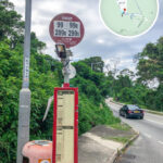
🚍 Public Transport Network
- Green Minibuses: Routes 807K and 807S.
- Bus Routes: KMB Routes 99 and 299X; alongside weekend/holiday leisure routes like 33R, 74R, and 99R.
- MTR (Mass Transit Railway): The viaduct section of the Tuen Ma Line spanning from Wu Kai Sha Station to Heng On Station runs directly above the central median of Sai Sha Road.
- Cycling Network: The Ma On Shan section features dedicated cycle tracks, though cycling is strictly prohibited on certain segments during weekends and public holidays.
—
🏞️ Key Landmarks & Villages Along the Route
Location (Chinese) English Name 泥涌 Nai Chung 十四鄉 Shap Sze Heung (Sai Sha Area) 烏溪沙 Wu Kai Sha 帝琴灣 Symphony Bay 馬鞍山運動場 Ma On Shan Sports Ground 頌安邨 Chung On Estate 澳頭村 O Tau Village —
🏘️ Regional Development Impacts
- The massive Shap Sze Heung residential mega-project injects 9,700 brand-new housing units into the area.
- Phase 2 of the development is set to introduce 88 exclusive units.
- The expansion welcomes a new international school campus and modern community clinics.
- The local median monthly household income is projected to rise toward HK$38,000.
—
🏞 Surrounding Infrastructure & Amenities
- Sai Sha GO PARK: A world-class multi-purpose sports and retail hub featuring a pet-friendly park, children’s playgrounds, outdoor athletic zones, and diverse dining options.
- Shap Sze Heung Residential Complex: Delivering 9,700 residential flats, accommodating an estimated incoming population of 27,000 residents.
- Community Facilities: Houses integrated international schools and healthcare clinics.
🧘♂️ Sai Sha GO PARK Highlights
- Dedicated pet park and premium glamping experiential zones.
- Adventure playgrounds for children alongside state-of-the-art outdoor sports amenities.
- Curated specialty restaurants, including popular spots like Pizza Express and NeNe Chicken.
- Equipped with 350 public parking spaces to accommodate visitors.
—
🚗 Parking & Access Points
- Kei Ling Ha Lo Wai Car Park: Accommodates 200 parking spots.
- Sai Sha Road Open-Air Car Park: Provides 150 parking spots.
- Hoi Ying Road Roundabout: Serves as the primary vehicle entrance point.
—
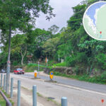
🏗 Widening & Infrastructure Upgrade Works (2018–2025)
Project Scope Project Details Carriageway Widening Upgrading the old two-lane single carriageway into a dual two-lane (four-lane) dual carriageway to boost traffic capacity. Active Mobility Infrastructure Integrating dedicated new cycle tracks and spacious pedestrian pavements along the widened route. Noise Mitigation Facilities Installing 1.5 kilometers of advanced noise barriers, effectively slashing roadside noise levels by up to 8 decibels. Drainage & Sewerage Upgrades Constructing comprehensive main trunk sewers built to withstand a 1-in-50-year flood prevention standard. Pedestrian Footbridges Erecting 3 modern pedestrian footbridges to ensure safe, grade-separated road crossings. Smart Lighting Systems Implementing energy-efficient LED streetlights fitted with smart, automated dimming systems. Cycle Track Extension Adding 3.5 kilometers of brand-new, interconnected bicycle paths.
- Scope of Works: Transforming the corridor from a two-lane road into a four-lane dual carriageway, alongside constructing cycle tracks, footbridges, noise barriers, and installing approximately 2.1 kilometers of vital sewer pipelines.
- Project Completion: The major structural and road works successfully reached completion in April 2024.
—
🏗️ Historical Evolution
- 1950s Planning Era: The corridor was originally conceptualized and designated as the “Nai Chung Access Road.”
- 1971–1973 Construction: Formally built in two distinct phases; Phase 1 extended to Kei Ling Ha Lo Wai, while Phase 2 pushed onward to Nai Chung.
- 1971: Phase 1 officially opens to traffic, connecting Tai Mong Tsai directly to Kei Ling Ha Lo Wai.
- 1973: Phase 2 reaches completion, extending the operational road network from Kei Ling Ha Lo Wai through to Nai Chung.
- 1988: The roadway is further extended westward to seamlessly connect with the junction of Ma On Shan Road.
- 1992–1996: The road undergoes extension projects to link up with Hang Hong Street and Hang Tek Street, marking the full alignment’s completion.
- Post-2001 Development: The elevated viaduct structure of the MTR Tuen Ma Line is constructed to run straight through the central median of Sai Sha Road’s urban section.
—