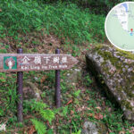
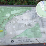
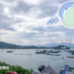
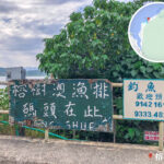
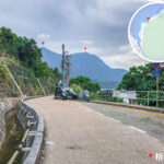
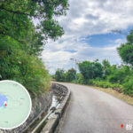
🏞️ 【Kei Ling Ha (企嶺下) 】 is a natural and historical treasure trove where mountains meet the sea. Located in Sai Kung North within the Tai Po District of the New Territories, it sits just northeast of Ma On Shan. The area derives its name from its location at the foot of the mountain historically known as “Kei Ling” (Mount Kei), and its coastal waters are known as Three Fathoms Cove (Kei Ling Ha Hoi). The locality comprises two traditional settlements: Kei Ling Ha Lo Wai (Old Village) and Kei Ling Ha San Wai (New Village). In 1994, the 【Kei Ling Ha Mangrove】 was designated as a Site of Special Scientific Interest (SSSI), covering 48.4 hectares of intertidal mudflats nestled between Tseng Tau Nam and Kei Ling Ha Lo Wai. —
—
📍 Geography & Village Structure
Item Details 🗺️ District Sai Kung North, Tai Po District, New Territories 🏘️ Villages Kei Ling Ha Lo Wai (A heritage-rich Hakka village preserving traditional architecture and local culture) and Kei Ling Ha San Wai (A relatively newer settlement featuring convenient transport links and close proximity to the main bus stops) 🌊 Coastal Waters Three Fathoms Cove (The scenic inlet directly fronting the area, renowned for its panoramic views and vibrant fish raft operations) 🌿 Ecological Site Intertidal mangrove mudflats designated as a Site of Special Scientific Interest (SSSI) —
🌳 Ecological Sanctuary: Kei Ling Ha Mangroves
- Establishment Date: August 13, 1994
- Total Area: 48.4 hectares
- Geographical Location: Coastal strip running between Tseng Tau Nam and Kei Ling Ha Lo Wai
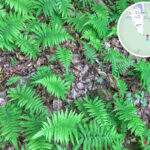
- Habitat Diversity: Mangrove forests, tidal mudflats, freshwater marshes, and oyster shell beaches
- Native Wildlife: Abundant populations of fiddler crabs, mudskippers, and migratory waterbirds
—
🕰️ History & Cultural Heritage
📜 Hakka Villages
The local inhabitants are predominantly Hakka people, primarily carrying the surnames Fong and Shing. The settlements beautifully preserve ancestral halls, traditional granite stone houses, and historic water wells.
⚔️ The Great Secret Rescue Operation
- Historical Period: The Japanese Occupation (1940s)
- Background: Served as a critical, covert evacuation route managed by the Hong Kong-Kowloon Independent Brigade of the East River Column.
- Notable Figures Rescued: Prominent intellectuals, cultural icons, and politicians including Zou Taofen, Hu Die (Butterfly Wu), Lian Guan, and Liao Chengzhi.
—
🌿 Natural Highlights & Recommended Activities
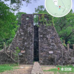
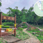
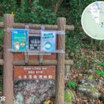
Attraction / Activity English Name Key Features & Highlights Sky Castle Sky Castle A mysterious stone castle structure draped in dense climbing vines, evoking scenes straight out of a Studio Ghibli animation. Au Mun Hill Au Mun Hill A steep “staircase to heaven” ascent that rewards climbers with a 270-degree panorama over Three Fathoms Cove; a legendary hotspot for landscape photographers. 水浪窩 • 觀星台 Stargazing Tower A unique 6-metre-tall stone tower crafted from rough granite blocks, architectural styled after ancient Chinese astronomical observatories. 榕樹澳 Yung Shue O A tranquil coastal village serving as the prime jumping-off point for offshore fish rafts and shoreline mangrove exploration. Fish Raft Activities WakeBen Fish Raft A hub for open-water fishing, banana boat rides, wakeboarding, and dynamic water sports, perfect for group charters and private events. Mangrove Mudflat Mangrove Mudflat An intertidal habitat thriving with true mangrove flora and fiddler crabs, offering excellent opportunities for eco-tours and nature photography. 水浪窩 Shui Long Wo Often dubbed “Hong Kong’s Sky Castle,” this lush, forested enclave hides the mystical stone tower and stargazing site. —
🚍 Transport Options
Mode Route & Directions 🚌 Franchised Bus Take KMB Route 299X running between Sha Tin Central and Sai Kung, and alight directly at the Kei Ling Ha San Wai stop. 🚢 Ferry & Trek Take the ferry from Ma Liu Shui Ferry Pier to Sham Chung, then continue on foot or by bicycle along the coast to reach the area. 🚗 Private Car Accessible via Sai Sha Road, though visitors should plan ahead regarding local parking availability and rural road conditions. Note: The access road leading into Yung Shue O village is a designated restricted zone. Non-residents must enter via urban/New Territories taxis or on foot. —
📸 Recommended Photography Hotspots
- Three Fathoms Cove Panorama: Climb the steep “heavenly steps” to Au Mun along the ridge line to capture stunning 270-degree vistas across the sparkling coastal inlet.
- Mangrove Sunset: Compose your shot with the dramatic silhouette of Ma On Shan in the background, capturing the shifting play of golden hour light over the mudflats and mangrove roots.
- Sky Castle Stone Tower: Head into the deep woodlands of Shui Long Wo to photograph the vine-covered granite tower, creating an ethereal, fairytale-like aesthetic.
—
🌟 Why Visit?
- Rich Biodiversity: Immerse yourself in a protected coastal ecosystem featuring complex mangrove communities, active mudflats, and pristine shorelines.
- Deep Historical Roots: Discover old客家 cultural traditions alongside gripping World War II wartime rescue routes.
- Photographer’s Haven: Capture a stunning diversity of landscapes ranging from dramatic mountain-sea vistas and coastal sunsets to clear starlit skies.
- Versatile Outdoor Escapes: An ideal destination whether you are looking for relaxing fish raft outings, stargazing, nature photography, or rewarding ridge hikes.