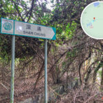
🌳【Sham Chung (深涌 – The Hidden Countryside)】 is a hidden wetland plain located in the northern part of the Sai Kung Peninsula, New Territories, Hong Kong. Situated along the inner coast of the peninsula, it sits adjacent to Three Fathoms Cove and Sam Pui Chau, right at the mouth of Three Fathoms Cove. The area forms a secluded basin, enclosed by hills on three sides (Shek Nga Tau, Shek Uk Shan, and Wa Mei Shan). Spanning about 20 hectares, this valley was originally a centuries-old Hakka village where residents farmed rice for generations. Following the abandonment of the paddies, it transformed into a vast grassland ecosystem. Its central “heart-shaped freshwater marsh” has become a famous landmark due to its romantic shape when captured from above. A pier was once built at the river mouth of Sham Chung to establish waterway links to places like Ma Liu Shui, and remnants of mangroves, abandoned farmlands, and traditional stone bridges can still be found today. —
📌 Quick Facts
Category Details 📍 Geographical Location Located in the northern part of the Sai Kung Peninsula, New Territories, Hong Kong, at the mouth of Kei Ling Ha, enclosed by hills on three sides (Shek Nga Tau, Shek Uk Shan, and Wa Mei Shan) 🏞 Topography & Geology Features a coastal river valley landscape facing the sea to the west; the geology comprises Jurassic sandstone, siltstone, mudstone, and rhyolite, holding high scientific value 🧭 Administrative District Geographically part of Sai Kung, but since its primary transport relies on waterways leading to Tai Po, it falls administratively under the Sai Kung North portion of the Tai Po District 🧑🌾 Village Composition Comprises Shing Kau Tong Village, Pau Nei Tsai Village, Shek Tau Keng Village, Tui Min Village, and Wan Chai Village—collectively known as Sham Chung Village, a traditional Hakka settlement 🧬 Lineage & Ancestry The Lee clan traces their ancestral roots to Xikeng Village in Changle, Guangdong. They migrated from Wu Kau Tang to Sham Chung during the Qianlong reign of the Qing Dynasty, and the current residents are mostly descendants of the Lee family 🏡 Hakka Culture Preserves the layout and architecture of a traditional Hakka farming village, including the Lee Grand House and Epiphany Chapel; the local lifestyle mirrors old Hakka customs ⛪ Religious History Catholicism was introduced in the 1870s. The Epiphany Chapel was built in 1879, rebuilt in 1956, and later housed a public school 🌿 Ecological Environment Boasts a diverse array of habitats including streams, freshwater marshes, and wetlands; it was once the largest habitat for the Hong Kong Paradise Fish 🚢 Transportation Accessible by kaito ferry from Ma Liu Shui (approx. 30 minutes), or via hiking trails from Shui Long Wo or Pak Sha O (approx. 1.5–2 hours) 🧪 Archaeological Finds Over 3,000 stone artifacts have been unearthed at the Wong Tei Tung site, potentially dating back to the Paleolithic or Neolithic period, making it one of Hong Kong’s oldest archaeological sites —
🗺 Geographical Location & Village Structure
- Location: Situated in the northern part of the New Territories’ Sai Kung Peninsula, at the mouth of Kei Ling Ha; bordered by mountains on three sides (Shek Nga Tau, Shek Uk Shan, and Wa Mei Shan) and facing the sea on one side
- Village Composition: Sham Chung Village is a collective name for five Hakka villages:
- Shing Kau Tong Village
- Pau Nei Tsai Village
- Shek Tau Keng Village
- Tui Min Village
- Wan Chai Village
- Administrative District: Though geographically closer to Sai Kung, it falls under the Tai Po District due to historical transport connections
- Ancestral Background: The Lee family originated from Xikeng Village in Changle, Guangdong, and moved here from Sha Tau Kok‘s Wu Kau Tang during the Qing Dynasty
— Getting to Sham Chung requires about a 2-hour hike from University Station via Lai Chi Chong, or a kaito ferry ride from Ma Liu Shui (schedules are infrequent and require booking). Given its remote location and absence of permanent residents, Sham Chung retains a serene, time-frozen ambience, making it a hidden paradise for photography, birdwatching, and grassland picnics. Its history of development debates and conservation successes also serves as a classic textbook example of balancing nature and development in Hong Kong. —
🥾 Hiking Route & Travel Highlights
📍 Recommended Route: Shui Long Wo → Yung Shue O → Sham Chung Grassland → Sham Chung Pier (Approx. 2.5 hours, 8.5 km)
Section Time Key Features Shui Long Wo → Yung Shue O Approx. 1 hr 15 mins Flat concrete pathway, lined with picnic areas and views of silvergrass Yung Shue O → Sham Chung Grassland Approx. 45 mins Passes through mangroves and coastlines, with refreshment options available mid-way at Loi Kee Store Sham Chung Grassland → Sham Chung Pier Approx. 15 mins Offers stunning sunset views at dusk; catch a kaito ferry from Sham Chung Pier back to Ma Liu Shui 🌄 Attraction Highlights
- Sham Chung Grassland: Covering 3.5 hectares, this area was originally planned as a golf course but has now become a hot spot for picnics (camping is prohibited), kite-flying, and photography
- Sham Chung Pier: When the sun dips below the horizon, the water shimmers in gold, making it an excellent spot for sunset photography
- Shum Chung Manor: Offers basic catering and snacks like noodles, congee, beer, and soft drinks
- Supply Points: Loi Kee Store and Shum Chung Manor
🧳 Quick Tips
- Bring a picnic mat if you wish to lounge on the grass
- It is highly recommended to bring your own food and water
- Set aside at least 30 minutes to walk to the pier
- Winds can be strong in winter; make sure to stay warm around the pier area at dusk
— The ecological value of this site is immense; the wetlands nurture dragonflies, frogs, and migratory birds, while the surrounding hills are dotted with feng shui woods and fruit trees. In the 2000s, a planned golf course project sparked a huge conservation controversy, which was eventually shelved following strong opposition from green groups. Today, parts of the land are managed by The Conservancy Association to promote ecological restoration. Surrounding human imprints include the abandoned Sham Chung School, the old Catholic chapel foundations, and the still-operating stores at Yung Shue O that provide light refreshments. —
🌱 Ecological Value & Conservation Controversies
🌿 Ecological Features
- Wetlands & Marshes: Formed naturally from abandoned rice fields, the area encompasses diverse habitats including streams, freshwater marshes, and mangroves
- Species Habitats:
- The endemic Hong Kong Paradise Fish (which once boasted its largest population here)
- The rare plant Liparis ferruginea was once discovered here, though it is now locally extinct
⚠️ Conservation Controversies
Year Event Outcome 1999 The marshland areas were damaged by private developers The habitat of the Hong Kong Paradise Fish was severely compromised, causing certain species to vanish; the paradise fish were urgently relocated to Kadoorie Farm for emergency conservation 2000s A golf course development project was proposed The Town Planning Board rejected the application for land-use zoning changes, putting the project on hold 2006 Land-use zoning application was approved The developer halted camping rentals and revived the development blueprints 2008 Plans for a spa resort were put forward Sun Hung Kai Properties partnered with Banyan Tree Hotels & Resorts, but the plan did not materialize Sham Chung is listed as one of the 12 priority sites for enhanced conservation under the Government’s “New Nature Conservation Policy,” yet it received the lowest ecological rating among them. —
🧠 Important Reminders
- ✅ Bring sun protection, plenty of water, and a picnic mat
- ✅ Pay close attention to the kaito ferry schedules to avoid missing the return trip
- ✅ Respect the local villagers and keep your volume down
- ❌ Camping is strictly prohibited on the grass (unless authorized by the manor)
- ❌ There are no public bins; please bring your own trash bags and carry your litter away
—
🏛 History & War Relics
- Qing Dynasty Migration: The Lee family moved here from Sha Tau Kok‘s Wu Kau Tang, tracing their lineage back to Xikeng Village in Changle, Guangdong, and lived off the land through farming
- Anti-Japanese Resistance Base: Between 1942 and 1944, Sham Chung served as the primary intelligence and communications center for the Hong Kong-Kowloon Independent Brigade of the East River Column, managing six separate courier routes
- Guerrilla Operations: Villagers actively supported the guerrilla forces by relaying intelligence, providing shelter, and supplying food, making vital contributions to the resistance efforts
—
🧘♂️ The Allure of Sham Chung: Where Countryside, History, and Conservation Converge
Sham Chung is more than just a weekend getaway destination; it is one of the precious few places in Hong Kong that retains both raw ecological landscapes and wartime memories. Its rolling lawns, reflective waters, historical villages, and warm sunsets weave together a quiet yet profound tapestry. Amid the ongoing tug-of-war between development and conservation, Sham Chung remains a sanctuary well worth treasuring. —