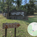
🌄 【South Lantau Trail】(南大嶼 • 郊遊徑)is a hiking route stretching about 10.3 kilometres across the southern part of Lantau Island, Hong Kong. Winding along the hillsides right between Lantau Peak and Sunset Peak, it treated hikers to sweeping views of the South Lantau coastline, mountain streams, and untouched woodlands. With its gentle slopes, this trail is perfect for beginner-to-intermediate hikers. Along the way, you will pass through lush secondary forests and cross several mountain rocky streams, all while looking up at the dramatic peaks of Sunset Peak and Lantau Peak, and looking down over the coastal views of Pui O and Cheung Sha Beach. While a few sections—like the climb from Tong Fuk Catchwater to the mountain pass of Cheung Yan Shan—get a bit steep and require careful footing, the overall trail is well-maintained and clearly marked with distance posts and signposts. —
🏞️ South Lantau Trail Overview
Item Details Location South Lantau Country Park Total Length Approx. 10.3 km Time Required Approx. 3 to 5 hours Difficulty Moderate (⭐️⭐️⭐️☆☆) Views Coastal views, mountain ranges, rocky streams, and shaded woodlands Starting Point Nam Shan Campsite Ending Point Tong Fuk Catchwater or South Lantau Road — The South Lantau Trail is not just packed with natural scenery; it beautifully blends ecology and leisure, featuring dramatic waterfalls at Tsing Lung Stream and Sheung Lung Stream alongside handy pavilions and barbecue spots. Getting there is a breeze: you can catch a New Lantao Bus from Mui Wo or Tung Chung and hop off right at the Nam Shan Campsite stop to start. For the finish, you can choose to exit at Tong Fuk or Pak Kung Au, making it incredibly easy to tailor the trip to your fitness level. This trail is especially great for summer hiking, as the abundant tree canopy offers plenty of shade, and the cool running streams provide the perfect escape from the heat, making it an ideal choice to experience the wild beauty of Lantau. —
🌟 Recommended Routes
🚶🏻➡️ The Leisurely Version
- Nam Shan Campsite → Pak Kung Au (Approx. 7.5 km)
- Lower difficulty with the absolute best views, perfect for casual hikers and families.
🏃🏻➡️ The Full Challenge Version
- Nam Shan Campsite → Tong Fuk (Approx. 13 km total walk out)
- Best suited for hikers with solid stamina, offering a longer route packed with diverse landscapes.
—
Bus Transport Info
Location Bus Routes Remarks Start: Nam Shan Campsite NLB Routes 1, 2, 3M Departing from Mui Wo or Ngong Ping Midpoint: Pak Kung Au NLB Routes 3M, 11, 23 Great for a midpoint exit or alternative starting spot End: Tong Fuk / South Lantau Road NLB Routes 3M, 11, 23 Catch a ride back to Tung Chung or Mui Wo 📍 Main Sections & Highlights
Section Features Nam Shan Campsite → Pak Kung Au The starting point comes with pavilions and public toilets; the trail offers plenty of tree cover. Pak Kung Au → SE slope of Lantau Peak Look straight up at the towering peaks of Lantau Peak and Sunset Peak. Lantau Peak → Tong Fuk Catchwater Wide-open vistas offering distant views of Cheung Sha Beach and the Soko Islands. Tong Fuk → South Lantau Road Choose to finish your hike down to South Lantau Road or link up with the Lantau Trail. —
🌅 Scenic Highlights Along the Way
- Distant views overlooking the Chi Ma Wan Peninsula and Pui O Beach.
- The Soko Islands can be spotted dotting the horizon on clear, blue days.
- Lantau Peak and Sunset Peak: Hong Kong’s second and third highest peaks, showcasing their majestic ridgelines right before your eyes.
- Cheung Sha Beach: One of Hong Kong’s longest stretches of pristine, natural sandy beach.
- Seasonal changes: Summer days get very hot, making sun protection and water essential; autumn brings blooming silvergrass, which turns the landscape into a golden wonderland.
—
⚠️ Important Safety Tips
- There are absolutely no replenishment shops along the trail, so pack plenty of water and snacks.
- If hiking in summer, pay extra attention to sun protection and keeping hydrated.
- Parts of the route follow hillside dirt tracks that can become incredibly slippery after rain.
- If you want to save your energy, you can easily opt to hike just the Pak Kung Au to Nam Shan section (around 7.5 km).
- Keep an eye on distance posts like L108 and C1118 to keep track of your exact location.
- We recommend setting aside 4 to 5 hours to comfortably complete the entire trail.
—