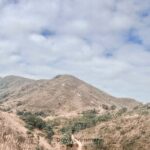
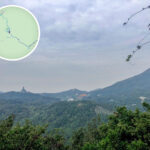
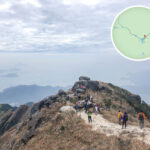
🐦🔥 【Lantau Peak (鳳凰山)】 is the highest summit on Lantau Island. Standing at 934 meters above sea level, it is Hong Kong’s second-highest peak right after Tai Mo Shan (957m). However, since the very top of Tai Mo Shan is a restricted area, Lantau Peak holds the title of the highest accessible peak for the public in Hong Kong. Its Cantonese nickname “Lan Tau Shan” (Ragged Head Mountain) inspired the English name “Lantau”, named because the summit’s heavily weathered rocks look like a “ragged head” from afar. Lantau Peak consists of twin summits: the main peak “Fung Fung” (934m) and the secondary peak “Wong Fung” (918m), standing side-by-side to form a spectacular, unique landscape.—
📌 Quick Facts
🗂 Item 📍 Details 📍 Location Southwest Lantau Island, inside South Lantau Country Park 🏔️ Elevation Main Peak (Fung Fung): 934m (HK’s 2nd highest peak) 🌄 Secondary Peak Wong Fung: 918m 🏞 Country Park South Lantau Country Park 📐 GPS Coordinates Main Peak: 22°14′57.30″N, 113°55′12.00″ESecondary Peak: 22°15′01.06″N, 113°55′11.19″E 🪨 Geology Composed of volcanic igneous rock; shrubs and grasslands dominate the summit, with dense woodlands on lower slopes 🌦 Climate Alpine climate—cool summers, freezing winters, often battered by strong winds and thick fog 🌄 Iconic Sights “Lantau Sunrise” lookout, unique rock formations like “South Heaven’s Gate” (Nam Tsin Mun) and “North Heaven’s Gate” (Pak Tsin Mun) —Lantau Peak is legendary for being incredibly steep and punishing. The most classic route is Lantau Trail Section 3, which kicks off from Pak Kung Au and tackles the brutal “Boardwalk / Sky Stairs” to reach the summit. The whole trek spans around 4.5 km and takes about 3 to 4 hours, serving up killer views of Sunset Peak and Shek Pik Reservoir along the way. The summit is the go-to spot for catching the famous “Lantau Sunrise”. However, because mountain weather flips in a heartbeat, frost can form during winter, while dense fog frequently rolls in during summer. Hikers must pack proper gear for both extreme cold and sun protection. It is also an absolute hotspot for stargazing, though future conditions might take a hit due to light pollution from the “Lantau Tomorrow Vision” project.—
📜 History & Cultural Background
- 📖 Historical Records: The “Xin’an County Gazetteer” notes that Lantau Peak resembles a grand phoenix pavilion facing Castle Peak (Tsing Shan) from across the waters.
- 🍵 Phoenix Tea: Local lore says the mountain once produced a “divine tea”, actually a wild medicinal herb called purple-backed Tiankui.
- 🧘♂️ Wisdom Path: A stunning installation showcasing the full text of the Heart Sutra on massive wooden columns, perfectly blending nature with Buddhist philosophy.
—
🗺️ Hiking Route Overview
🔹 Standard Route: Pak Kung Au → Lantau Peak → Ngong Ping
Section Duration Highlights Pak Kung Au → Lantau Peak Summit Approx. 2.5 hours Steep stone steps but completely wide-open panoramic views Lantau Peak Summit → Ngong Ping Approx. 1.5 hours A knee-buckling, steep descent leading straight down to the Wisdom Path
- Distance: Approx. 5.5 km
- Difficulty: Intermediate to Advanced
- Best Timing: Start in the dead of night to catch the sunrise at the summit, or head up at dusk to shoot the sea of clouds.
—The area around Lantau Peak is packed with incredible side trips, including the Wisdom Path, Tian Tan Buddha (Big Buddha), and Ngong Ping Village, making it a fantastic network of nature and culture. The government has included Lantau Peak in its “Four Peaks” tourism development plan, with upgrading works expected to wrap up by the end of 2026, further cementing its status as Hong Kong’s ultimate hiking and sightseeing destination.—
🚍 Transport
- Starting Point: Pak Kung Au (Bus routes 3M, 11, or 23)
- Ending Point: Ngong Ping (Bus routes 2, 23, or the Ngong Ping 360 Cable Car)
—
📸 Photo Spots & Tips
- 🌄 Sunrise: The ultimate vantage point is right at the Lantau Peak summit.
- ☁️ Sea of Clouds: You have the highest chance of catching this during autumn and winter.
- 🧘♀️ Wisdom Path: Perfect for capturing moody, Zen-style shots of the winding trail and the towering wooden pillars.
- 📷 Pro Photography Tip: Bring a solid tripod and use manual exposure to retain all the crisp details in the moving clouds.
—
🎒 Hiking Gear Checklist
Gear Purpose 🧢 Sun hat & sunscreen Shield yourself from intense high-altitude UV rays 💧 At least 2L of water There are absolutely zero water refills along the trail 👟 Proper hiking shoes Crucial for good grip and solid ankle support 🥾 Trekking poles Save your knees during the brutal climbs and descents 🔦 Headlamp An absolute must-have if you’re night-hiking for the sunrise —
🧗♂️ The Hardcore Route: Roaring Tiger Rock River
- 🐯 Roaring Tiger Rock River: A jaw-dropping scree slope flanked by towering cliffs that look like two tigers facing off.
- ⚠️ Single Lifeline: An incredibly narrow ridge walk with sheer drops on both sides.
- 🧱 Yim Wong Pik (Yama’s Wall): A near-vertical cliff face that requires solid scrambling skills and proper climbing gear.
- 🪨 The Bird Rock: The iconic bird-shaped boulder you’ll hit right before tackling the final summit push.
—
⚠️ Crucial Warnings
- There are zero early-exit paths on this trail; once you start, you have to smash out the whole hike, so be honest with your fitness levels.
- Mountain weather is notoriously unpredictable; always check the Hong Kong Observatory forecast right before you leave.
- Advanced routes like the Roaring Tiger Rock River require intense hands-on scrambling—never attempt these paths alone.
- Always let your friends or family know your itinerary before heading out, and always pack a fully charged power bank.
—