🛣️【Tung Chung Road (東涌道)】 is a vital north-south primary arterial road on Lantau Island, Hong Kong, connecting the Tung Chung New Town with southern Lantau areas such as Mui Wo and Cheung Sha. Originally built in the 1960s as a narrow mountain track, the road was constructed to support the building of the Shek Pik Reservoir and to improve traffic flow between the north and south of Lantau Island. Following successive developments on Lantau Island—most notably the construction of Hong Kong International Airport and the Tung Chung New Town—the road underwent multiple expansions and upgrades. Today, sections of Tung Chung Road have been widened into a two-lane, two-way standard. Following the completion of major improvement works in 2008, the re-aligned Tung Chung Road significantly flattened steep inclines and eliminated sharp bends, vastly boosting driving comfort and traffic capacity while serving as an essential conduit to southern Lantau’s beaches and country parks. —
📌 Key Information
Item Details 🛣️ Road Name Tung Chung Road 📍 Location Lantau Island, Western New Territories, Hong Kong 🗓️ History Originally opened on 28 September 1966, with an opening ceremony officiated by Governor David Trench 🛠️ Improvement Works Widening and alignment upgrades commenced in 2004; fully opened as a single two-lane undivided road on 6 February 2009 📏 Length Approx. 7.3 km (4.5 miles) 🚗 Number of Lanes Single two-lane (two-way undivided) 🚦 Speed Limit Initially 30 km/h, later increased to 50 km/h 🧭 Starting Point Outside Yu Tai Court, Tung Chung (near Pa Mei Road) 🧭 End Point Cheung Sha South Lantau Road Junction (San Shek Wan Roundabout) 🏞️ Geographical Profile Traverses north to south across Lantau Island via Pak Kung Au; flanked by Lantau Peak and Sunset Peak; features steep terrain and winding curves 🚧 Special Regulations The section south of Shek Mun Kap is designated as a closed road; vehicles must hold a “Lantau Closed Road Permit” to enter 🚌 Public Transport Serviced by New Lantao Bus routes, linking Tung Chung, Mui Wo, Ngong Ping, Tai O, and other areas 🏗️ Engineering Features Includes viaduct sections, 21 passing bays, bus laybys, footpaths, sharp curve warning signs, and crash barriers 🌿 Ecological Conservation Vehicle entry restrictions are enforced on the southern section to protect Lantau’s ecology and prevent overdevelopment ⚠️ Notable Incidents In 2006, torrential rains triggered flash floods that cracked the road surface, requiring emergency repairs 🧱 Original Purpose Originally built as a waterworks access track used to transport stream water to Shek Pik Reservoir 🏞️ Geographical Coordinates Approx. 22.2576°N, 113.9401°E — As the primary arterial route to several popular destinations in South Lantau (such as Ngong Ping, Tai O, Pui O, and Cheung Sha Beach), Tung Chung Road sees remarkably heavy traffic. Multiple New Lantao Bus routes (including 3M, 11, and 23) traverse this corridor, providing convenient transit for residents and holidaymakers. Notably, sections of the old Tung Chung Road (the original route prior to the alignment upgrades) have been preserved and repurposed into pedestrian paths and cycling tracks, offering outdoor enthusiasts another way to explore the natural beauty of Lantau Island. —
🗺️ Guide to Attractions Along Tung Chung Road
Attraction Name Type Highlights 🏙️ Citygate Outlets Shopping & Entertainment Features over 150 designer brands offering year-round discounts; a major hotspot for shoppers 🏰 Tung Chung Fort Historical Monument Built in 1832 as a Qing Dynasty coastal defense facility; now a declared monument 🎨 Ma Wan Chung Village Fishing Village Culture Known as “Mini Tai O,” this nostalgic enclave features colorful painted murals interspersed with traditional stilt houses 🎣 Ma Wan Chung Pier Scenic Spot Boasts vibrant 3D floor paintings and spectacular sunset views; a favorite among photography enthusiasts 🏯 Tung Chung Battery Historical Site Built in 1817, featuring an L-shaped retaining wall and gun platform; situated adjacent to a Tang Dynasty lime kiln relic 🛕 Hau Wong Temple Religious Architecture Dedicated to Yeung Hau Wang; a Grade II historic building steeped in rich folklore and local traditions Bridge Ngong Ping 360 Cable Car Station Transport Attraction Spanning 5.7 km, it connects Ngong Ping with Tung Chung, offering panoramic aerial views of Lantau’s spectacular landscapes 🧘♂️ Po Lin Monastery Religious Culture A renowned Buddhist monastery in Ngong Ping, offering a peaceful environment that draws numerous worshippers 🗿 Tian Tan Buddha Landmark Structure A majestic 34-meter-tall bronze seated Buddha; Hong Kong’s most iconic religious landmark 🏞_ Pak Kung Au Natural Landscape The mountain pass nestled between Lantau Peak and Sunset Peak; a mandatory, highly scenic staging point for hikers 🏖️ Cheung Sha Beach Beach Leisure One of the longest stretches of beach on Lantau Island; ideal for surfing, camping, and beach barbecues 🐟 Tai O Fishing Village Traditional Settlement Renowned for its stilt houses, water channels, and salt-fish culture, beautifully preserving an authentic fishing village lifestyle — Celebrated for its winding mountain corridors and majestic scenery, Tung Chung Road extends roughly 9.5 kilometers through lush hillsides, treating travelers to stunning vistas of mountains and coastal waters. The northern section near Tung Chung is relatively straight, whereas the southern half coils along mountain ridges, offering expansive panoramic lookouts over Tung Chung Bay and Hong Kong International Airport from elevated vantage points. Since this route serves as a mandatory pathway to iconic destinations such as Ngong Ping 360, Tai O Fishing Village, and South Lantau Country Park, it remains heavily used by local residents and tourists alike. —
📍 Route and Attraction Distribution Overview
- Starting Point: Tung Chung Town Centre (Citygate, MTR Station)
- Head along the northern section of Tung Chung Road → Visit Tung Chung Fort, Tung Chung Battery, and Ma Wan Chung Village
- Pass through Pak Kung Au → Take in the mountain views and natural ecosystem
- Arrive at Ngong Ping → Ngong Ping 360, Tian Tan Buddha, and Po Lin Monastery
- Head south along South Lantau Road → Cheung Sha Beach and Tai O Fishing Village
—
🌸 Recommended Seasonal Hotspots
Attraction Name Blossom Season Highlights 🌸 Cherry Blossom Avenue (Chek Lap Kok South Road) January–February Features over 80 cherry blossom trees coming into full bloom, creating a spectacular pink canopy 🌼 Golden Trumpet Tree Path March Approximately 200 Golden Trumpet trees burst into a poetic, sea of bright golden blossoms —
🌄 Geographical and Scenic Highlights
- Traverses the precipitous Pak Kung Au mountain pass, nestled between Lantau Peak and Sunset Peak.
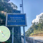
- Prior to improvements, certain segments featured a maximum incline of 1:4; following upgrades, gradients still reach 1:6 to 1:8.
- Offers spectacular landscapes well suited for sightseeing, though drivers must exercise extreme caution.
—
🚌 Public Transport and Tourism Roles
- Traversed by numerous New Lantao Bus routes, linking Tung Chung with Mui Wo, Ngong Ping, Tai O, and beyond.
- Before the commissioning of Ngong Ping 360, Tung Chung Road was the primary vehicle route to the Tian Tan Buddha and Po Lin Monastery.
- Upgrades have allowed the deployment of double-decker buses, significantly improving carrying capacity.
—
🚧 Traffic Management and Entry Restrictions
- The section south of Shek Mun Kap is designated as a “Closed Road,” requiring a valid permit for vehicle entry.
- Urban and New Territories taxis are barred from entering the southern section; entry is strictly limited to Lantau taxis and franchised buses.
- The Transport Department requires bus captains to possess at least two years of driving experience before operating on the southern stretch.
- CCTV monitoring systems are installed along the route to manage and audit vehicle entries.
—
🏗️ Historical Background and Evolution
🔹 Early Operations (1960s–1980s)
- Originally served as a waterworks track, built alongside water tunnels transferring stream water from Tung Chung to Shek Pik Reservoir.
- Opened in 1966 by Governor David Trench; early operations featured a single 3.5-meter-wide village track flanked by multiple passing bays.
- Officially named “Tung Chung Road” in 1969.
🔹 Strategic Turning Point (1997–2004)
- Following the opening of Lantau Link and the new international airport, Tung Chung Road became the sole land-based vehicle link between north and south Lantau.
- Traffic volumes skyrocketed, overwhelming the original layout and prompting major alignment upgrade demands.
—
🛠️ Improvement Work Breakdown (2004–2009)
Engineering Segment Details 🛣️ Northern Section Upgrades (Lung Tseng Tau to Pak Kung Au) Spanning 3.6 km, reconstructed into a two-lane undivided standard while smoothing sharp turns and steep gradients 相關文章 Southern Section Alignment (Pak Kung Au to Cheung Sha) Spanning 2.6 km, including a 750-meter viaduct segment that successfully brought maximum inclines below 15% 🚏 Passing Bays and Bus Stops Equipped with a total of 21 passing bays, bus laybys, and emergency escape ramps 🔄 Roundabout Infrastructure Constructed a new roundabout at San Shek Wan to intersect with South Lantau Road 🚶♂️ Pedestrian & Safety Facilities Introduced new footpaths, crash barriers, road warning signs, and real-time traffic monitoring loops 💰 Budgetary Cost Costing roughly HK$627 million; completed in phases over the 2008–2009 timeline —