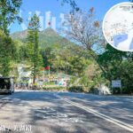
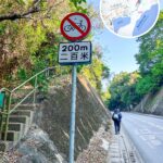
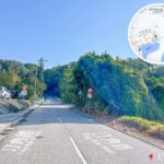
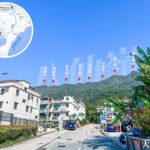
🛣️【Ting Kok Road (汀角路)】 is a major trunk road in the Tai Po District of the New Territories, Hong Kong. Spanning approximately 9.7 kilometers, it extends from Tai Mei Tuk in the east, where it connects to Bride’s Pool Road, to Tai Po Town Centre in the west, intersecting with Kwong Fuk Road and Po Nga Road. Along its route, the road passes through various villages such as Ting Kok, Shuen Wan, and Sam Mun Tsai, as well as the Tai Po Industrial Estate. Built in the 1950s, the road was initially constructed to facilitate the Plover Cove Reservoir project. Following several widening and improvement works over the years, the speed limit on certain sections has been raised to 70 km/h, making it a vital transportation artery linking urban Tai Po with its rural outskirts.
📌 Quick Facts
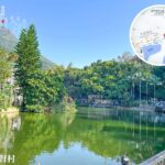
Item Detailed Information 🏷️ Chinese Name 汀角路 🌐 English Name Ting Kok Road 📍 Region Tai Po District, New Territories, Hong Kong 🚩 Starting Point Tai Mei Tuk near Bride’s Pool Road 🏁 Endpoint Tai Wo, at the junction of Kwong Fuk Road and Po Nga Road 📏 Total Length Approx. 9.7 km 🏗️ Construction Years Built in phases between 1952 and 1960 📅 Gazettal Date April 3, 1970 🚘 Traffic Direction Two-way traffic ⛺️ Number of Lanes 2 to 6 lanes (dual carriageway) ⚠️ Speed Limit Mostly 50 km/h; 70 km/h between Nam Wan Road and Sam Mun Tsai 🔗 Major Intersections Bride’s Pool Road, Nam Wan Road, Yuen Shin Road, Kwong Fuk Road, Po Nga Road 🗺️ Areas Passed Tai Mei Tuk, Ting Kok, Shuen Wan, Sam Mun Tsai, Tai Po Industrial Estate, Fu Shin Estate, Tai Po Town Centre, Tai Wo, etc. 🚌 Public Transport KMB Route 75K, various green minibuses 🚴 Cycling Facilities Equipped with a cycle track linking Tai Po Industrial Estate to Tai Mei Tuk 🌟 Features & Use Traced along the historical coastline; vital traffic artery bridging natural landscapes with cultural landmarks 🏞️ Nearby Attractions Plover Cove Reservoir, Tsz Shan Monastery, Lung Mei Beach — Ting Kok Road is more than just a thoroughfare; it seamlessly integrates natural scenery with cultural heritage, granting access to tourist hotspots like Lung Mei Beach and Tsz Shan Monastery. A network of buses and minibuses services residents and visitors alike. Due to recent residential developments (such as The Mont Vert) and growing infrastructure, traffic demands have increased; in response, the government has implemented management measures to ease congestion and has earmarked land for future widening. —
🕰️ Historical Evolution
Year Development Stage Notes 1952–1957 Initial Construction Built in sections; work was temporarily halted at one point due to funding shortages 1955–1960 Phased Opening Included sections from Tai Po Market to Ha Hang, Shuen Wan to Ting Kok, and Ting Kok to Tai Mei Tuk 1961 Widening Scheme Government resumed land to upgrade the route into a standard dual-lane road April 3, 1970 Official Naming The government formally designated the former “Tai Po to Sha Tau Kok Road” section as “Ting Kok Road” —
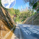
🚧 Improvement Works
- 1990–1994: Widening of the section between the Industrial Estate and Oi Tak New Village, accompanied by the layout of a dedicated cycle track.
- 1998–2001: Improvement works along a 3.5-kilometer stretch from Shuen Wan to Tai Mei Tuk.
- 2002–2005: Widening of a 1.8-kilometer stretch from the fire station to Wong Yue Tan.
- 2014-present: Implementation of lay-bys and active traffic management solutions.
—
🚦 Traffic & Operations
- Speed Limit: 50 km/h on standard sections, upgraded to 70 km/h along the widened corridors.
- Traffic Volume: Handles approximately 30,000 to 32,000 vehicle trips daily.
- Public Transport: Anchored by KMB Route 75K alongside a robust green minibus service network.
—
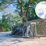
🏘️ En-Route Community Profiles
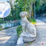
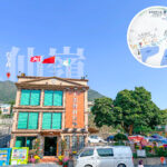
Location Distinctive Features Tai Mei Tuk A vibrant hub for water sports, positioned adjacent to Plover Cove Reservoir. Ting Kok Village A traditional Hakka settlement that safely preserves centuries-old stone tablets. Shuen Wan Sited in close proximity to Tsz Shan Monastery and The Mont Vert residential sector. Sam Mun Tsai Steeped in rich fishing village culture, showcasing a distinct Fishermen’s New Village. Tai Po Industrial Estate A prominent cornerstone for local industrial and commercial production. Fu Shin Estate A foundational residential community situated within urban Tai Po. —
🚗 Transport Functions & Regional Value
- Serves commuting needs for peripheral residents, specifically across traditional fishing and agricultural villages.
- Supports the operational logistics of the Tai Po Industrial Estate and matching residential sectors.
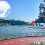
- Acts as the gateway route toward Plover Cove Reservoir and Tsz Shan Monastery.
—
🚴♂️ Cycling Network & Upgrades
- Opened in 1991: A 6-kilometer dedicated cycle track linking Tai Mei Tuk directly with the Tai Po Industrial Estate.
- Completed in 1994: Road widening ventures that substantially leveled up traffic flow efficiency and public safety.
- Late 2000s: Integrated strategic vehicle lay-bys and real-time monitoring infrastructure to effectively curb traffic bottlenecks.
—
Compass Strategic Regional Significance
- Traces the evolution from a cluster of agrarian and fishing villages into a fully integrated New Town.
- Ting Kok Road was structurally paved along Tai Po’s original coastline prior to historical marine reclamation.
- Bridges the rural frontier with the urban core, driving regional socio-economic integration.
- Stands historically as the pioneer overland transit lifeline for the greater Tai Po area.
—