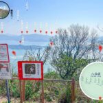
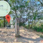
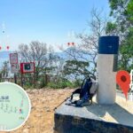
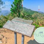
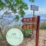
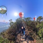
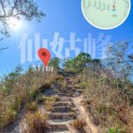
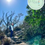
🚶🏻➡️【Wilson Trail • Section 9 (衛奕信徑 • 第9段)】 is one of the most physically demanding and challenging hiking routes in Hong Kong. Spanning approximately 10.5 kilometers and taking about 4.5 hours to complete, it traverses the rugged core of Pat Sin Leng Country Park. The route kicks off from the summit of Cloudy Hill, drops down past Hok Tau Reservoir, and tackles the formidable ridges of Ping Fung Shan and Wong Leng. From there, it launches into an epic roller-coaster traverse across the eight distinct peaks of the Pat Sin Leng range (including Shun Yeung Fung, Chung Li Fung, and Kao Lao Fung), finally concluding at Sin Ku Fung. Hikers are rewarded with sweeping, majestic panoramas over Shuen Wan Plover Cove Reservoir, Tolo Harbour, and the distant coastline of Guangdong. During autumn and winter, the ridges are beautifully blanketed in shimmering silvergrass. However, with its punishingly steep inclines, loose scree fields along Ping Fung Shan, aggressive climbs up Wong Leng, and absolute lack of shade, this segment is widely regarded as the toughest section of the entire Wilson Trail. —
📌 Trail Facts & Overview
Item Details Starting Point Cloudy Hill (Kau Lung Hang Shan) Route Alignment Cloudy Hill → Hok Tau Reservoir → Ping Fung Shan → Wong Leng → Pat Sin Leng Ending Point From Sin Ku Fung descending to Tai Mei Tuk Total Distance Approx. 10.5 km Duration Around 4.5–6 hours Cumulative Ascent Approximately 802 meters Difficulty Rating High (Advanced / Difficult) Terrain Type A technical mix of dirt mountain trails, stone steps, and old concrete paths; exceptionally high sun exposure. — Wilson Trail Section 8 serves up an intense physical workout while seamlessly blending dramatic natural landscapes with local cultural folklore. The serene, mirror-like waters of Hok Tau Reservoir, framed by weeping, overhanging branches, provide a poetic and peaceful interlude before the main climbs. At the journey’s end, the summit of Sin Ku Fung offers completely unobstructed horizons stretching out across Double Haven (Yan Chau Tong) and the South China Sea. After descending, the popular coastal hub of Tai Mei Tuk provides the perfect spot to unwind with casual bicycle rentals, watersports, and seaside dining. For transit, the trailhead at Hok Tau can be accessed via green minibus 52B from Fanling Station for those breaking the hike up, while the final exit requires walking down the Pat Sin Leng Nature Trail to the Tai Mei Tuk bus terminus. Given the technical nature of this route, it is strictly recommended for experienced trekkers equipped with ample water, heavy-duty sun protection, and a keen eye on changing weather conditions. —
🚍 Transport Logistics
Getting to the Start (Cloudy Hill)
- The section officially commences on the high mountain peak, requiring hikers to hike up directly from Wilson Trail Section 8 for seamless navigation.
- Alternatively, you can take a local taxi or minibus from Tai Po to Kau Lung Hang Village, and then trek up the access path to connect with the end of Section 8.
Leaving from the Finish (Sin Ku Fung ➝ Tai Mei Tuk)
- From the summit of Sin Ku Fung, descend along the stone steps of the Pat Sin Leng Nature Trail for about an hour to reach the road at Tai Mei Tuk.
- From the Tai Mei Tuk transport interchange, you can return to the city center via:
- Green Minibus 20C ➝ Tai Po Market MTR Station
- KMB Bus 75K or Route 275R (Sundays & Public Holidays only)
—
🗺️ Detailed Trail & Viewpoint Breakdown
1. Cloudy Hill
The trail begins directly at the summit infrastructure, acting as the continuation of Section 8. Looking back, you can enjoy bird’s-eye views over Sha Lo Tung and Fung Yuen. The opening stretch follows an old military access road on a long, steady descent into the Hok Tau valley.
2. Hok Tau Reservoir
The path meanders through the shaded groves of the Hok Tau Family Walk before revealing this hidden, crescent-shaped reservoir nestled deeply within a quiet basin. Originally built for agricultural irrigation rather than drinking water, its glassy surface reflects the surrounding hillsides. A public pavilion near the dam houses automated vending machines for a quick mid-hike refreshment before you cross the main masonry structure and hook into the rugged mountain paths.
3. Ping Fung Shan
Prepare your legs for a punishing, near-vertical climb along a steep stone staircase. The relentless ascent brings you onto a dramatic ridge that acts as a natural viewing deck, offering wide vistas over the entirety of Hok Tau Reservoir below. The trail underfoot here is heavily weathered, rough, and covered in unstable scree.
4. Wong Leng
Standing proud at 639 meters, this is the highest geographic point of the entire section. From this towering crest, hikers can look out over Tolo Harbour and spot the massive white Tsz Shan Monastery Guanyin statue in the valley. The narrow track tracks directly along the cliff edges, providing immensely broad, panoramic horizons.
5. Lai Pek Shan
A high-altitude sub-peak flanked by sweeping slopes of wild silvergrass, which turns into a dazzling, golden sea during the late autumn months.
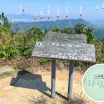
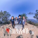
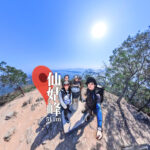
6. Pat Sin Leng
The legendary “Ridge of the Eight Immortals” comprises eight consecutive mountain peaks, each named after a figure from Taoist mythology. The ridge line path is an exhausting series of steep ups and downs, with sections reinforced by concrete steps to manage erosion on the precipitous drops.—
⛰️ The Eight Peaks of Pat Sin Leng
Peak Name (English / Chinese) Elevation Taoist Immortal Representative Shun Yeung Fung 590m Lu Dongbin (Leader of the Immortals; embodies masculine energy) Chung Li Fung 529m Han Zhongli (Identified by his characteristic fan) Kao Lao Fung 543m Zhang Guolao (The elderly sage who rode his donkey backward) Kuai Li Fung 522m Iron Crutch Li (Li Tieguai; patron of the sick and needy) Tsao Kau Fung 508m Royal Uncle Cao (Cao Guojiu; representing the nobility) Choi Wo Fung 489m Lan Caihe (The gender-fluid immortal carrying a flower basket) Sheung Tsz Fung 488m Han Xiangzi (The patron of musicians who played the sacred flute) Sin Ku Fung 511m He Xiangu (The immortal woman holding a lotus flower) —
💡 Pro Tips & Trail Wisdom
- Pack a minimum of 2–3 liters of drinking water; there are zero natural water sources or replenishment stalls once you commit to the high ridges.
- The weather on these coastal mountains can change in an instant; always carry a lightweight waterproof shell jacket.
- Ensure your mobile devices are fully charged and keep an offline digital map running to cross-reference your location along the ridge lines.
- Aim for an early morning departure to conquer the grueling climbs before the intense midday sun hits the exposed rock faces.
- Because the trail tracks high along exposed ridges, winds can be exceptionally fierce and biting; pack an extra layer to maintain core warmth.
- The descents and ascents across the eight peaks feature abrupt, steep steps; high-traction hiking shoes with aggressive lugs are absolutely essential.
- Autumn and winter offer the best atmospheric conditions, where the blooming silvergrass makes for spectacular landscape photography.
- Never attempt this advanced ridge walk if there are active thunderstorm, heavy rain, or high-wind warnings in place.
—
🎒 Recommended Gear Checklist
- Heavy-duty sun protection (UV-blocking hat, polarized sunglasses, and SPF 50+ sunscreen).
- A sturdy pair of trekking poles to take the heavy impact off your knees during the steep steps.
- At least 2 to 3 liters of fluids alongside electrolyte replacement tablets.
- High-density energy rations (such as energy gels, bars, and trail mix) to stave off physical fatigue.
- A reliable smartphone loaded with offline topographic maps or a physical trail map.
- Compact, lightweight rain gear to deal with unexpected coastal squalls.
—