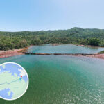
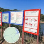
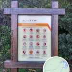
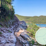
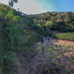
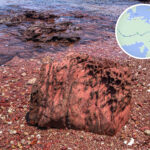
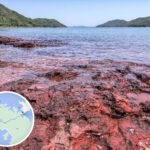
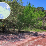
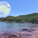
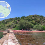
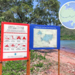
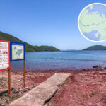
🌊 【Yan Chau Tong • Marine Park (印洲塘 • 海岸公園)】 is a major marine protected area in northeast Hong Kong. Located right on the border of Tai Po and North Districts in the New Territories, it is part of the Plover Cove Country Park. Formally designated as a marine park in 1996, it covers around 680 hectares of sea and multiple islands around Yan Chau Tong. As part of the UNESCO Global Geopark of Hong Kong, this area is famous for its unique geological formations and rich marine ecology, boasting crystal-clear waters, mangrove communities, and diverse coral species. The winding coastline forms various bays and headlands like Kat O and Ap Chau, serving not only as crucial habitats for marine life but also as hotspots for checking out geological wonders like sedimentary rock layers and wave-cut landforms. — This body of water is famous for its unique “mini-Guilin” scenery. Surrounded by hills on all sides, it forms a calm, sheltered bay protected from southeast monsoons in summer and chilly northwest winds in winter, resulting in a relatively dry microclimate. The park is packed with rich marine life, including two seagrass species (Zostera japonica and Halophila ovalis) and all 8 true mangrove species native to Hong Kong. On top of that, 39 species of stony corals have been found in the Lai Chi Wo waters, making it a biodiversity hotspot. The sedimentary rock formations here date back to the Jurassic and Cretaceous periods, making them a key part of the Hong Kong UNESCO Global Geopark with massive geological value. —
🗺️ Geological Features
Dubbed the “Little Guilin of Hong Kong”, Yan Chau Tong features diverse landforms:
- Location: Northeast New Territories, part of the Hong Kong UNESCO Global Geopark
- Geological Formation:
- Volcanic rock formed by volcanic eruptions and subsequent sedimentation around 160 million years ago.
- River erosion created sedimentary rock layers (Sandstone, Siltstone, Shale) up to 500 metres thick.
- Rock layers consist of Sandstone, Siltstone, and Shale.
- Rising sea levels eventually created an enclosed inland sea environment.
- Geological Hotspots: Hung Shek Mun, Kat O, and Lai Chi Wo.
—
📍 Location & Area
Item Details 📍 Location Northeast New Territories, northeast coast of Shuen Wan Country Park (Plover Cove Country Park), close to Kat O and Lai Chi Wo 📐 Area Around 680 hectares 🧭 Core Zones Split into two main areas: Yan Chau Tong and Lai Chi Wo 🌊 Coastline Features Bays, headlands, peninsulas, sand pits, mudflats, and rocky shores —
🌊 Marine Park Boundaries & Structure
Section Boundary Description Part 1: Yan Chau Tong From the Sam A Tsuen to Wong Wan Chau coastline. Covering Yan Chau Tong waters, stretching west to Sam A Tsuen and east to Wong Wan Chau. Part 2: Lai Chi Wo From Kau Lo Tau to Chung Wan Tsui, right next to Lai Chi Wo, stretching west to Kau Lo Tau and east to Chung Wan Tsui. —
🐠 Ecosystem & Biodiversity
Yan Chau Tong boasts a thriving marine and wetland ecosystem, serving as a prime breeding ground and habitat for all sorts of marine life.
Ecosystem Type Features & Species Mangrove Forest Provides shelter and nursery grounds for fish and crustaceans; home to mudskippers, fiddler crabs, etc. Seagrass Beds Nursery grounds for juvenile marine life, also helps stabilize seabed sediments. Mudflats High biodiversity of benthic organisms. Rocky Shores Inhabited by snails, sea urchins, and starfish. Pink Rock Beach Iron-rich rock layers oxidized into a distinct pink hue. Marine Fauna Fish, crustaceans, molluscs, etc., living in a pristine, untouched environment. — Yan Chau Tong Marine Park is more than just a nature reserve—it is also a perfect blend of culture and eco-tourism. Traditional Hakka villages nearby, like Lai Chi Wo and Kat O, have preserved a wealth of historic buildings and cultural heritage, making them massive eco-tourism hotspots in recent years. The Agriculture, Fisheries and Conservation Department (AFCD) has set up a visitor centre and education trails here, alongside marine sightseeing routes for visitors to get an up-close look at the mangroves, seagrass beds, and geological wonders. With its tranquil sea views framing the surrounding hills, it is widely praised as a “fairyland on earth” and the ultimate getaway from the city hustle. —
🏞️ Geological & Cultural Attractions
Attraction Features & Highlights Lai Chi Wo A 400-year-old Hakka walled village with ancestral halls, stone walls, a feng shui wood, a geo-education centre, and ancient trees. Packed with rich natural and cultural resources. Sam A Village A traditional Hakka village right next to the mangroves and the pink rock beach. Kat O A traditional fishing village steeped in local fishing culture. Features historical sites like the Tin Hau Temple and ancient wells, plus great local seafood. Accessible by boat. Ngo Mei Chau One of the islands on the eastern side of the Marine Park (Crescent Island). Hung Shek Mun Clear, visible rock strata with a vibrant red color; a huge hotspot for geological observation. —
🚶♂️ Recommended Hiking Route
- Starting Point: Wu Kau Tang
- Route: Sam A Village → Pink Rock Beach → Lai Chi Wo → Geo-Education Centre
- Total Distance: Around 8 km
- Time Needed: Around 3–4 hours
- Difficulty: Moderate (⭐️⭐️⭐️☆☆)
—
🚢 Transport & Getting There
- Going there: MTR Tai Po Market Station → Green Minibus 20R or Bus 275R → Get off at Wu Kau Tang Road junction
- Heading back (if not returning the same way): Lai Chi Wo Pier → Ferry to Ma Liu Shui Pier
Take Note: The kaito ferry service only runs on weekends and public holidays, leaving at around 3:30 PM.—
📌 Tips for the Trip
- Try to head to the pink rock beach during low tide so you don’t get blocked by the rising water.
- You can sign up for a Lai Chi Wo guided tour to dive deeper into Hakka culture and geology.
- Pack plenty of drinking water, sun