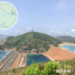
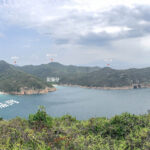
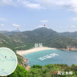
🏞️ 【Biu Tsim Kok (標尖角)】 is a semi-circular headland located north of the East Dam of High Island Reservoir in Sai Kung, Hong Kong. Surrounded by the sea on three sides, it sits at an altitude of about 120 metres with a viewing platform reaching around 170 metres. Once at the pavilion, you can enjoy a stunning 270-degree panoramic view of the coastline, look down at the East Dam, and take in the breathtaking scenery of Long Ke Wan, Po Pin Chau, and the surrounding islands. This area is part of the Hong Kong UNESCO Global Geopark, featuring massive hexagonal rock columns formed by a volcanic eruption 140 million years ago. These rock columns stretch from the mountains right down to the sea, creating a spectacular natural geological masterpiece. —
📌 Quick Facts
Item Details 📍 Location The northern headland of the East Dam, High Island Reservoir, Sai Kung, Hong Kong 🕒 Opening Hours Open 24 hours 🚶♂️ Difficulty Easy (Beginner-friendly) ⏱️ Hiking Time Around a 30-minute walk 🌅 Highlights 270-degree coastline view, hexagonal rock columns, fresh and saltwater junction, panoramic view of Long Ke Wan 🧭 Starting Point High Island Reservoir East Dam —
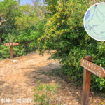
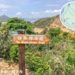
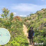
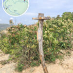
— Biu Tsim Kok is part of the High Island Geo Trail. This trail is roughly 1 km long and is a pretty easy walk. Starting from the East Dam of High Island Reservoir, it takes just about 30 minutes along the paved path to reach the viewing platform. Along the way, you can look out at the clear blue waters and sandy beach of Long Ke Wan, as well as the impressive sea stack of Po Pin Chau. On your way back, you can even spot the unique S-shaped curved rock columns of Fa Shan from afar. It’s perfect for beginners and families. Since some sections have absolutely no shade, make sure to bring enough water and sun protection if you go during summer. It’s also best to avoid going in bad weather for safety reasons. —
🌋 Geological Features & Formation Background
🔶 Hexagonal Columnar Joints
- Formed around 140 million years ago during a supervolcanic eruption.
- The rock type is rhyolitic tuff, which is quite different from most hexagonal columns in the world that are made of basalt.
- The columns can measure up to 3 metres in diameter, covering an area of over 100 square kilometres—making it the largest hexagonal rock column cluster in China.
🌊 Marine Erosion Landforms
- Sea Cave
- Sea Arch
- Sea Stack
—
🗺️ Biu Tsim Kok Route Overview
Section Description Starting at East Dam Walk along the concrete path with clear signage along the way. The Fork in the Road We recommend taking the path on the left—it has less loose gravel and features stone benches where you can take a breather. Arriving at the Pavilion Takes about 30 minutes to get here. The view is completely wide open, perfect for taking photos or just chilling out. —
—
🚗 Getting There
🚶♂️ Starting Point: High Island Reservoir East Dam
Weekdays: Take KMB Bus 94 from Sai Kung Pier, get off at Sheung Yiu station, and walk along Section 1 of the MacLehose Trail all the way to the East Dam.
Weekends & Public Holidays: Take KMB Bus 94 to Pak Tam Chung, then switch to Minibus 9A which takes you straight to the East Dam.
—
🧭 Biu Tsim Kok Viewing Platform Details
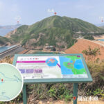
🗺️ Scenery Guide
Direction Sights To your left Long Ke Wan Straight ahead Tsang Pang Kok Tsui, Fan Tsang Chau To your right Po Pin Chau、East Dam —
🌄 Scenic Highlights & Geological Wonders
As part of the Hong Kong Geopark, the Biu Tsim Kok viewing platform boasts some of the most iconic volcanic rock landscapes. Here are the main features you can see:
English Name Description Hexagonal Rock Columns Hexagonal rock columns formed by cooling volcanic material after an eruption about 140 million years ago. Sea Stack An isolated pillar of rock formed when waves erode a cliff face. Sea Cave A cave hollowed out of the rock by wave action. Sea Arch An arch-like structure formed when two sea caves erode and meet in the middle. Headland / Promontory A piece of land that juts out into the sea, surrounded by water on three sides. Geopark A protected natural area dedicated to preserving geological heritage. —
🌿 Ecology & Nature Watching
Biu Tsim Kok is not just about cool rocks; it’s also a fantastic spot for coastal ecology watching:
Ecological Element Description Coastal Flora Includes salt-tolerant plants, shrubs, and bushes. Seabirds Egrets and seagulls are commonly spotted here. Brackish Water Species Unique fish and aquatic insects found where fresh water meets the salty sea. —
🌟 Why Is It Worth Visiting?
✅ Geological Value
- A world-class cluster of hexagonal rock columns with massive geological importance.
- A live demonstration of landscape evolution shaped by volcanic activity and marine erosion.
✅ Incredible Scenery
- A 270-degree panoramic coastline that overlooks multiple natural landforms at once.
- You get to admire the freshwater High Island Reservoir on one side and the saltwater Long Ke Wan on the other.
✅ Super Convenient
- On weekends, you can hop on a minibus straight to the East Dam, and it’s just a short walk up to the viewing platform.
- Short trail, massive views—perfect for beginners and photography lovers alike.
—
🧠 Nearby Spots to Explore
If you want to extend your day trip, check out these spots nearby:
Location Highlights Po Pin Chau Famous for its sea stack and sea arch formations. Long Ke Wan One of Hong Kong’s most beautiful beaches with crystal-clear water and fine white sand. MacLehose Trail Section 1 Hong Kong’s famous long-distance trail, connecting several iconic geological attractions. —