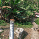
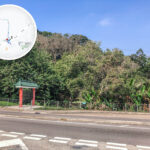
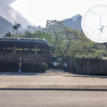
🛣️【Lam Kam Road (林錦公路)】 is a major thoroughfare in the New Territories of Hong Kong, connecting Lam Tsuen in Tai Po District with Kam Tin in Yuen Long District, spanning a total length of approximately 5.7 kilometers. Opened to traffic in 1950, this highway was initially constructed to enhance the transport network across the New Territories. Traversing between Tai To Yan and Kwun Yam Shan, Lam Kam Road passes through notable attractions such as the Kadoorie Farm and Botanic Garden and Ngong Shing Chai (Ngong Shing Chai / Wu Tong Chai). The road is notorious for its steep, lingering inclines, with gradients on certain stretches hitting 1:8 and 1:10. While it once served as the primary link between Yuen Long and Tai Po, its strategic importance has shifted following the opening of the New Territories Circular Road (Route 9); today, it primarily caters to local villages and tourist hotspots along the corridor. —
Item Details 📍 Starting Point Lam Tsuen, Tai Po District, connecting to Fanling Highway and Tolo Highway 📍 End Point Kam Tin, Yuen Long District, connecting to Kam Tin Road and Chuen Kam Road 📏 Length Approx. 5.7 km (3.5 miles) 🚧 Construction Year Works commenced in 1949 🚦 Commissioning Year Completed on 28 July 1950 (Opened to the public on 9 March 1952) 🚗 Speed Limit 50 km/h 🛤️ Lane Type Single two-lane undivided road —
🚌 Public Transport
- KMB Route 64K: The only franchised bus service traversing the entire length of Lam Kam Road.
- KMB Route T74: Extended to Wu Tong Chai in 2025, providing direct express service to urban Kowloon.
- Green Minibus Routes 21K, 25K, etc.: Serving local commutes between Lam Tsuen and Tai Po Market.
—
🕰️ Historical Evolution and Milestones
- 1949: Construction initiated by the British Forces in Hong Kong as a strategic element of the military logistics network.
- 1950: Road completed; initial access was restricted to military and emergency vehicles, requiring special permits for civilian motorists.
- 1952: Formally opened for unrestricted public use.
- 1953: KMB rolled out Route 64K, making it the sole bus route running the full length of Lam Kam Road.
- 1978: The westernmost stretch was truncated, with the original segment absorbed into Kam Tin Road.
- 1994: The section between Hong Lok Yuen and Kadoorie Farm was widened to 7.3 meters, with a dedicated climbing lane introduced.
- 2025: Certain vehicle length restrictions were lifted, permitting buses exceeding 11 meters in length to operate.
—
🏞️ Attractions and Cultural Landmarks Along the Corridor
Location Highlights Kadoorie Farm and Botanic Garden An ecological education and nature conservation center; the highway cuts past its main entrance, making it a major local landmark. Ngong Shing Chai (Wu Tong Chai) Waterfalls A highly popular hotspot for hiking and photography, renowned for its breathtaking scenery. Ling Wan Monastery A traditional Buddhist temple and a serene sanctuary for quiet contemplation. Lam Tsuen Wishing Trees A legendary Chinese New Year pilgrimage site for making wishes, drawing vast crowds of visitors. From Tai To Yan to Kwun Yam Shan Features two remarkably punishing stretches of road with steep gradients of 1:8 to 1:10, locally dubbed “long-life slopes.” —
🚧 Widening and Alignment Infrastructure Upgrades
- 1994: The stretch between Hong Lok Yuen and Kadoorie Farm was widened to 7.3 meters alongside the rollout of a slow-vehicle climbing lane.
- 2022–2025: Vehicle length restrictions of 11 meters were progressively revoked across specified sections.
- From 2025 onwards: Bus length caps on chosen road segments were relaxed to accommodate 12-meter double-deckers.
- 2025: A new bus terminus infrastructure was set up at the Wu Tong Chai section to support the extension of KMB Route T74.
—
🚦 Vehicle Restrictions and Traffic Volume
- Vehicle length is generally capped at 11 meters (though repealed on designated stretches).
- KMB Route 64K historically could not utilize full-sized double-decker buses, leading to chronic ridership saturation during peak periods.
- Section between Lam Kam Road Interchange and Kadoorie Farm: Approx. 21,060 vehicles per day.
- Section between Kadoorie Farm and Kam Tin Road: Approx. 20,420 vehicles per day.
—
🧭 Key Intersections
Intersecting Roads Role & Function Tai Wo Service Road West Servicing the local Tai Wo community Tolo Highway Heading towards Sha Tin and Tai Po Tai Po Road – Tai Wo Section Heading towards Tai Po Market and Fanling —