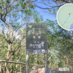
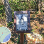
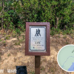
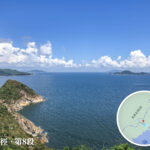
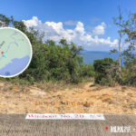
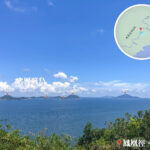
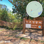
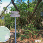
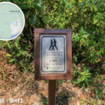
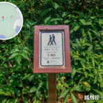
🚶♂️ 【Lantau Trail – Section 8 (鳳凰徑第8段)】 is a gentle, relaxing route nestled in southern Lantau Island, beautifully weaving together natural coastal scenery and deep historical heritage. Spanning roughly 5 to 6.5 kilometers, the trail sets off from Kau Ling Chung and follows the smooth, flat Tai Long Wan Catchwater road all the way to its finish at Shek Pik Reservoir. Renowned for being exceptionally easy underfoot, this section rewards hikers with wide-open, endless ocean horizons looking out over distant offshore islands like Tai A Chau and Siu A Chau. Walking along this path offers a perfect blend of coastal tranquility and majestic distant views of Lantau Peak, making it an incredibly refreshing and peaceful stroll.
📌 Quick Facts
Item Details 🚩 Route Kau Ling Chung ➝ Shek Pik Reservoir 📏 Distance Approx. 5–6.5 km ⏱️ Duration Approx. 1.5 – 2.5 hours 🧗 Difficulty Moderate (The path is flat and easy, though slightly winding) 📍 Distance Posts L087 to L099 🚌 Transport From Shek Pik, you can easily catch buses to Mui Wo, Ngong Ping, Tai O, or Tung Chung 💡 Supplies Absolutely zero supply points along the way; packing your own food and water is essential 🏕️ Camping The starting point at Kau Ling Chung features a basic, rustic campsite — Beyond its raw natural beauty, Section 8 is steeped in historical significance. Situated a short walk from the trail near Kau Ling Chung is the South Lantau Boundary Stone. Erected in 1902, this monument stands as a historic witness to the Qing Dynasty leasing the New Territories to Great Britain. The final destination, Shek Pik Reservoir, is a vital part of Hong Kong’s water supply infrastructure, sitting quietly as a peaceful lake beautifully framed by rolling mountain ridges. This section isn’t just a leisure walk for weekend hikers—it’s a beautiful cultural journey where nature and history collide. —
🌿 Landscapes & Geography
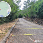
- Catchwater Path: The vast majority of the route hugs the Tai Long Wan Catchwater road, offering a wide, paved, and flat surface that is absolutely perfect for a leisurely stroll.
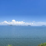
- Ocean Horizons: Serves up sweeping, unobstructed marine views looking straight out at Tai A Chau, Siu A Chau, and the cluster of the Soko Islands.
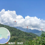
- Lantau Peak: The trail treats hikers to stunning distant views of Hong Kong’s second-highest summit, adding a touch of mountain majesty to the coastal walk.
- South Lantau Boundary Stone: Tucked away near Kau Ling Chung, this historic stone was erected in 1902 to mark the lease boundary between the Qing Government and Great Britain, pairing historically with the North Lantau Boundary Stone in Tai O.
- Shek Pik Reservoir: A crucial fresh water source for Hong Kong, offering a serene lake setting at the official end of the section.
—
📍 Start & End Points
- Kau Ling Chung
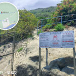
- Nestled along the wild southwestern coast of Lantau Island, featuring a secluded sandy beach and a quiet campsite.
- Key Feature: Home to the South Lantau Boundary Stone (1902), a historical monument demarcating the colonial boundary lines of the New Territories lease.
- The campsite is equipped with basic, functional amenities, making it a well-loved overnight spot for wilderness hikers.
- Shek Pik Reservoir
- Hong Kong’s fourth-largest reservoir, officially completed in 1963.
- Primary Function: Supplies vital fresh drinking water across Lantau Island and all the way to Hong Kong Island.
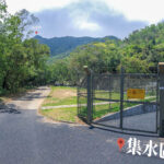
- The open, sweeping scenery surrounding the reservoir is incredibly peaceful, with mountain shadows reflecting beautifully on the calm water surface.
—
🏕️ Facilities & Leisure
- Kau Ling Chung Campsite: Features designated camping spots and dry pit toilets, ideal for overnight backpackers.
- Water Sources: Local mountain streams provide seasonal water only; carrying your own treated drinking water is non-negotiable.
- Transport: Upon reaching Shek Pik, you can readily hop on several New Lantao Bus routes:
- Route 1: Tai O ↔ Mui Wo
- Route 2: Ngong Ping ↔ Mui Wo
- Route 11: Tai O ↔ Tung Chung
- Route 23: Ngong Ping ↔ Tung Chung
- Paved Catchwater Path
- The trail runs extensively alongside the Tai Long Wan water catchwater channel, remaining flat, predictable, and very easy on the joints.
- Running parallel to the lush mountain slopes, it offers wide, unhindered vantage points for an effortless walk.
- Coastal Panoramas
- Look out over the ocean to easily spot distant outposts like Tai A Chau, Siu A Chau, and the entire Soko Islands archipelago.
- The endless blue sky merges seamlessly with the sea, putting South Lantau’s beautiful coastline on full display.
- Mountain Vistas
- Glance toward the north to take in magnificent views of Lantau Peak, Hong Kong’s second-highest summit.
- The beautiful intersection of rugged peaks and open ocean makes for incredibly dramatic landscapes.
—
📊 Quick Comparison (Section 7 vs Section 8 vs Section 9)
Section Route Distance Difficulty Key Features Section 7 Tai Long Wan → Kau Ling Chung Approx. 6.5 km Moderate Sandy beach views, traditional rustic coastal villages Section 8 Kau Ling Chung → Shek Pik Reservoir Approx. 5–6.5 km Moderate Flat catchwater paths, South Lantau Boundary Stone, offshore island seascapes Section 9 Shek Pik Reservoir → Ngong Ping Approx. 6 km Moderate to Hard Sustained uphill climbs, finishing near Ngong Ping and the Tian Tan Buddha