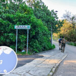
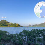
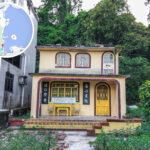
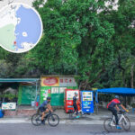
🛣 【Luk Keng Road (鹿頸路)】 is a rural road in the northeastern part of the New Territories. Spanning around 3 km, it connects Sha Tau Kok Road and Luk Keng Village. Winding along the coastline of the Starling Inlet, this is one of the few areas in Hong Kong that still beautifully preserves its untouched, rustic countryside charm. This two-lane road was originally built in the 1950s. Because of the Frontier Closed Area policy, public access was strictly limited for decades, and it only gradually gained popularity after parts of the border zone were opened up in 2012.
📌 Quick Info
Item Details 🛣 Road Name Luk Keng Road 📍 Location Sha Tau Kok, North District, New Territories 🚦 Starting Point Sha Tau Kok Road 🛣️ Ending Point Bride’s Pool Road / Access road to Luk Keng Wong Uk Village ↔️ Traffic Direction North of Nam Chung Children’s Playground: Two-way (North-South); East of it: Two-way (East-West) 🏘️ Along the Way Yim Tso Ha Village, Bok Tau Ha Village, Nam Chung Children’s Playground, Nam Chung Public Toilet, Luk Keng Public Toilet 🚐 Minibus Terminus Luk Keng Minibus Terminus (Green Minibus 56K) 🚫 Vehicle Restrictions Red minibuses and vehicles over 5.5 tonnes are banned 🕰️ Historical Background There was originally no proper road to Luk Keng Village. A road connecting to Sha Tau Kok Road was built in 1960, and the government launched improvement works on the sections in 1978. 🌊 Geographic Features Sits right next to the southwestern shore of Starling Inlet, featuring natural landscapes like mangroves, wetlands, and rocky beaches. — 【Luk Keng Road】 is deeply steeped in historical and ecological value. Along the route, Fung Hang Village preserves traditional Hakka row houses and a stunning “Mirror of the Sky” mudflat view, while Kuk Po Village features the ruins of the century-old Kai Choi School and golden reed fields, offering a glimpse into traditional village life. On the east side of the road, the mangroves of Starling Inlet serve as a bustling habitat for mudskippers and fiddler crabs. Its egretary is also one of the largest egret breeding sites in Hong Kong; every summer, hundreds of Little Egrets and Night Herons nest here, making its ecological value through the roof. On the west side, the foothills look out onto the modern skyline of Shenzhen’s Yantian Port, creating a “borderline painting” unique to the northeastern New Territories. Since the road is a dead-end for vehicles, visitors have to head back at Luk Keng Village, or go on foot via So Lo Pun all the way to Lai Chi Wo. —
🧭 Historical Evolution
- 1960: Luk Keng Village gets its first proper road connection to Sha Tau Kok Road.
- 1978: The government builds a causeway along the southwestern shore of Starling Inlet to widen and improve the narrow sections of Luk Keng Road.
- The area in front of Luk Keng Village used to be salted fields, which were later turned into fish ponds. The villagers originally branched off from Tsuen Wan.
— For transport, green minibus 56K is the only line running between Fanling Station and Luk Keng, running every 20 to 30 minutes. Expect long queues on weekends and holidays when the crowds filter in. Drivers should take note that some sections are narrower than 5 metres, making it quite a squeeze to pass oncoming cars. Also, the intersection with Bride’s Pool Road further up has seen several serious traffic accidents over the years, so drive carefully. With the boom in eco-tourism lately, the mangroves and reed fields along Luk Keng Road have become major hotspots for photography. During autumn and winter, the golden waves of reeds catching the sunset are an absolute dream. This road perfectly captures the quiet, peaceful charm of Hong Kong’s border villages, drawing hikers, photographers, and nature lovers alike to explore. —
🚐 Transport
Mode Details Minibus Take Green Minibus 56K from Exit C of Fanling MTR Station straight to the Luk Keng terminus. Things to Note Luk Keng Road is narrow and gets packed on holidays, so head out early. Respect the mangrove conservation—pack walk-in, pack walk-out! —
🥾 Hiking Route
Luk Keng ➔ Fung Hang ➔ Kuk Po ➔ Return via the same route. The entire trail is around 7 km and is 90% flat, making it perfect for families and hiking beginners.
Item Details Distance Approx. 7 km Duration Around 2–3 hours round trip Difficulty ⭐️☆☆☆☆ (Beginner) Terrain 90% flat trail, with a few steps Pit Stops BB Happy Café, Fat Kee Store, Ying Ka Café, Chung Kee Store —
📸 Top Photo Spots
- Fung Hang Pier: Where the sea meets the sky—stunning at sunset.
- Kuk Po Reed Fields: Sparkling with golden vibes in autumn and winter.
- Shui Tsam Tsui Sandbar: A tidal tombolo accessible only during low tide.
- Mangrove Walkway: Pure nature and total tranquility.
—
🧭 Quick Tips
- Wear non-slip shoes and bring plenty of drinking water.
- Keep an eye on the tide times so you don’t get trapped on the sandbar.
- Respect the villagers and their cultural heritage; do not trespass into private properties.
- Stay safe when snapping photos, as some spots do not have guardrails.
—
🏘 Luk Keng Village Cluster
Chinese Name English Name Remarks 鹿頸村 Luk Keng Village Includes Wong Uk, Chan Uk, and Sheung Wai 雞谷樹下村 Kai Kuk Shue Ha A Chu clan village with over 200 years of history 河瀝背村 Ho Lik Pai Village A branch family of Kai Kuk Shue Ha 鹹坑尾村 Ham Hang Mei Village Also known as Nam Hang Mei; a Lam clan village 鹽灶下村 Yim Tso Ha Village – 膊頭下村 Bok Tau Ha Village – —
🏘 Hakka Cultural Villages
Fung Hang Village
- With over 300 years of history, it was originally named “Fung Hang” (Windy Valley).
- Features the Cheung Ancestral Hall, historic老屋 houses, and an ancient well.
- The Fung Hang Pier is a major hotspot for photos.
Kuk Po Village
- With a history of over 370 years, the village is traditionally divided into five “tuk” (valleys).
- Kai Choi School: Built in 1931, it is a Grade 3 Historic Building.
- Hip Tin Temple: Dedicated to Lord Kwan (Guan Di).
—
🌿 Ecology & Landscapes
Mangrove Forests
Luk Keng features a mangrove wetland rare in Hong Kong, pulling in various bird and marine species. Holding immense ecological value, it acts as a natural breakwater that helps with wave defense and water filtering.
Rocky & Muddy Shores
Lined with distinct rock joints along the coast, it opens up a path to the tidal tombolo “Shui Tsam Tsui Sandbar” when the tide goes out.
Wildlife
Frequently spotted wildlife includes Egrets, cattle, and mudskippers.
Reed Fields
Glows completely golden during autumn and winter, making it a dream spot for Instagram photos.
—