🏔️【Nui Po Shan (女婆山)】 is a mountain peak located in the eastern part of Sha Tin District, New Territories, Hong Kong. Rising to an elevation of 399 meters, it lies within the boundaries of Ma On Shan Country Park. This mountain is highly renowned for its unique natural landscapes and granite rock formations. Among its most famous attractions are the “Nui Po Rock” and the “Penis Rock” (Yangyuan Rock)—strikingly shaped, massive boulders that attract numerous hikers and photography enthusiasts. While one local legend suggests the mountain was named after an old lady who went missing here, another widely accepted origin traces its name back to the area’s frequent thunderstorms, which historically earned it the title “Lui Po Shan” (Thunder Lady Mountain). —
📌 Basic Information
Item Details 🏞️ Mountain Name Nui Po Shan (女婆山) 🗺️ Location Eastern Sha Tin District, New Territories, Hong Kong; south of Tai Shui Hang and east of Shek Mun ⛰️ Elevation Approx. 399 meters (1,309 feet) 🧭 Coordinates 22°23′37.7″N 114°13′48.68″E 🏔️ Mountain Range Ma On Shan Range 🪨 Name Origin Named “Lui Po Shan” (Thunder Lady Mountain) by locals because thunderstorms in the Sha Tin area often seemed to gather around this peak; later corrupted to “Nui Po Shan” 🏗️ Historical Use Site of a major granite quarry (operational from the mid-1960s until production ceased in 1995) 🏞️ Current Status Houses a refuse transfer station and a columbarium; government studies are underway to relocate the Sha Tin Sewage Treatment Works into caverns within the mountain 🚶♂️ Hiking Access Can be ascended from Chevalier Garden, Shek Mun, Breakthrough Youth Village, or Wong Nai Tau 🪨 Key Attractions Penis Rock and an array of uniquely weathered granite boulders along the ridges 🧗♀️ Difficulty Intermediate; features steep ascents, loose gravel, and rugged paths that require good fitness and proper footwear 🚌 Transport Accessible via buses and green minibuses to Chevalier Garden or Wong Nai Tau, both close to the trailheads — The surroundings of Nui Po Shan are rich in natural ecology, history, and culture. Nestled at its foothills is Mui Tsz Lim, a 400-year-old Hakka village that still preserves its traditional architecture and rustic farming heritage. With the growing popularity of outdoor activities, Nui Po Shan has become a favorite getaway for Sha Tin residents and hikers alike, offering a peaceful escape from the urban hustle alongside its iconic, weathered stone structures. —
🧭 Geography & Historical Background
- Name Origins: Apart from the legendary thunder connection, its English alias “Turret Hill” refers to a little tower, likely inspired by the prominent rock outcrops dotting its ridges.
- The Quarry Era:
- The southwestern face of the mountain was home to a busy granite quarry that started operations in the mid-1960s and stopped production in 1984.
- The site has since been repurposed for the Sha Tin Refuse Transfer Station and a columbarium, though the dramatic quarry scars remain clearly visible.
- Future Development: A major government project plans to relocate the nearby Sha Tin Sewage Treatment Works into cavern spaces inside Nui Po Shan, releasing about 28 hectares of prime coastal land for residential use.
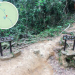
— Nui Po Shan offers a handful of distinct trails, with most hikers setting off from Shek Mun or Mui Tsz Lim. The paths wind through dense woodlands and past seasonal streams before tackling steep, rocky ridges that occasionally demand light scrambling. The open summit serves up expansive, panoramic views across the Sha Tin cityscape, Shing Mun River, and the Ma On Shan range. On crisp, clear days, you can easily spot Lion Rock and Fei Ngo Shan in the distance. Because some paths are overgrown and granite rocks can get slick, it is best to tackle this mountain with a hiking buddy and full gear. —
🥾 Recommended Hiking Routes
🔹 Route 1: Chevalier Garden ➝ Nui Po Shan ➝ Wong Nai Tau
- Total Length: Approx. 4.5 km
- Time Required: Approx. 2.5 hours
- Route Highlights:
- Starts off A Kung Kok Street, entering the trail via Mui Tsz Lim Road.
- A steep, continuous climb leads you straight into the boulder fields before hitting the summit, where you can explore the south slope rock formations and the famous Penis Rock.
- The descent takes you down through Nui Po Au and the Fa Sam Hang pavilion, finishing up at the Wong Nai Tau bus terminus.
🔹 Route 2: Shek Mun Station ➝ Nui Po Shan West Ridge ➝ Shek Ku Lung Shan ➝ Wong Nai Tau
- Total Length: Approx. 4 km
- Time Required: Approx. 3.5 hours
- Route Highlights:
- Starts at Shek Mun Station (Exit C), heading past On Kwan Street and Wah Shuen Square to hit the trailhead.
- This route is an absolute paradise for rock hunters, taking you past the Heart Rock, Three Brothers Rock, Fish Basket Rock, and the Mui Diamond Rock.
- The trail is well-trodden but noticeably steep—perfect if you are looking for a solid cardio workout.
—
🚍 Transport Information
Start / End Point Transport Routes & Methods 襲 Chevalier Garden 🚌 Buses: 289K, 84M, 43X, 81C, 85K, 89C
🚐 Minibus: 805S🚉 Shek Mun Station 局 MTR Tuen Ma Line: Shek Mun Station (Exit C), followed by a 15-minute walk to the trailhead 🪨 Wong Nai Tau 🚌 Buses: 83K, 83S, 83X, 86
🚐 Minibuses: 65A, 65K, 65S—
🪨 Guide to the Famous Boulders
Rock Name Features & Location 🌄 Penis Rock (陽元石) A 3 to 4-meter-tall pillar that bears an uncanny resemblance to male anatomy. Tucked just below the main boulder field on the southern slope, it is also playfully dubbed the “Crude Rock.” ❤️ Heart Rock (心形石) A distinct, heart-shaped rock sitting cleanly on a concrete base right along the main western path. 👨👩👦 Three Brothers Rock (三兄弟石) Also known as the Husband and Wife Rock. It is a cluster of three massive boulders tightly wedged together, though some angles make it look like a mythical Chimera. 🐟 Fish Basket Rock (魚簍石) A large, textured boulder shaped like a traditional woven bamboo basket. It features fixed ropes to help hikers scramble onto its flat top. 🧈 Tofu Rock (豆腐石) A remarkably blocky, smooth-faced stone that looks just like a giant cube of tofu, sitting right next to the Mui Diamond. 🐭 Mouse Rock (老鼠石) A whimsical rock with added graffiti that perfectly highlights its mouse-like profile, found right beside the Tofu Rock. 💎 Mui Diamond (梅鑽石) A beautifully geometric, diamond-shaped rock that greets hikers along the descent toward Wong Nai Tau. —
🌄 The Summit Experience
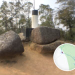
- The summit features a standard black-and-white trigonometrical station marking the official 399-meter peak.
- It opens up to brilliant vistas of Shek Nga Shan, Ma On Shan, and Tate’s Cairn (Tai Lo Shan).
- The southern slope geomorphology is incredibly striking, with layers of blocky granite stacked up like natural Jenga blocks.
- Catching the ridge on a misty morning adds an atmospheric, ethereal vibe that photographers absolutely adore.
—
🌿 Safety & Eco Tips
- Expect loose dirt and steep, gravel-filled slopes—proper hiking shoes with solid grip, a pair of gloves, and trekking poles are highly recommended.
- You will encounter fixed auxiliary ropes along the steeper crags; always test them first and never rely solely on them for your weight.
- There are no shops or water sources anywhere on the mountain, so pack plenty of water and trail snacks.
- The network of paths can get confusing with numerous ribbons; always keep an eye on a reliable offline GPS map.
- The rock formations can be tricky to navigate; prioritize safety over getting the perfect camera angle.
- Pack out what you pack in—leave no trace to keep these hillside trails clean.
—