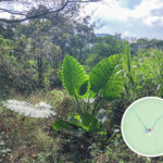
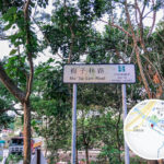
🛣️【Mui Tsz Lam Road (梅子林路)】 is a rural road rich in both history and natural charm, located in the Sha Tin District of the New Territories, Hong Kong. Nestled along the western foothills of Ma On Shan Country Park, this 1.5-kilometer path connects Tai Shui Hang Village with Mui Tsz Lam, a traditional Hakka village with over 400 years of history. Originally an ancient trail, the route retains its traditional stone-paved foundations and feng shui woodlands. Along the way, hikers can spot trickling mountain streams and remnants of old terraced fields. Following recent revitalization efforts that introduced mock-stone footpaths, it has transformed into an excellent leisure hiking trail that seamlessly blends cultural heritage with local ecology. —
📌 Key Information
Category Details 🏞️ Geographic Location Situated in the northeastern part of Sha Tin District, New Territories, between Ma On Shan and A Kung Kok; considered part of the Ma On Shan New Town perimeter 🏘️ Village History Tai Shui Hang Village boasts around 300 years of history. It was settled by ancestors of the Cheung clan who migrated from Wuhua County in Guangdong, and has now been passed down through 13 generations 🌊 Toponymy Origin Named “Tai Shui Hang” (literally “Big Water Creek”) due to the rapid, heavy torrents of the two mountain streams running alongside the village: Ma Dai Stream and Mui Tsz Lam – Tai Shui Hang Stream 🗺️ Terrain Profile A continuous gentle uphill climb; the road surface is narrow but well-paved, flanked mostly by woodlands and valleys with exceptionally fresh air 🏡 Mui Tsz Lam Village A historic Hakka village sitting at the dead end of Mui Tsz Lam Road, where early villagers relied on farming, pig-rearing, and seafaring for their livelihoods 🚶♂️ Route Character The mountain road is built alongside the stream valley leading straight to Mui Tsz Lam Village. Enveloped in lush greenery, it is highly popular among hikers and cycling enthusiasts, and serves as an access path into Ma On Shan Country Park 🚉 Closest MTR Station Tai Shui Hang Station (Tuen Ma Line), requiring a 25–30 minute walk to reach Mui Tsz Lam Road itself 🛣️ Principal Roads Ma On Shan Road, A Kung Kok Street, Hang Shin Street, Mui Tsz Lam Road 🌿 Natural Setting Nestled comfortably between Shek Nga Shan, Nui Po Shan, and Luk Chau Shan. The local streams feed directly into the Shing Mun River before emptying into Sha Tin Hoi (Tolo Harbour) 🚢 Maritime History In the early days, villagers owned wooden vessels to commute to the market at Tai Po Market. Each boat could carry 20–30 passengers, serving a purpose much like modern-day family cars Bus Routes Accessible via MTR followed by a walk from Tai Shui Hang Station; various bus and minibus routes also service the broader Ma On Shan area 🥾 Interconnecting Trails Mui Fa Ancient Trail, Mau Ping Ancient Trail, and Luk Chau Shan Trail, linking onwards to Siu Lek Yuen and Fa Sam Hang — The core value of this road lies in its preservation of endangered Hakka culture. As one of the oldest settlements in the Sha Tin District, Mui Tsz Lam Village still retains its original green-brick houses, ancestral shrines, and Earth God (Tu Di Gong) shrines. Through local rural revitalization initiatives, villagers have begun restoring abandoned terraced fields to cultivate traditional crops like wampee and longan, alongside hosting community workshops to pass down the craft of making Hakka herbal tea cakes (Cha Kwo). Illustrated information boards stand along the roadside, detailing the village’s history with wartime guerrilla forces and their migration lineage, turning the path into an open-air cultural museum. —
🏡 History of Mui Tsz Lam Village
- Village Origins: Mui Tsz Lam Village was established roughly 400 years ago by the Hakka Ng (Man) clan and represents one of the historical “Nine Alliances” (Nine Yeuks) of Sha Tin.
- Demographic Shift: While the village once bustled with two to three hundred residents, today only a dozen or so inhabitants remain, though the traditional Indigenous Inhabitant Representative system is actively maintained.
- Cultural Value: The site preserves a wealth of traditional Hakka architecture and historical trail relics, making it an invaluable resource for studying the village history of the New Territories.
—
🏘️ Local Settlement Culture
- Tai Shui Hang Village: Formed nearly three centuries ago by the Cheung clan migrating south from Guangdong. Its name originates from its low-lying topography and the fast-flowing mountain streams nearby.
- Mui Tsz Lam Village: Situated at the upper stretch of Mui Tsz Lam Road, it elegantly retains its heritage buildings and old rural lifestyle layout.
- While early ancestors relied entirely on natural stream water and maritime transport to survive, the area has gracefully evolved into a popular hotspot for eco-tourism and weekend excursions.
—
🥾 Hiking and Eco-Exploration
- Popular Trail Route: Setting out from Tai Shui Hang, tracking up Mui Tsz Lam Road through Mau Ping, and heading up to Ngong Ping makes for a fantastic intermediate遠足 (hiking) route.
- Scenic Backdrops: The trail treats walkers to sweeping mountain vistas of Shek Nga Shan, Luk Chau Shan, and Nui Po Shan, which burst alive with wild blossoms during spring and summer.
- Ancient Trail Crossroads: Mui Tsz Lam historical village served as the old junction connecting the Sai Sha Ancient Trail and the Mau Ping Ancient Trail, making it an exceptional playground for hikers who love exploring historical footpaths.
— In terms of accessibility, a gentle 15-minute walk from MTR Tai Shui Hang Station brings you directly to the start of the road. The initial stretch is flat, paved, and well-equipped with rest areas, making it ideal for family day trips. Mui Tsz Lam Road is more than just a buffer zone between urban high-rises and countryside; it showcases Hong Kong’s efforts in rural preservation and ecological harmony. In recent years, resident artists have decorated the village with vibrant murals, injecting a refreshing creative energy and turning it into an essential link along the cultural green corridor of eastern Sha Tin. —
🚉 Public Transport Directions
Mode of Transport Route Details MTR Take the Tuen Ma Line to “Tai Shui Hang Station” and walk for about 25–30 minutes to reach the trailhead. Bus Take any bus bound for Ma On Shan, alight near Chevalier Garden, and proceed on foot or transfer to a local minibus. —
🏞️ Trail Route: Tai Shui Hang → Mui Tsz Lam → Mau Ping → Pak Kong
🧭 Itinerary Overview
Item Details 📍 Starting Point MTR Tai Shui Hang Station Exit B → Chevalier Garden 🧭 End Point Pak Kong, Sai Kung (where you can catch bus 92 back to urban areas) 🥾 Total Distance Approx. 6.3 kilometers ⏱️ Time Needed Approx. 2 hours and 50 minutes ⛰️ Highest Elevation Approx. 300 meters (at the MacLehose Trail junction) 🔥 Difficulty Rating ★★★☆☆ (Moderate) 🌿 Canopy Shade High canopy cover, making it comfortable even during hot summer days 🚫 Supply Points No stores or kiosks along the mountain path; please bring your own food and water supply 🗺️ Section-by-Section Breakdown
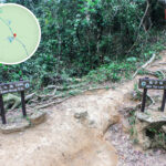
① Tai Shui Hang → Chevalier Garden → Mui Tsz Lam Village
- Depart from the MTR station, walk past Chevalier Garden, and enter Mui Tsz Lam Road.
- The initial concrete vehicle road slowly transitions into a peaceful, shaded woodland footpath.
- Arrive at Mui Tsz Lam Village, a historical Hakka settlement spanning over 400 years.
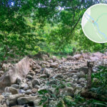
② Mui Tsz Lam → Nui Po Au → Mau Ping Ancient Trail
- Cross into the borders of Ma On Shan Country Park, where the path shifts to historic stone slab steps.
- Along the way, you will pass the Lau Clan Ancestral Hall, traditional Earth God shrines, and the abandoned Mau Ping old stone houses.
- Keep an eye out for mossy surfaces which can be very slippery; this section should be avoided on rainy days.
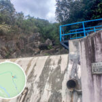
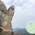
③ Mau Ping → Pak Kong
- Descend from the high ridge of Mau Ping, where you can enjoy sweeping coastal views overlooking Hebe Haven (Pak Sha Wan).
- Follow the catchwater trail down toward the vicinity of the Pak Kong Water Treatment Works.
- Board bus route 92 at the main road to head back to the city.
📸 Highlight Photography Spots
Location Visual Features & Description Mui Tsz Lam Village Traditional Hakka architecture, ancient ancestral halls, and rustic stone paths. Nui Po Au A prominent mountain pass crossroads marking the boundary of the Country Park. Mau Ping Bamboo Forest A serene, dense bamboo grove featuring ruined stone houses and the famous giant “King of Vines” (藤皇) spot. Hebe Haven Overlook An open clearing offering gorgeous, elevated vistas across the yacht-filled bay. ✅ Essential Hiking Tips
- Wear high-grip hiking shoes with good traction to prevent slips on stone steps.
- Do not attempt this hike during wet weather, as the historic stone slab trails become extremely slick when wet.
- Bring plenty of water and quick energy snacks, as there are no shops or vendors anywhere along the trail.
- It is highly recommended to download offline maps or track your journey using a GPX routing app before heading out.
- Stay alert for local wildlife such as snakes or insects; wearing long trousers instead of shorts is highly advisable.
—
📸 Quick Tips and Recommendations
- Best Time to Visit: Early morning or late afternoon to avoid the midday sun and fully experience the peaceful woodland atmosphere.
- Gear Checklist: Sturdy footwear with solid tread and plenty of personal hydration packs.
- Top Photo Spots: The entrance of Mui Tsz Lam Village, the high mountain ridges, and the moss-covered ancient trail thresholds all offer fantastic backdrops.
—