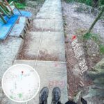
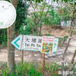
🏔️【Yuk Sau Fung (玉秀峰)】 is a peak standing at about 288 meters above sea level in the Tai Po District of the New Territories, Hong Kong. Forming part of Wilson Trail Section 8, it connects directly to Cloudy Hill. Its name comes from the trigonometrical station at the peak—an iconic landmark on the trail. The surrounding vegetation consists mostly of low shrubs and grassy slopes, leaving several sections completely exposed with zero shade. Mainly composed of granite, the mountain feature a gentle slope on the eastern side and a much steeper drop to the west. The western flank connects to the main summit of Cloudy Hill (440 meters above sea level) via a continuous, brutal flight of stone steps known as the “Sky Ladder.” With over a thousand steps to crush, this section is a major fitness test for local hikers looking to push their limits. —
📌 General Information
Item Details 🏞️ Location Tai Po District, New Territories, Hong Kong 📏 Elevation Approx. 288 m 🧭 Trail Section Wilson Trail Section 8 🚶♂️ Difficulty Beginner to Intermediate, perfect for casual hikers 🛤️ Trail Conditions A mix of paved roads and dirt/gravel paths; pavilions available along the way, but very little shade 👀 Scenic Views Overlooking Tai Po town center, Tolo Harbour, Ma On Shan, and all the way to Shenzhen 🚉 Getting There Tai Wo Station Exit A, then catch feeder buses like 64K, 73B, or minibuses like 21K, 25A 🏘️ Getting Away Fu Heng Estate, where you can hop on buses like 71K or 73B back to town 🕒 Time Needed Around 1–2 hours (short route) or 4 hours (full long route) 🧃 Amenities & Supplies Restrooms and supply spots are available at Tai Wo Plaza and Fu Heng Shopping Centre; zero shops on the actual trail ⚠️ Safety Tips It gets scorching hot in the summer, so slap on sun protection and bring plenty of water; some dirt paths are rough with serious soil erosion 🧭 Extended Routes You can level up your hike by continuing on to Cloudy Hill (440 m) or heading towards Lau Shui Heung Reservoir — The hiking routes up Yuk Sau Fung are pretty flexible, but the most popular option starts right from Tai Wo Station and heads up via Tai Po Tau Drive. The whole trek is about 4.1 km long and takes around 2 to 3 hours, making it a comfortable beginner-to-intermediate trail. The path is a mix of paved roads and dirt tracks. Once you reach the top, the panoramic views open up completely, giving you a top-down look at Tai Po town center, Tolo Harbour, Ma On Shan, and the sweeping ridges of Pat Sin Leng. If you visit during autumn, the silvergrass fields around the peak burst into full bloom, making the sunset views incredibly stunning. Plus, tucked away along the ridgeline is a homemade DIY swing built by locals, which has become a major hotspot for photos—just make sure you watch your step! —
🧭 Hike Breakdown
Item Details 🗺️ Route Tai Wo Station (Start from Exit A) ➝ Tai Po Tau Drive ➝ Yuk Sau Fung ➝ Fu Heng Estate ⛰️ Elevation Approx. 288 m 🚶♂️ Distance Approx. 4.1 km 🕒 Time Needed Approx. 2–3 hours 🧭 Difficulty Beginner to Intermediate 🛣️ Trail Surface 90% Paved Road, 10% Dirt Path 🌳 Shade The middle section has practically zero shade —
🧗♀️ Difficulty & Challenges
- Difficulty: Beginner to Intermediate
- Key Feature: Parts of the trail involve the relentless “Sky Ladder” steps; grabbing a pair of hiking poles is a smart move.
- The middle stretch is completely exposed, so sun protection and hydration are absolutely vital during summer.
- Several dirt tracks are pretty uneven and rough due to heavy soil erosion.
— On the transport side of things, starting from Tai Wo Station is incredibly easy with tons of bus and minibus options available (like the 64K, 73B, or 21K), and you can easily wrap things up at Fu Heng Estate (catching the 71K or 271 bus). Just a heads-up: the middle section has zero tree cover, so slap on plenty of sunblock and load up on water if you are tackling this in the summer heat. Since some of the dirt paths are quite rugged from erosion, wearing grippy shoes and carrying hiking poles will save your knees. In recent years, there has been a bit of debate over trail safety, with some district councilors suggesting adding proper concrete steps to the steeper parts. This sparked a local conversation about conservation versus development, but for now, the trail remains in its beautifully natural, raw state. —
🚌 Transport Guide
Item Details To the Start: Tai Wo Station Buses 64K, 73B, 74C; Minibuses 21K, 25A From the Finish: Fu Heng Estate Buses 71K, 271; Minibuses 20A, 502 —
⚠️ Important Safety Tips
- Sun Protection & Hydration: There is zero shade in the middle section, making heatstroke a real danger in summer.
- Recommended Gear: Wear shoes with solid grip and bring along hiking poles.
- Network Coverage: Most of the trail has decent mobile signal, though it can get a bit weak at the very top.
- Bail-out Route: If you run out of juice, you can hang a right at Yuk Sau Fung and head straight down to Fu Heng Estate, bypassing the main peak of Cloudy Hill completely.
—
🌄 Views & Landmarks
Landmark Description Trigonometrical Station The classic check-in spot right at the peak of Yuk Sau Fung. DIY Swing A fun, homemade installation built by locals—great for photos and a quick break, but use it at your own risk. Distance Posts W100–W102 Official trail markers keeping you on track along the Wilson Trail. Vantage Points Offers epic, sweeping views over Tai Po town, Tai Mo Shan, Ma On Shan, and Tolo Harbour. —
📷 Top Photo Spots
- Yuk Sau Fung Trigonometrical Station: The ultimate “I made it to the top” summit shot.
- The DIY Swing: Perfect for matching a creative pose with the sweeping mountain backdrop.
- Tolo Harbour Sunset: Absolutely magical if you catch it during the golden hour.
- Ridgeline Selfies: Great for showing off the dramatic, rolling terrain.
—
💡 Quick Insider Tips
- Get an early start in the morning to beat the brutal afternoon heat.
- Download offline maps (like Hiking Trail HK or Maps.me) just in case you lose track of the path.
- Skip the hike if it rains; several sections can turn into a serious slip-and-slide.
- Safety first when taking photos—do not stand too close to the edge.
—
🎒 Recommended Gear
- Sturdy hiking shoes, a sun hat, and sunglasses.
- Water (at least 1.5L) and some quick energy snacks.
- Hiking poles, a small towel, and a light raincoat (just in case weather turns).
- Your phone, a power bank, and a basic first-aid kit.
—
🗺️ Extended Routes
Route Name Description Cloudy Hill Standing at 440 m, this is the ultimate extension from Yuk Sau Fung (adds about 2–3 hours). The views up here are next-level, with a sweeping ridgeline looking out over Pat Sin Leng and the Plover Cove Reservoir. Perfect for advanced hikers looking for a challenge. Lau Shui Heung Reservoir Famously known as Hong Kong’s “Mirror of the Sky”—an absolute stunner in autumn when the paperbark and cypress trees turn red. Hok Tau Reservoir An extended trek you can tack on after hitting Cloudy Hill, best suited for those with plenty of fuel left in the tank. — If you want to check out the full step-by-step itinerary, take a look at 《 Yuk Sau Fung • Daydreamer 》. —