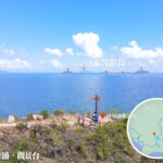
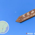
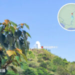
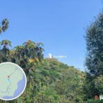
🔭 【Kau Ling Chung View Compass (狗嶺涌 觀景台)】is situated on the hill east of the Kau Ling Chung Campsite within South Lantau Country Park, offering an exceptionally wide and open vantage point. From here, you can enjoy a panoramic view of the vast Lantau Channel. On clear days, you can even look out toward the Pearl River Estuary, with the sunset views being particularly magnificent. The viewing platform is equipped with an informational signpost that indicates the names and distances of the surrounding islands, making it convenient for visitors to identify the landscape before them. — Traveling to the Kau Ling Chung View Compass is a wonderful mini-journey in itself, allowing you to experience the tranquil beauty of southwestern Lantau Island. Since it cannot be reached directly by any vehicular roads, the most common approach is to set off from Shek Pik Reservoir, walk along Wang Pui Road, and connect onto Lantau Trail Section 8, which takes about 1 to 1.5 hours on foot. Due to its remote location, there are almost no commercial facilities nearby, and mobile network signals can be very weak. Visitors planning a trip are highly advised to prepare sufficient drinking water, food, and maps, and to choose a day with stable weather conditions to peacefully enjoy this magnificent scenery far away from the hustle and bustle of the city. —
📌 Basic Information
Item Details 🏞️ Location Name Kau Ling Chung View Compass (狗嶺涌 觀景台) 📍 Location Southwestern coast of Lantau Island, Hong Kong, located at the junction of Lantau Trail Section 7 and Lantau Trail Section 8, between Fan Lau and Shek Pik; it can also be reached via the Keung Shan Country Trail 🗺️ Geographical Coordinates Approx. 22°9′ N, 113°52′ E, matching the coordinates inscribed on the South Lantau Obelisk 🏔️ Elevation The viewing platform is built on the hillside of Kau Ling Chung at an elevation of about 94 meters, featuring a direction compass dial and an old hilltop trigonometrical pillar 🪧 Historical Landmark Nearby stands the South Lantau Obelisk, erected in 1902 to mark the southernmost boundary of the New Territories leased to Great Britain by the Qing Government in 1898 🌅 Scenic Highlights Offers sweeping views of the Lantau Channel, Fan Lau, and the Soko Islands; sunset and moonrise views are spectacularly grand with completely unobstructed sightlines 🛤️ Hiking Route Can be accessed from Shek Pik Reservoir, Tai O, or the Keung Shan Country Trail, following Lantau Trail Section 7 or Lantau Trail Section 8. The paths are well-defined but sections run alongside a concrete catchwater road 🕒 Journey Time About 1.5 to 2 hours, depending on the starting point (from Shek Pik to Kau Ling Chung is approx. 5 km) 🏕️ Nearby Facilities Kau Ling Chung Campsite, picnic area. There are no supply points or intermediate exit routes; ideal for camping, hiking, and landscape photography 🚌 Transportation Take New Lantao Bus Route 11 or 23 and alight at the “Shek Pik Police Station” stop, then continue on foot; alternatively, start from Tai O and follow Lantau Trail Section 7 ⚠️ Important Notes The route is remote; you must bring your own food, water, and gear. The Kau Ling Chung segment consists of mountain trails where you need to watch your step. There are no exit routes along the way, so hiking with companions is highly recommended —
🚍 Transportation Information
Starting Point Bus Route Alighting Stop Tung Chung Route 11, Route 23 Shek Pik Police Station Mui Wo Route 1, Route 2 Shek Pik Police Station Tai O Take any bus to Tai O Town Centre, then set off on foot Tai O —
🚶♂️ Recommended Hiking Routes
🔹 Classic Route: Shek Pik Reservoir → Kau Ling Chung View Compass
- Starting Point: Shek Pik Police Station (Bus Route 11 or 23)
- Route: Lantau Trail Section 8 → Distance Post L076 → Descend down the stone steps → Kau Ling Chung Campsite → View Compass
- Time: Approx. 2 hours
- Difficulty: Moderate (some sections pass through landslide mitigation areas)
🔹 Long-Distance Expedition Route: Tai O → Fan Lau → Kau Ling Chung View Compass → Peaked Hill (Kai Yik Kok)
- Total Distance: Approx. 20 km
- Time Required: Approx. 8 hours
- Attractions: Fan Lau Lighthouse, Scented Tower (Nam Layer Lau), Fan Lau Fort, Elephant Trunk Rock, etc.
- Note: There are no early exit routes along the trail, and supply points are highly unreliable; you must bring your own food and water supply
—
🌄 Scenic Highlights
Landscape Feature Description 🔭 Panoramic Channel View Offers full views of the Lantau Channel, Soko Islands, and Fan Lau East Bay with an immensely open field of vision 🌕 Sunset & Moonrise Enjoy the glowing sunset in the evening, followed by the poetic romance of moonlight shimmering across the ocean surface at night 🪧 Special Direction Compass Dial In addition to local Hong Kong districts, the directional sign uniquely indicates the direction of Macau (approx. 32 km away), adding a fascinating touch of interest 📍 Old Hilltop Pillar Sitting at an elevation of 94 meters, this former surveying marker has now become a popular hotspot for photos 🪨 Historical Ruins Located near the South Lantau Obelisk, serving as a standing monument to colonial history 🏕️ Camping & Excursions Kau Ling Chung beach is a designated campsite, making this view compass a premier check-in spot for campers — This viewing platform is not only an excellent spot for taking in natural scenery, but its surroundings are also steeped in profound historical and cultural value. Erected near the platform is the famous “South Lantau Obelisk”. Together with the “North Lantau Obelisk” on Tai O‘s Cheung Shan, it was put up by the British Navy in 1902 to mark the southern boundary between China and British Hong Kong back then, serving as a vital monument of Hong Kong’s modern history. From a certain angle, the platform also grants hikers a stunning view of the treacherous mountain ridges of Kau Nga Ling (Dog Teeth Range). —
🪨 Historical Landmark: South Lantau Obelisk
- Erected following the 1898 convention to define the boundary line of the New Territories leased to Great Britain by the Qing Government
- The obelisk is inscribed with clear latitude and longitude markings, corresponding precisely to the North Lantau Obelisk in Tai O
- Standing roughly at a person’s height, it is located on the hillside next to the viewing platform and requires caution when accessing via the landslide mitigation zone
—
🎒 Recommended Gear
- 🥾 Non-slip hiking shoes
- 🧴 Sunscreen and mosquito repellent
- 📱 Offline maps or GPS device
- 🍱 Food and drinking water provisions
- 🔦 Headlamp or flashlight
—