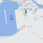
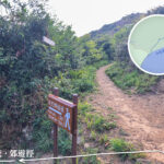
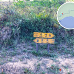
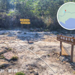
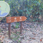
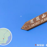
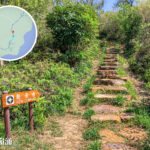
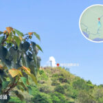
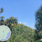
🗺️ 【Lantau Trail – Section 7 (鳳凰徑第7段)】 is the longest single stretch of the entire Lantau Trail on Lantau Island, Hong Kong. Spanning roughly 10 kilometers, it links the historic fishing town of Tai O with the remote coastal valley of Kau Ling Chung. Setting off from Nam Chung Tsuen in Tai O, the trail winds its way through Yi O and Tsin Yue Wan, finally wrapping up at Kau Ling Chung—a journey that typically takes about 3 hours to complete. The elevation profile along this entire section remains relatively flat and gentle, hugging the wild, untouched southwestern coastline of Lantau Island, allowing hikers to fully immerse themselves in peaceful coastal vistas and unique natural ecosystems. —
📌 Quick Facts
Item Details 🗺️ Trail Name Lantau Trail – Section 7 (鳳凰徑 • 第7段) 🚩 Starting Point Tai O (Nam Chung Tsuen) 🏁 Ending Point Kau Ling Chung (Note: There is no transport here; you must continue onto Lantau Trail Section 8 to Shek Pik to leave) 📏 Distance Approx. 10 km ⏱️ Duration Approx. 3 hours (Breakdown: Tai O to Yi O ~40 mins; Yi O to Fan Lau ~1 hour 20 mins; Fan Lau to Kau Ling Chung ~50 mins) 🧭 Distance Posts L055 to L076 🧗♀️ Difficulty Moderate (A long haul, but mostly flat terrain; perfect for hikers with decent stamina) 🌄 Terrain Features Coastal footpaths, mudflats, dense mangroves, ancient flagstone trails, sandy beaches, catchwaters, and quaint fishing village vistas 🏕️ Sights Along the Way Yi O Mudflats, Tsin Yue Wan, Peaked Hill (Kai Yi Kok), Fan Lau Sai Wan, and Kau Ling Chung Campsite 🌊 Natural Wonders The dramatic estuarine marine boundary line where the Pearl River meets the Pacific Ocean; thriving mangrove habitats; a pristine coastline within the habitat of the Chinese Pink Dolphin 🛍️ Supply Points Fan Lau Store (highly irregular opening hours); Yi O Store (open occasionally depending on farming activities) 🚌 Transport Info Start: New Lantao Bus Route 11 (Tung Chung to Tai O), Route 1 (Mui Wo to Tai O), or the Tuen Mun-Tai O Ferry.
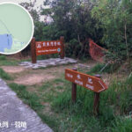
End: No public transportation available. Thru-hikers must continue along Section 8 to Shek Pik Reservoir to catch a bus.⚠️ Key Warnings Portions of Yi O were historically closed due to private land disputes but are now mostly accessible via designated footpaths; this route is deeply remote with no early bailout options. 🗺️ Navigation The trail is well-marked with official Lantau Trail distance posts and directional signs; carrying a physical topographic map or a reliable offline GPS app is highly recommended. — The scenery along this stretch is incredibly rich and ever-changing. Hikers start by walking past the vast, sweeping mudflats of Yi O and its newly revitalized eco-farming village. From there, the path unfurls past rocky shores, dense mangrove forests, and the offshore islet of Peaked Hill (locally known as “Kai Yi Kok” or Chicken Wing Angle due to its unique shape). The absolute showstopper, however, awaits near Fan Lau. On a clear day, you can witness the incredible natural phenomenon of the muddy fresh waters from the Pearl River crashing into the clear, salty blue water of the Pacific Ocean, creating a striking split-colored sea. Additionally, Tsin Yue Wan offers Hong Kong’s westernmost campsite, while Fan Lau Sai Wan provides a quiet beach retreat steps away from historical treasures like the Fan Lau Fort and Fan Lau Lighthouse. —
📍 Detailed Route & Sightseeing
1️⃣ Setting off from Tai O (L055)
- Depart from the Tai O Bus Terminus and follow the seaside embankment path toward Nam Chung Tsuen.
- Pass the Nam Chung public toilets to officially step onto Lantau Trail Section 7.
- Follow the coastal path; the initial stretch is a smooth, paved concrete path offering wide-open marine views.
2️⃣ Nga Ying Kok Campsite
- Continue along the concrete coastal track, passing the peaceful Nga Ying Kok Campsite.
- Soak in the serene ambiance while looking out over the shoreline and nearby mangrove patches.
3️⃣ Yi O Village (L060–L063)
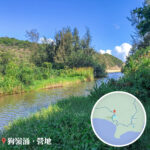
- Enter the historic valley of Yi O. Once blocked due to land rights issues, it has been beautifully transformed into a revived agricultural village.
- The area is steeped in history, featuring ancient flagstone paths, a small sea deity shrine, and old village structures.
- If local farm diversions are in place, simply follow the clearly marked bypass paths.
- The vast mudflats open up incredible horizons 🌅, adding an air of mystery to this hidden valley.
4️⃣ Tsin Yue Wan Campsite (L066)
- This holds the title of Hong Kong’s westernmost official campsite, equipped with dry pit toilets and seasonal stream water sources.
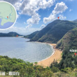
- Look out over the rocky shore to spot Peaked Hill island, a legendary local photography hotspot shaped curiously like a chicken wing.
5️⃣ Fan Lau Sai Wan & Fan Lau Village (L068–L071)
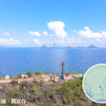
- A remarkably quiet, uncrowded sandy beach framing the split-colored waters where two major currents collide.
- Consider taking a quick detour inland to explore the ancient Fan Lau Fort ruins, the Neolithic stone circle, or the historic lighthouse.
- The village features a couple of local village stores (“shih-to”), though they are rarely open on weekdays.
- The contrasting ocean boundary line 🌊 is magnificent, making it a blast to explore the coastal crags and defensive ruins.
6️⃣ Reaching Kau Ling Chung (L076)
- The final stretch transitions onto a flat, incredibly easy-to-walk water catchwater road.
- After passing the forested campsite trail, you will arrive at the official end of Section 7. Since there are no roads or buses here, you must push right into Section 8 toward Shek Pik to catch a ride out.
— Because there is absolutely no public transport or road access at the end of Section 7 in Kau Ling Chung, hikers must continue walking along Lantau Trail Section 8 out to Shek Pik Reservoir to find a bus stop. While the overall path is largely flat and moderately easy on the knees, the true challenge lies in its sheer length, the total lack of early exit routes, and highly unreliable village stores. Packing plenty of snacks, lunch, and ample hydration is essential. —
🚍 Transport Guide
Getting to the Start Getting from the End 🚌 New Lantao Bus 1 (Mui Wo ↔ Tai O)
🚌 New Lantao Bus 11 (Tung Chung ↔ Tai O)
Ferry (Tuen Mun ↔ Tai O)🚌 New Lantao Bus 1, 2, 11, 23 (Board at Shek Pik after completing Section 8) —
🛒 Supplies & Key Precautions
- Do not rely on the Fan Lau village stores as their operating hours are highly unpredictable; packing all your own food and water is a must.
- There are no escape or exit routes along this section. Once you pass Yi O, you are committed to completing the coastal loop or pushing through Section 8.
- Wear sturdy, high-traction hiking shoes and ensure you are fully prepared for a full-day wilderness trek.
—
🧭 Itinerary Tips & Recommendations
- 🕗 Start Early: Hit the trail in the morning to ensure you have plenty of daylight to finish Section 8 at Shek Pik—otherwise, you will be stranded without transport.
- 💧 Hydration Factor: Carry at least 1.5L to 2L of water and sufficient trail snacks, as trail side kiosks cannot be trusted to be open.
- 🌧️ Weather & Tides: Keep a close eye on weather reports and high tides; certain low-lying mudflats and stream crossings can flood during heavy summer downpours.
- 📱 Digital Tracking: Use local hiking apps like TrailWatch or TimHiking to easily track your location against the L-numbered distance posts.
—
🧭 Hiking Pro-Tips
- ✅ Essential Gear:
- Sturdy trail shoes, sun block, a wide-brimmed hat, and light rain gear.
- Plenty of water (minimum 1.5L) and easily packable trail food.
- An offline digital map or GPS tracking app (cellular signals can be patchy near the border).
- ⚠️ Things to Remember:
- Mountain streams can swell rapidly during the rainy season; always put safety first.
- Never count on Fan Lau Village for lunch or water refills; treat this as a self-supported trek.
- Save plenty of energy for the final stretch across the catchwater to Shek Pik.
- 📷 Photography Suggestions:
- Fan Lau Coastline: Capture the stunning, dual-toned estuarine water boundary line.
- Tsin Yue Wan: Compose a gorgeous shot framing the pristine sandy beach with Peaked Hill floating in the background.
- Yi O Ancient Trail: Document the beautifully restored flagstone paths and rustic eco-farming landscapes.
—
🌊 Natural Wonder Highlights
Scenic Spot Description & Highlights Fan Lau Marine Waters The exact point where the turbid, silt-laden waters of the Pearl River estuary clash with the deep blue currents of the Pacific, creating a fascinating split-color sea. Peaked Hill (Kai Yi Kok) A rugged offshore islet shaped remarkably like a chicken wing, forming a dramatic coastal silhouette against Tsin Yue Wan beach. Coastal Mangroves The shoreline stretching from the start toward Nga Ying Kok boasts a thriving, bio-diverse mangrove ecosystem teeming with coastal life. Ancient Flagstone Paths The historic trail connecting Yi O and Fan Lau preserves beautiful, old-world stone-paved paths that are deeply rich in heritage. —