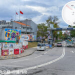
🛣️【Sha Tau Kok Road – Shek Chung Au Section (沙頭角公路《石涌凹段》)】 Section is the northeasternmost stretch of Sha Tau Kok Road in the North District of the New Territories, Hong Kong. Spanning approximately 2.25 kilometers, it connects Mu Tin with the Sha Tau Kok Town Border Control Point. Since its opening to traffic in 1927, this section has witnessed the area’s transformation from a colonial military stronghold to a modern cross-boundary gateway. The name “Shek Chung Au” is rooted in the geographical features of the local Hakka villages, describing a valley where rocky hills meet flowing streams—a name that blends the stamps of nature and human history. —
📌 Quick Facts
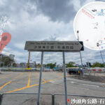
Item Details 🗺️ Section Name Sha Tau Kok Road – Shek Chung Au Section (沙頭角公路《石涌凹段》) 📍 Location Northeast New Territories, North District, Hong Kong; situated within the Sha Tau Kok Frontier Closed Area 🗓️ Year Opened 1927 (Commissioning of Sha Tau Kok Road as a whole) 📏 Section Length Approx. 2.25 km 🚗 Road Type Dual 2-lane road with a speed limit of 50 km/h 🚩 Starting Point The 5th Milestone mark east of Mu Tin 🏁 Ending Point Shun Lung Street, Sha Tau Kok Town 🏘️ Places Along the Route Mu Tin, Shek Kiu Tau Village, Yim Tso Ha, Nam Chung, Luk Keng Road, Sha Tau Kok Clinic, Tong To Village, etc. 🚌 Public Transport Served by KMB routes 78K, 277A, N78, and NT Green Minibus route 55K 🧳 Cross-Border Access Close to the Sha Tau Kok Border Checkpoint; travelers with valid permits can commute to the Mainland via Sha Ho Road 📜 Historical Background Originally built as an alternative route to the KCR Sha Tau Kok Branch Line, it became the main artery after the railway line ceased operations in 1928 🌄 Geographical Features Located at the northeasternmost end of Sha Tau Kok Road near the Mainland border; features flat terrain and dense clusters of roadside villages 🔗 Intersecting Roads Sha Ho Road, Shan Tsui Village Road, Shun Hing Street, and Heung Yuen Wai Highway (leading to Liantang Port) 🚧 Special Status Classified as a Frontier Closed Area; certain sections require a Closed Area Permit for entry — The surroundings of this section are a treasure trove of cultural and ecological assets: military relics like World War II bunkers and trenches sit on the east side, while the Sha Tau Kok War Memorial Hall (the Lo Ka Tai Uk) and traditional Hakka villages lie to the west. Alongside the carriageway, cycling tracks and footpaths offer views of the egretries and mangrove forests across the Luk Keng wetlands. At the end of the road, Sha Tau Kok Pier operates kaito ferry services to Geopark islands like Kat O and Ap Chau, mapping out a unique “road + sea” travel itinerary. —
🕰️ Historical Background & Development
- 1924: The Hong Kong Government greenlights the construction of Sha Tau Kok Road.
- 1927: As the final leg of Sha Tau Kok Road, the Shek Chung Au Section is completed, replacing the KCR Sha Tau Kok Branch Line to become the primary overland artery linking Fanling and Sha Tau Kok.
- Frontier Closed Area Role: Given its location hugging the Mainland border, the Shek Chung Au Section served as a vital border corridor and remained locked behind the Frontier Closed Area boundary for decades, requiring a permit for entry.
- 1970: The Hong Kong Government divides Sha Tau Kok Road into four sections; the final stretch is officially gazetted as “Sha Tau Kok Road – Shek Chung Au Section”.
- 2013–2018: In tandem with the construction of the Heung Yuen Wai Control Point, sections of the road are widened alongside traffic infrastructure upgrades.
—
🚏 Transport Facilities & Roadside Villages
The Shek Chung Au Section boasts convenient transport connections, lined with multiple bus and minibus stops serving residents and visitors alike:
🚌 Bus and Minibus Routes
Route No. Origin & Destination Remarks KMB 78K Fanling ↔ Sha Tau Kok Runs through the entirety of Sha Tau Kok Road KMB 277A Sheung Shui ↔ Sha Tau Kok Provides enhanced frequency during peak hours KMB N78 Night Service: Fanling ↔ Sha Tau Kok Late-night commuter shuttle Green Minibus 55K Fanling ↔ Luk Keng / Sha Tau Kok Heads toward the nature conservation areas 🏘️ Places Along the Route
The Shek Chung Au Section is lined with several bus stops (from south to north) catering to locals and travelers:
Village / Landmark Key Features Mu Tin Near the starting point; the milestone marks the closed area boundary Shek Kiu Tau Village Traditional Hakka village that retains its original village house character Yim Tso Ha Once a salt-making site; now a quiet residential community Nam Chung Teeming with wetland life; commonly spotted with waterbirds and mangroves Luk Keng Road Leads to the Luk Keng Nature Conservation Area Sha Tau Kok Clinic The primary medical facility in the district Tong To Village Sits near Sha Ho Road and close to the Sha Tau Kok Control Point Sha Ho Road Border Checkpoint 🚧 Note: The area north of Sha Ho Road is a Frontier Closed Area. Passengers without a valid permit must get off the bus before this point. — Following the gradual opening of the Sha Tau Kok Frontier Closed Area since 2022, the Shek Chung Au Section has transformed from a restricted border corridor into a tourism corridor connecting Hong Kong and Shenzhen. Today, vehicles travel through here to reach the Sha Tau Kok Port, and pedestrians can apply for a permit to explore historical sights beyond Chung Ying Street. Looking ahead, the area will be developed into a cultural and eco-tourism hub under the “Northern Metropolis” blueprint, showcasing the opening up and integration of Hong Kong’s border regions. —
🌿 Natural & Cultural Landscapes
More than just a traffic artery, the Shek Chung Au Section serves as a convergence point for culture and nature:
🏛️ Sha Tau Kok War Memorial Hall
- Housed in the former Lo Ka Tai Uk, it exhibits the anti-Japanese resistance history of the East River Column and the Hong Kong-Kowloon Brigade.
- As Hong Kong’s first exhibition hall themed around the War of Resistance, it holds immense educational and cultural value.
🌿 Luk Keng & Nam Chung Wetlands
- Nam Chung Wetlands: Rich in biodiversity, it draws a wealth of birds and insects, making it a hotspot for eco-photography and hiking.
- Luk Keng Road: Leading to Luk Keng Village, this route features vast swathes of mangroves and intertidal zones where water buffaloes, egrets, and mangrove flora are easily spotted.
🏘️ Hakka Culture
- Historical architecture such as Hakka walled villages, ancient wells, and ancestral halls line the path.
- Sha Tau Kok Town keeps traditional festivities alive, including the Tai Ping Ching Chiu festival, dragon dances, and lion dances.
—
🗺️ Suggested Itinerary (Half-Day Tour)
Time Slot Recommended Activities Morning Hike through Luk Keng Wetlands + Birdwatching at Nam Chung Midday Savor Hakka cuisine at Yim Tso Ha or Shek Kiu Tau Village Afternoon Tour the Sha Tau Kok War Memorial Hall + Snap photos to remember the trip —
🏞️ Villages & Communities
The Shek Chung Au Section passes through several villages steeped in history:
Village / Facility Features & Functions Shek Kiu Tau Village A historic, traditional Hakka village that preserves old village houses and ancestral halls, with a bus stop right at the village entrance Yim Tso Ha A Hakka village that has undergone partial rebuilding in recent years; once a salt-making site, it is now a peaceful residential pocket Nam Chung Situated near Luk Keng Road; leads to the nature conservation area and sits close to the wetlands, with most villagers engaged in farming and fishing Muk Min Tau / Tam Shui Hang Rural villages offering a serene and tranquil environment Tong To Village A small-scale village located close to the Sha Tau Kok Clinic and Control Point Sha Tau Kok Clinic The primary medical facility in the district Public Transport Interchange Bus terminus connecting commuters to Fanling and Sheung Shui —
🚧 Frontier Closed Area & Entry Policies
The Shek Chung Au Section falls within the Sha Tau Kok closed area limits, meaning entry requires a valid Closed Area Permit.
- Non-residents or individuals without a valid permit are restricted from entering Sha Tau Kok Town.
- Permits can be applied for through the Police Force, requiring valid reasons and proof of address.
- Since 2022, parts of the closed area have been gradually opened to visitors for sightseeing (such as during Sha Tau Kok Open Days).
—
🧠 Trivia Corner
- The name “Shek Chung Au” is a classic Hakka toponym, derived from the local terrain where a valley indentation meets intersecting streams.
- This stretch of road used to be under strict military control; today, it is gradually opening up to permitted residents and tourists.
- Sha Tau Kok Road remains one of the few roads in Hong Kong that still uses the traditional milestone markers (“ma” / 碼) as a unit of measurement.
—