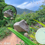
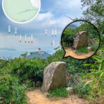
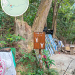
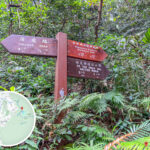
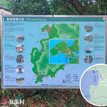
🗺️ 【Country Trails】 are a unique network connecting the city with nature, systematically planned by the Agriculture, Fisheries and Conservation Department. Spanning across 24 country parks and special areas throughout Hong Kong, they aim to provide citizens with a safe way to get close to nature. These trails are categorized by difficulty into beginner Family Walks, intermediate Country Trails, and advanced Long-Distance Hiking Trails (such as the MacLehose Trail), totaling over 500 kilometers in length. Many of them were converted from historical old paths; for instance, the Yuen Tsuen Ancient Trail was originally a trade route for villagers traveling between Yuen Long and Tsuen Wan, while the Hok Tau Reservoir Family Walk follows the lines of former irrigation waterways. —
🥾 Detailed Breakdown of the Four Major Long-Distance Hiking Trails
1. MacLehose Trail|Total Length: 100 km|Sections: 10
Section Start → End Length Difficulty Featured Attractions Section 1 Pak Tam Chung → Long Ke 10.6 km ⭐⭐ Long Ke Beach, coastal scenery Section 2 Long Ke → Pak Tam Au 13.5 km ⭐⭐⭐ Sai Kung mountain ridges, pristine woodlands Section 3 Pak Tam Au → Shui Long Wo 10.2 km ⭐⭐ Reservoir views, shaded paths Section 4 Shui Long Wo → Tai Mo Shan (Tate’s Cairn area) 12.7 km ⭐⭐⭐ Highland scenery, distant views of Ma On Shan Section 5 Tate’s Cairn → Tai Po Road (Piper’s Hill) 10.6 km ⭐⭐ Interweaving city and nature vistas Section 6 Tai Po Road (Piper’s Hill) → Shing Mun Reservoir 4.6 km ⭐ Easy short walk, perfect for beginners Section 7 Shing Mun Reservoir → Lead Mine Pass 6.2 km ⭐⭐ Reservoir surroundings, shaded trails Section 8 Lead Mine Pass → Route Twisk (Tai Mo Shan) 9.7 km ⭐⭐⭐ Slopes of Tai Mo Shan, misty forests Section 9 Route Twisk → Tin Fu Tsai 6.3 km ⭐⭐ Valley views, quiet paths Section 10 Tin Fu Tsai → Tuen Mun 15.6 km ⭐⭐⭐ The longest section, a test of endurance 🚍 Transport Suggestions: Most starting points can be reached by taking a bus or minibus from an MTR station, such as Bus 94 to Pak Tam Chung. —
2. Wilson Trail|Total Length: 78 km|Sections: 10
Section Start → End Length Difficulty Featured Attractions Section 1 Stanley Gap Road → Hong Kong Parkview 4.8 km ⭐⭐ Southern Hong Kong Island trails, sea views Section 2 Hong Kong Parkview → Quarry Bay 6.6 km ⭐⭐⭐ Mount Violet, historical reservoirs Section 3 Yau Tong → Tseng Lan Shue 9.3 km ⭐⭐⭐ The junction of city fringes and countryside Section 4 Tseng Lan Shue → Sha Tin Pass 8 km ⭐⭐ Ma On Shan ridgeline Section 5 Sha Tin Pass → Kowloon Reservoir 7.4 km ⭐⭐ Below Lion Rock, panoramic views of Kowloon Section 6 Kowloon Reservoir → Shing Mun Reservoir 5.3 km ⭐ Easy short walk, great for families Section 7 Shing Mun Reservoir → Yuen Tun Ha 10.2 km ⭐⭐⭐ Foot of Tai Mo Shan, shaded forest paths Section 8 Yuen Tun Ha → Cloudy Hill 9 km ⭐⭐ Tai Po mountains, pristine woodlands Section 9 Cloudy Hill → Pat Sin Leng 10.6 km ⭐⭐⭐ Pat Sin Leng ridgeline, magnificent vistas Section 10 Pat Sin Leng → Nam Chung 6.8 km ⭐⭐ Northern District mountain paths, tranquil villages 🚍 Features: The only hiking trail that stretches across Hong Kong Island, Kowloon, and the New Territories; Section 2 to Section 3 requires crossing Victoria Harbour. —
3. Lantau Trail|Total Length: 70 km|Sections: 12
Selected Sections Start → End Length Difficulty Highlights Section 3 Pak Kung Au → Ngong Ping 4.5 km ⭐⭐ Ngong Ping Village, Tian Tan Buddha Section 5 Sham Wat Road → Man Cheung Po 7.5 km ⭐⭐⭐ Ridgeline scenery, pristine woodlands Section 7 Tai O → Kau Ling Chung 10.5 km ⭐⭐ Tai O Fishing Village, coastline Section 12 Pui O → Mui Wo 9 km ⭐⭐ Coastal paths, Mui Wo market town 🚍 Transport Suggestions: Take a bus from Tung Chung Station to Pak Kung Au or start directly from the Mui Wo Ferry Pier. —
4. Hong Kong Trail|Total Length: 50 km|Sections: 8
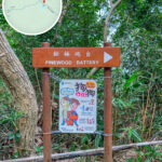
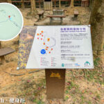
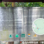
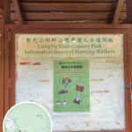
Selected Sections Start → End Length Difficulty Highlights Section 1 Victoria Gap → Pok Fu Lam Reservoir 7 km ⭐⭐ City and nature contrasts, Western Hong Kong Island views Section 4 Wan Chai Gap → Wong Nai Chung Gap 7.5 km ⭐⭐ Urban oasis, historical reservoirs Section 8 To Tei Wan → Tai Long Wan 8.5 km ⭐⭐ Dragon’s Back, Shek O Beach 🚍 Features: Most suitable for beginners, with highly convenient transport and exceptional scenery. — These trails serve not only as recreational facilities but also as outdoor ecological and cultural classrooms. Information boards are set up along the paths to introduce geological features, World War II relics, traditional village culture, and feng shui woods—such as the Silvermine Cave relics in Shing Mun Country Park, or the laminated wave-cut platforms of Tung Ping Chau. At the same time, they nurture rich ecosystems, such as the hundreds of butterfly species in the Tai Po Kau Nature Reserve, or the migratory bird flocks in the Mai Po Wetlands, acting as a living museum of biodiversity. In recent years, thematic routes have been developed, including “Tree Walks” and “Geopark Guided Trails,” to meet the growing demand for nature education and in-depth travel. —
📌 Classification & Features
Type Features & Purposes Difficulty Range Suitable For Country Trails Short-distance, equipped with distance posts, scenic, and easy to navigate Low to Medium Beginners, families Long-Distance Trails Sectional designs, long distances, and highly challenging Medium to High Experienced hikers Family Walks Highly educational, with interpretation boards and nature observation points Low Parents, children, students Thematic Routes Special itineraries designed around flower seasons, culture, or geology Medium to High Photography and culture enthusiasts —
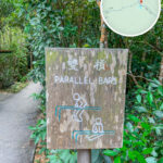
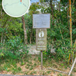
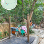
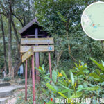
📍 Detailed Breakdown of the Distance Post System
- Every official hiking trail is equipped with clearly numbered distance posts (such as M001, W045, etc.).
- Each post displays:
- The trail name and section number
- A six-digit grid reference coordinate
- An illustration of the current location
- In an emergency, reporting the distance post number allows rescue teams to quickly track your location.
— Hiking trails embody Hong Kong’s unique value of urban-nature symbiosis. On weekends, they are frequently filled with family educational activities, ecological tour groups, and photography enthusiasts. The government has also promoted the “Great Outdoors Hong Kong” campaign, using mobile applications to provide AR guided tours and real-time route information, letting these century-old paths find new life in the digital era as a vital part of citizens’ spiritual lives. From relaxing family strolls to self-challenging wilderness expeditions, these paths have become an indispensable part of local life. As weekend comes, crowds can always be seen walking along stone steps into the green shade, sketching a unique cityscape of natural and urban harmony against a background of skyscrapers. —
🚍 Transport & Gear Suggestions
Item Suggestions Transport Mode MTR paired with Bus / Minibus; some routes offer direct urban transit to the starting points Gear Non-slip shoes, sun hat, water, hiking poles, map or GPS Safety Tips Hike with a partner, check the weather forecast, do not wander off-trail, and avoid hiking completely alone Seasonal Advice Autumn and winter are ideal for silvergrass viewing; spring and summer require extra sun protection and hydration —
📱 Planning Tips
- Using an MTR plus bus/minibus combination is the most convenient choice.
- It is recommended to use the “Enjoy Hiking” App to check routes and distance posts.
- Always check the weather and tide schedules before setting off (especially for places like Ha Pak Nai and Nam Sang Wai).
- For popular weekend routes like Dragon’s Back or Sunset Peak, set off early in the morning to beat the crowds.
🎒 Hiking Gear Checklist
Gear Type Recommended Items Basic Essentials Hiking shoes, sun hat, backpack Safety Gear Map, compass, flashlight, first-aid kit Supplies Water, energy bars, salt tablets Others Camera, raincoat, hiking poles —
🌤️🌳 Seasonal Hiking Trail Recommendations
Based on Hong Kong’s seasonal climate, scenic highlights, and route difficulties, here is a curated selection of the best country trails for Spring, Summer, Autumn, and Winter, allowing you to immerse yourself in nature, capture stunning photographs, and unwind all year round 🥾📸:
🌸 Spring Hikes (March–May): Blossoming Flowers, Birdsong & Pleasant Weather
Trail Name District Scenic Highlights Difficulty Reasons for Recommendation Shing Mun Reservoir Walk 💧 Tsuen Wan Reservoir, lush trees, wild boar sightings ⭐⭐ Spring brings vibrant foliage and comfortable temperatures, perfect for family outings. Pat Sin Leng Nature Trail 🧙♂️ Tai Po Peaks named after the Eight Immortals, mountain vistas ⭐⭐ Spring flora is in full bloom, accompanied by rich educational facilities. Pak Tam Chung Nature Trail 🌳 Sai Kung Plant interpretation boards, mountain streams, butterflies ⭐ Ideal for leisurely strolls and peaceful nature observations. —
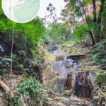
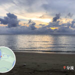
🌊 Summer Hikes (June–August): Beating the Heat, Waterside Walks & Ecological Exploration
Trail Name District Scenic Highlights Difficulty Reasons for Recommendation Ha Pak Nai Mudflat Trail 🦀 Lau Fau Shan, Yuen Long Mirror of the sky, fiddler crabs, mudskippers ⭐ Provides breathtaking photography opportunities during summer low tides alongside a rich ecosystem. Double Haven Country Trail 🏝️ Northeast New Territories Bays, islets, natural typhoon shelters ⭐⭐⭐ Refreshing summer sea breezes make it ideal for birdwatching and landscape photography. Cape D’Aguilar Nature Trail 🐚 Stanley, Hong Kong Island Sea caves, spectacular geological wonders ⭐ Features distinct coastal landforms, making it perfect for geology enthusiasts. —
🌾 Autumn Hikes (September–November): Silvergrass Season & Sunset Lovers’ Paradise
Trail Name District Scenic Highlights Difficulty Reasons for Recommendation Sunset Peak Silvergrass Trail 🌾 Lantau Island Silvergrass fields, Lantau Mountain Camp stone cabins, sunsets ⭐⭐⭐ Autumn silvergrass blooms beautifully, paired with fairy-tale golden sunsets. Dragon’s Back Trail 🐉 Shek O, Hong Kong Island Mountain ridgelines, 360-degree ocean views ⭐⭐ Crisp autumn weather provides wide-open horizons, making it the top choice for scenic photography. High West Trail 🌄 Western Hong Kong Island Victoria Harbour sunsets, romantic peak vistas ⭐ Offers perfectly timed sunset views, ideal for couples on dates. —
❄️ Winter Hikes (December–February): Cool, Dry Weather & Peak Challenges
Trail Name District Scenic Highlights Difficulty Reasons for Recommendation Lantau Peak Trail 🦅 Southwest Lantau Island Hong Kong’s second highest peak, sea of clouds, sunrise ⭐⭐⭐⭐ Dry winter weather creates ideal conditions for mountain climbing and distant view-gazing. MacLehose Trail Section 2 🏕️ Long Ke Wan, Sai Kung Beaches, vertical cliffs, pristine coastlines ⭐⭐⭐ The cool winter temperatures make this long-distance challenge highly manageable without the summer heat. Man Cheung Po Country Trail 🏞️ Southern Lantau Island Mountain forests, clear streams, intersection with Lantau Trail ⭐⭐⭐ Winter brings stable water levels and highly distinct trail conditions. —