2022.10.23 SUN
【Hiking • 018】
Lion Rock . Lion Tail Ridge . Beacon Hill
獅子山 . 獅尾脊 . 筆架山
This is a classic cross-country route that seamlessly connects urban hustle with the iconic peaks of Kowloon. Starting from Wong Tai Sin Centre, you pass by Our Lady’s Primary School and the incense-filled Fat Jong Temple before hitting the trails via the Lion Tail Ridge. This ascent is a real test of stamina, taking you past the uniquely shaped Sky Ladder Rock and the Fool Tower, a spot steeped in local hiking folklore. As you gain elevation, the views open up spectacularly, leading you to the ultimate symbol of the Hong Kong spirit—the summit of Lion Rock, where the entire Kowloon Peninsula and Victoria Harbour stretch out beneath you in a breathtaking panorama. The second half of the journey transitions into more tranquil, shaded paths. After a quick breather at the Kowloon Pass Reunion Pavilion, you’ll head west along the MacLehose Trail towards Beacon Hill. Once a vital site for aviation navigation, it now serves as a prime vantage point to see the city skyline interwoven with rolling ridges. The descent is relatively gentle, finally bringing you to the serene Kowloon Reservoir. It’s the perfect spot to wind down by the peaceful waters, wrapping up a rich journey that balances physical challenge, urban vistas, and natural ecology.
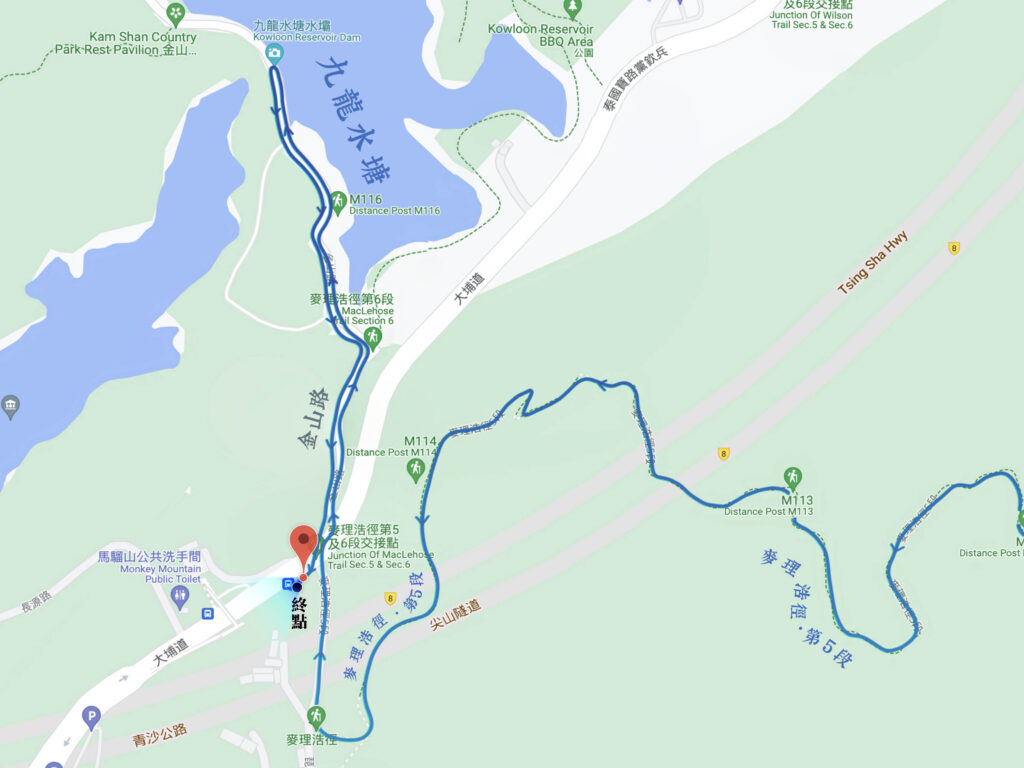
Wong Tai Sin Centre → Our Lady’s Primary School → Fat Jong Temple → Lion Tail Ridge → Sky Ladder Rock → Fool Tower → Lion Rock → Kowloon Pass Reunion Pavilion → Beacon Hill → Kowloon Reservoir
Route Overview
Wong Tai Sin Centre → Our Lady’s Primary School → Fat Jong Temple → Lion Tail Ridge → Sky Ladder Rock → Fool Tower → Lion Rock → Kowloon Pass Reunion Pavilion → Beacon Hill → Kowloon Reservoir
【Start】 Setting off from Wong Tai Sin Centre, head along Shatin Pass Road, where you will first pass by Our Lady’s Primary School. Continuing further up Shatin Pass Road, you will reach Fat Jong Temple. This historic Buddhist temple offers a serene environment, making it a perfect spot for a short rest.
【Mid-Sectoin】
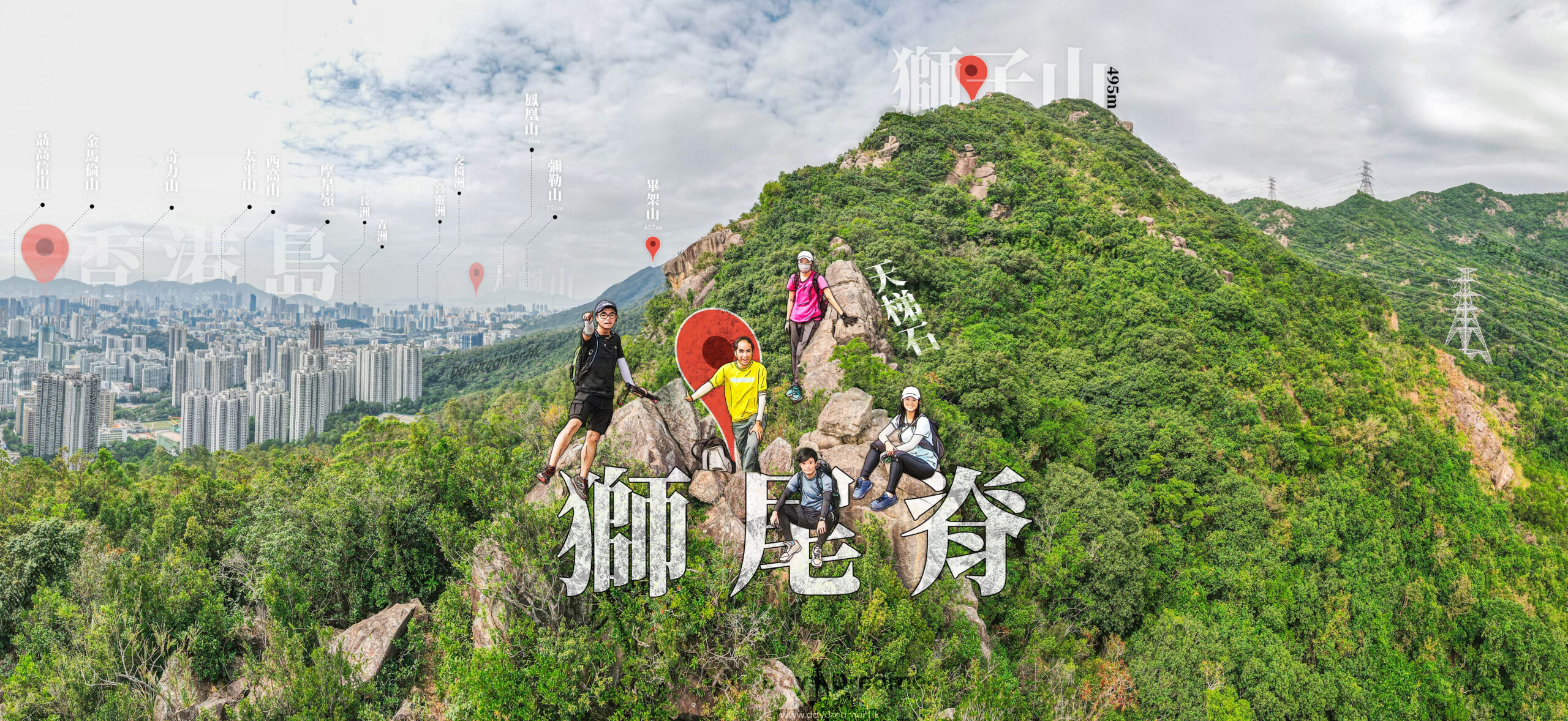
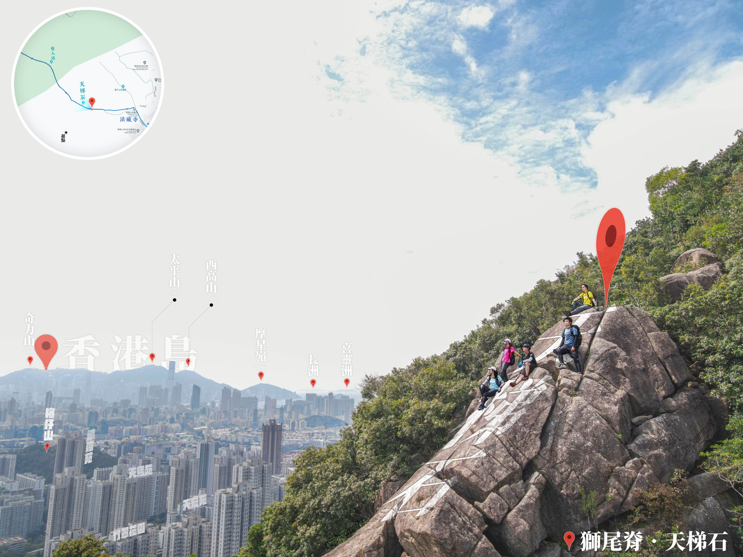
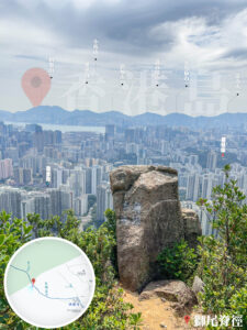
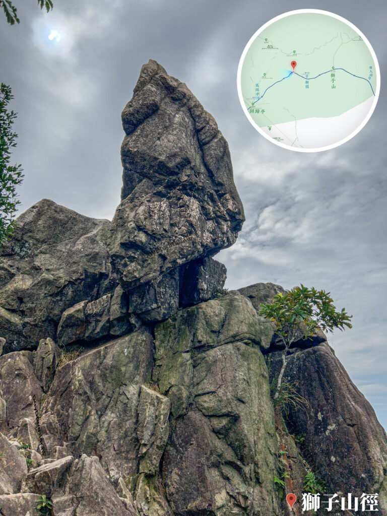
After leaving the temple, you will begin your ascent via the Lion Tail Ridge Path. This route is famous for its steep gradients and magnificent views, often requiring some hands-on scrambling. Along the way, you can enjoy panoramic vistas of the Kowloon Peninsula and Victoria Harbour. You will eventually encounter Sky Ladder Rock, a massive rock formation that requires careful climbing.
Keep pushing forward until you reach Fool Tower. Built in 1959, this six-tier stone tower is inscribed with the phrases 『Standing Tall Between Heaven and Earth』 and a poetic couplet describing the surrounding landscape. It is a popular landmark for photos and a well-earned breather.
【Finish】
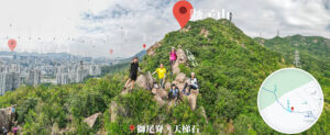
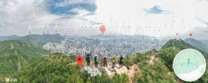
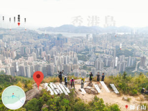
Leaving the tower behind, continue along the ridge to finally reach the summit of Lion Rock. As one of Hong Kong’s most iconic peaks, the summit offers a breathtaking view overlooking the entire Kowloon Peninsula and Hong Kong Island. Descending from the peak, you will pass the Kowloon Pass Reunion Pavilion, an important landmark commemorating Hong Kong’s handover.
Next, follow the trail to Beacon Hill known for its unique terrain and grand vistas, making it an excellent vantage point for photography. Finally, descend along the path to reach the Kowloon Reservoir. The reservoir area is beautifully scenic, providing a relaxing atmosphere perfect for unwinding or having a picnic.
Here are the reference statistics for this journey:
Related Videos
Transport Guide
START
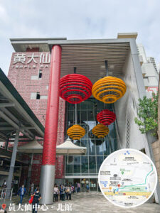
Temple Mall North
- 🚇 MTR Wong Tai Sin Station, Exit E

END
Shek Lei Pui Reservoir, Bus Stop
- Take 《Bus 72 or 81》 to return to West Kowloon urban areas.
💡 Tips:
- Just a small heads-up—the bus route heading back to West Kowloon (like Sham Shui Po or Jordan) is usually 《72 (not 77)》, while 《81》 takes you straight to Mong Kok and Jordan. Both are great options for getting back to the city!
Route Breakdown
🚩
Start
《Wong Tai Sin Centre → Lion Tail Ridge → Lion Rock》
1. 📍 Temple Mall North
MTR Wong Tai Sin Station
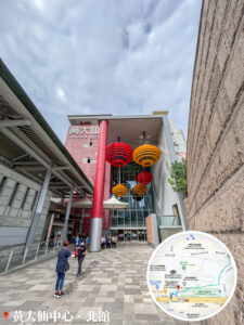
Wong Tai Sin Centre, Temple Mall North
2. 📍 Wong Tai Sin Square


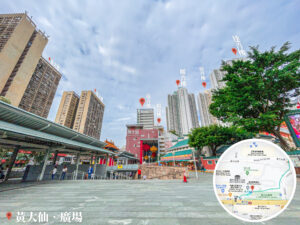


Wong Tai Sin Square
3. 📍 Shatin Pass Road


Shatin Pass
4. 📍 Our Lady’s Primary School

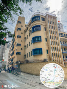
Our Lady’s Primary School
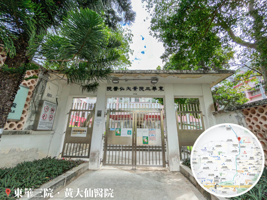
5. 📍 Our Lady of Maryknoll Hospital 🏥

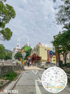
Our Lady of Maryknoll Hospital 🏥
6. 📍 TWGHs Wong Tai Sin Hospital
TWGHs Wong Tai Sin Hospital 🏥
7. 📍 Diamond Hill Fresh and Salt Water Pumping Station

Diamond Hill Fresh and Salt Water Pumping Station
8. 📍 CLP – Tsz Wan Shan Operations Centre
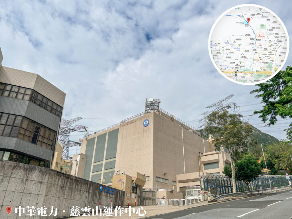
CLP – Tsz Wan Shan Operations Centre
9. 📍 Tsz Wan Shan, Fat Jong Temple


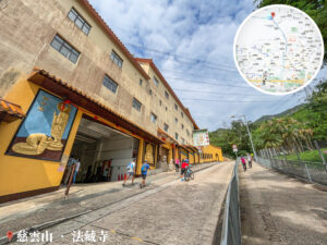
Tsz Wan Shan, Fat Jong Temple
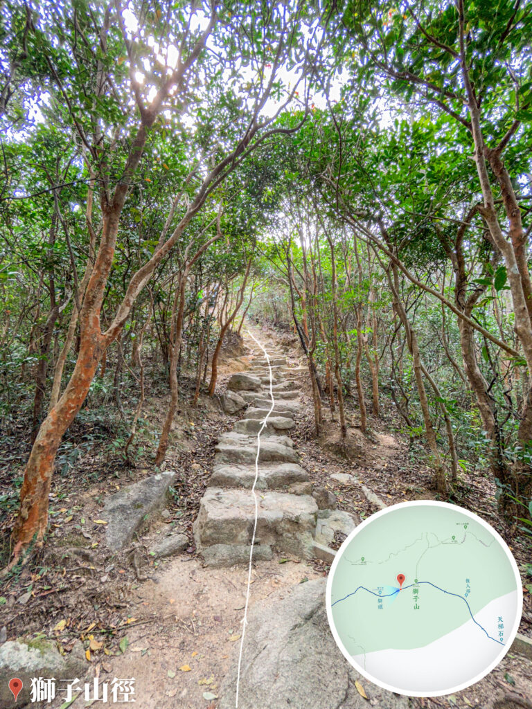
10. 📍 Lion Tail Ridge Path 《I》


Lion Tail Ridge Path 《I》
11. 📍 Lion Tail Ridge Path 《II》


Lion Tail Ridge Path 《II》
12. 📍 Lion Tail Ridge Path 《III》

Lion Tail Ridge Path 《III》
13. 📍 Sky Ladder Rock

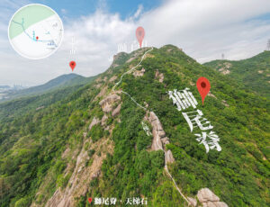
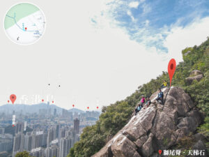
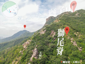


Sky Ladder Rock
14. 📍 Lion Tail Ridge Path 《IV》


Distant View of Hong Kong Island
15. 📍 Lion Tail Ridge Path 《V》

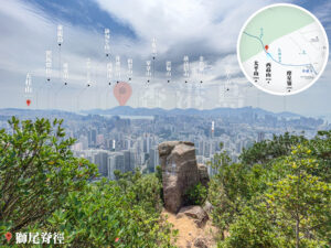


The Solitary Boulder
16. 📍 Fool Tower


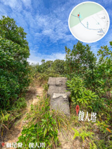
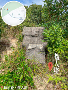
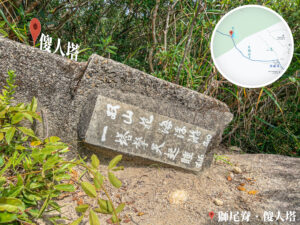
Fool Tower
📷 Tips:
- To see what it originally looked like, you can visit this Facebook page: https://www.facebook.com/tsewaii/posts/2669884376631463/
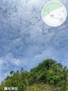
17. 📍 Lion Tail Ridge Path 《VI》


Lion Tail Ridge Path 《VI》
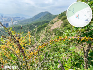
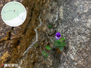
18. 📍 Lion Tail Ridge Path 《VII》


Wild Coffee and Big Blue Lilyturf
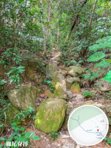
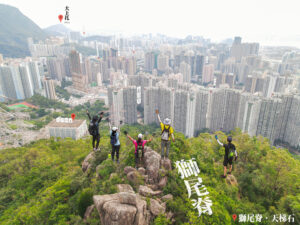
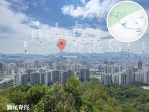
19. 📍 The Tail of 🦁️Lion Rock

The Tail of 🦁️Lion Rock
20. 📍 🦁️Lion Rock


🦁️Lion Rock
Route Breakdown
🏁
Finish
《Lion Rock → Beacon Hill → Kowloon Reservoir》
21. 📍 Lion Rock Trail 《I》
Lion Rock Trail 《I》
22. 📍 Lion Rock Trail 《II》


Lion Rock Trail 《II》
23. 📍 The Head of 🦁️Lion Rock •


The Head of 🦁️Lion Rock •
24. 📍 Lion Rock Trail 《III》
Lion Rock Trail 《III》
25. 📍 Rain Shelter


Rain Shelter
26. 📍 Kowloon Pass Reunion Pavilion
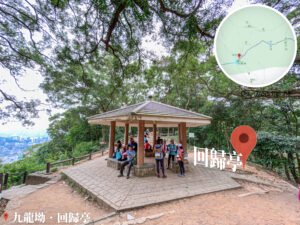


Kowloon Pass Reunion Pavilion
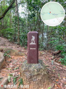
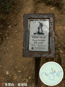
27. 📍 MacLehose Trail – Section 5 《I》


MacLehose Trail – Section 5, Fan-leaved Maidenhair Fern
28. 📍 MacLehose Trail – Section 5 《II》

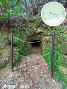
MacLehose Trail – Section 5, Mysterious Cave
29. 📍 MacLehose Trail – Section 5 《III》
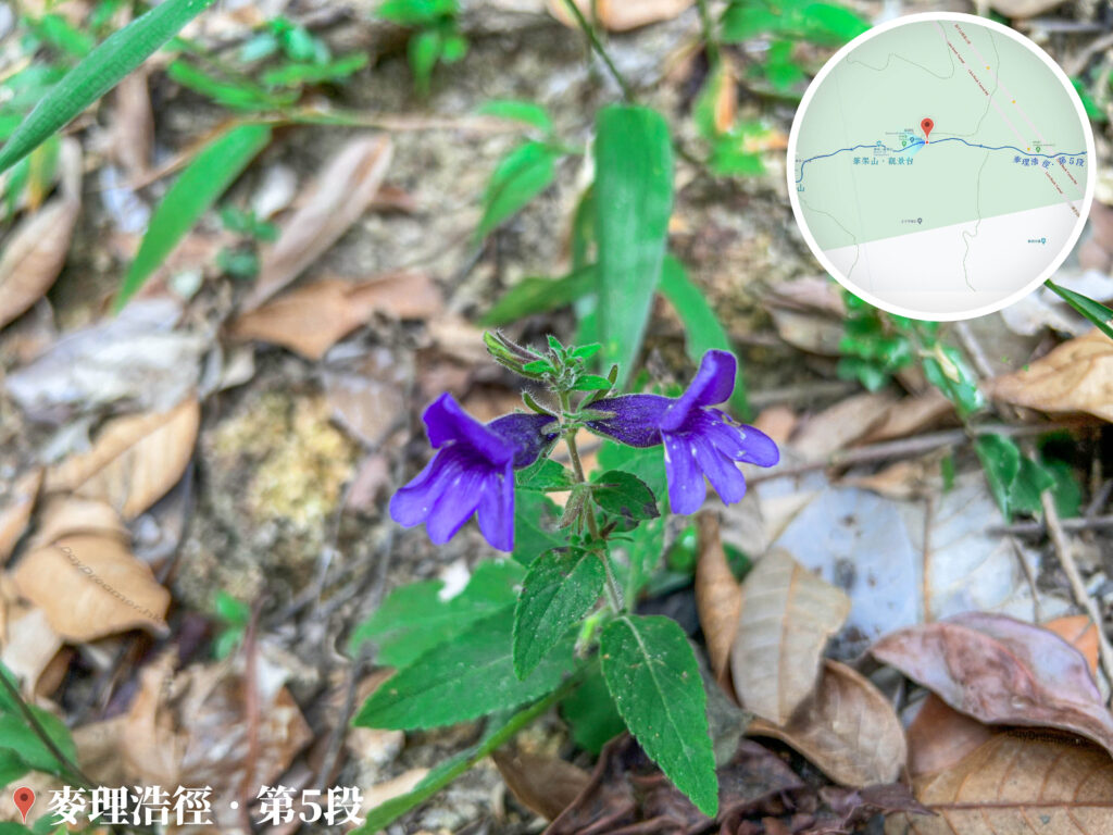
MacLehose Trail – Section 5, Sticky Adenosma
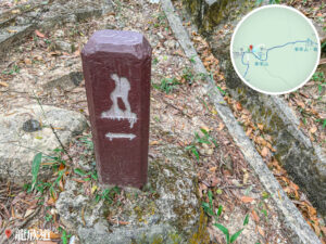
30. 📍 Military Coordinate Stone Base


Military Coordinate Stone Base
31. 📍 MacLehose Trail – Section 5 《IV》

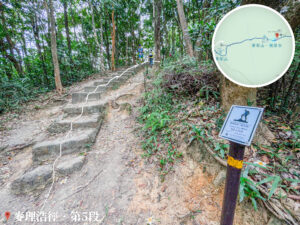
MacLehose Trail – Section 5 《IV》
32. 📍 Beacon Hill Viewing Platform

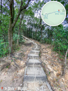
Beacon Hill Viewing Platform
33. 📍 Beacon Hill Trig Pillar

Beacon Hill Trig Pillar
34. 📍 Lung Yan Road

Lung Yan Road
35. 📍 Beacon Hill Radar Station


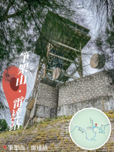
Beacon Hill Radar Station
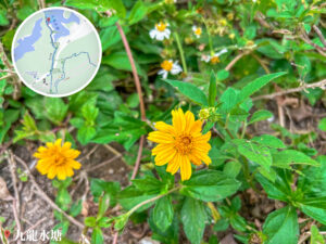
36. 📍 Kowloon Reservoir


Kowloon Reservoir
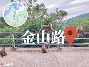
37. 📍 Kam Shan Road

Kam Shan Road
38. 📍 Shek Lei Pui Reservoir, Bus Stop