2022.04.15 FRI
【Hiking • 017】
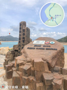
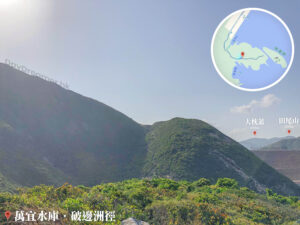
High Island Reservoir – East Dam . Biu Tsim Kok . Po Pin Chau
萬宜水庫-東壩 . 標尖角 . 破邊洲
This trail is a world-class visual feast that showcases Hong Kong’s unique geological wonders and stunning coastlines. Starting from the East Dam, you first ascend to the Biu Tsim Kok Viewing Platform for a panoramic view of the High Island Reservoir and the vast seas of Leung Shuen Wan. Afterwards, stroll along the High Island Geo Trail to get an up-close look at the magnificent hexagonal rock columns. Along the way, you’ll witness nature’s craftsmanship, including the profound Kwun Mun Monument Cave and the massive Breakwater made of giant dolos blocks, offering a striking contrast between human engineering and natural forces. The second half of the journey takes you into more rugged and pristine territory. You’ll pass the tranquil Drumstick Bay and the hidden, mystical Kim Chu Wan, where you can enjoy crystal-clear waters and rocky shores. The adventure culminates at the iconic Po Pin Chau, a sea stack that looks as if it were split from the mainland by a giant axe. Looking out at its unique tubular rock columns provides the most breathtaking finale to this journey through the Global Geopark. The entire route covers approximately 12 km and takes about 5 hours to complete. This scenic trail is packed with stunning geological wonders and natural landscapes, making it a perfect choice for intermediate hikers looking for a rewarding challenge.
East Dam → Biu Tsim Kok Viewing Platform → High Island Geo trail → Kwun Mun Monument Cave → Dolosse / Breakwater → Drumstick Bay → Kim Chu Wan → Po Pin Chau

Route Overview
East Dam → Biu Tsim Kok Viewing Platform → High Island Geo trail → Kwun Mun Monument Cave → Dolosse / Breakwater → Drumstick Bay → Kim Chu Wan → Po Pin Chau
【Start】 Setting off from the East Dam, you’ll first walk along a flat concrete path. This section is well-shaded and very easy to tackle. Shortly after starting, you’ll pass the East Dam Pavilion, which is a great spot to take a breather. Continuing on, you will reach the Biu Tsim Kok Viewing Platform, which offers a stunning 270-degree panoramic view. From here, you can overlook the entire East Dam and Long Ke Wan, while spotting Tsang Pang Kok Tsui and Po Pin Chau in the distance.
【Mid-Section】
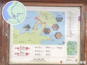
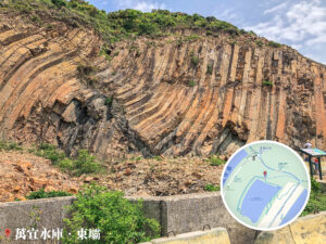
Moving on from the viewing platform, you’ll arrive at the High Island Geo Trail. This is one of Hong Kong’s most famous geological landmarks, where you can see world-class hexagonal rock columns, fault breccia, and S-shaped curved columns. These spectacular wonders were formed by a super-volcano eruption 140 million years ago. Following the trail leads you to the Kwun Mun Monument Cave and the Sea Cave. The Kwun Mun Monument Cave is a well-preserved relic from the Qing Dynasty (清朝), offering a glimpse into Hong Kong’s history, while the Sea Cave — formed by relentless wave erosion—features amazing natural echoes that are truly impressive.
Continuing past the cave, you’ll reach the Breakwater. Composed of thousands of massive dolos blocks, it is incredibly grand and serves as an ideal photo spot to capture the majestic sea views and the sheer scale of the engineering.
【Finish】
Next, follow the trail to Drumstick Bay, a beautiful beach equipped with camping facilities that makes for a perfect rest stop. Keeping along the path, you’ll hit Kim Chu Wan, another scenic beach where you can relax and enjoy the natural surroundings.
Finally, a short trek from the beach leads you to the iconic Po Pin Chau. This unique geological site features breathtaking sea cliffs and extraordinary rock formations. After taking in the sights of Po Pin Chau, head back the way you came to the East Dam Pavilion to wrap up your hiking adventure.

Here are the reference statistics for this journey:
Related Videos
Transport Guide
START
Sai Kung Pier
- Take a taxi directly to the High Island Reservoir – East Dam.
- (Saturdays, Sundays, and Public Holidays only): You can take 《Bus • 94》 to Pak Tam Chung, then transfer to 《Green Minibus • 9A》 to reach the High Island Reservoir – East Dam.

Route Breakdown
🚩
Start
《East Dam → Biu Tsim Kok → High Island Geo Trail》
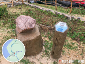
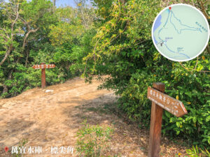
1. 📍 Start: East Dam Pavilion
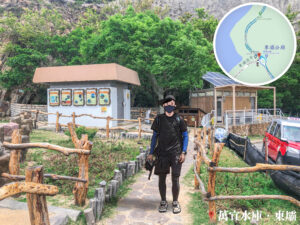
East Dam Pavilion
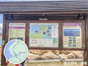
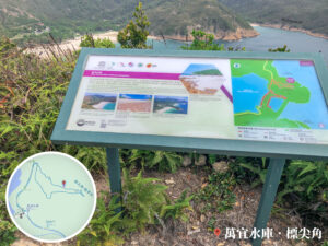
High Island Geo Trail – Information Board
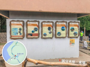
Northeast New Territories – Sedimentary Rock Region
Additionally, there are marine sandstone and mudstone from the Permian Period (二疊紀) (approx. 280 million years ago) outcropping at Ma Shi Chau (馬屎洲), as well as Early Jurassic marine sandstone and siltstone (approx. 180 million years ago) on both sides of the Tolo Channel (赤門海峽).
The red sandstone, siltstone, conglomerate, and breccia (approx. Late Cretaceous) found at Port Island / Chek Chau (赤洲), Double Haven / Yan Chau Tong (印洲塘), and several islands in Mirs Bay / Dapeng Wan (大鵬灣) indicate an arid terrestrial geological environment at that time. Finally, the siltstone and shale exposed at Tung Ping Chau (東平洲) belong to the Paleogene Period (古近紀) (approx. 56 – 32 million years ago), making it the youngest rock formation in Hong Kong. These sedimentary rocks, shaped by varying geological and geographical conditions, have formed a diverse array of geomorphological landscapes.
💡 Excerpt from:
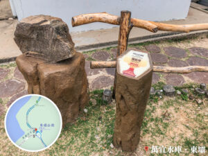
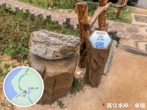
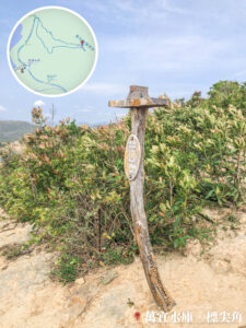
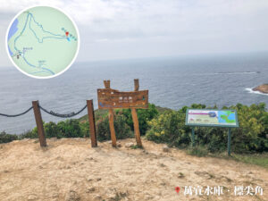
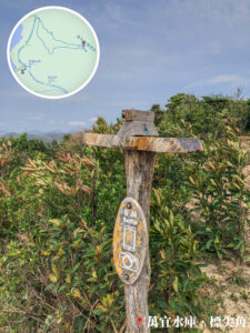
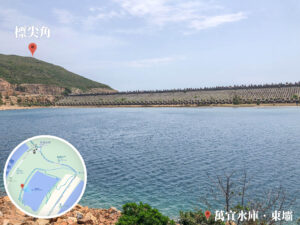
2. 📍 Biu Tsim Kok Viewing Platform – Signpost

Biu Tsim Kok Viewing Platform – Signpost
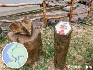
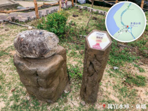
3. 📍 Distance Post M019 《I》

Distance Post M019 《I》
Grid Reference: KK 295 757.
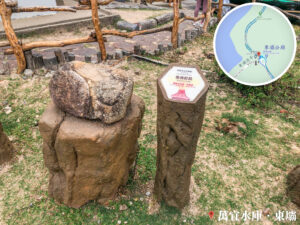
4. 📍 MacLehose Trail – Section 1 《II》

MacLehose Trail – Section 1 《II》
5. 📍 MacLehose Trail – Section 1 《III》

Biu Tsim Kok Viewing Platform – Signpost 《II》
6. 📍 Biu Tsim Kok 《I》
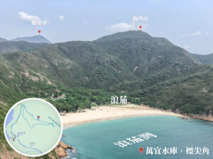
Long Ke Wan
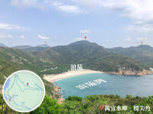
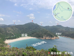
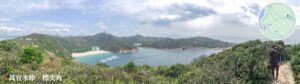
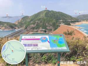
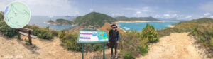
7. 📍 Biu Tsim Kok Viewing Platform
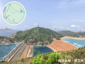
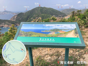
Biu Tsim Kok Viewing Platform
📷 View towards Long Ke:
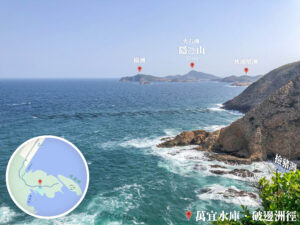
- You can see Lo Tei Tun (螺地墩), Long Ke (浪茄), Long Ke Tsai (浪茄仔), Sai Wan Shan (西灣山), Tung Shan (東山), Cheung Ngam Teng (長岩頂), Tai Yue Ngam Teng (睇魚岩頂), Tsang Pang Kok Teng (罾棚角頂), and Conical Island / Fan Tsang Chau (飯甑洲).
📷 View towards Fa Shan:
- You can see the East Dam (東壩), Po Pin Chau (破邊洲), Wang Chau (橫洲), Basalt Island / Fo Shek Chau (火石洲), Bluff Island / Sha Tong Hau Shan (沙塘口山), Fa Shan (花山), High Junk Peak / Diu Yue Yung (釣魚翁), Miu Tsai Tun (廟仔墩), Ping Pai (平排), and Pak Ah Teng (北丫頂).
8. 📍 Biu Tsim Kok 《II》
View of East Dam from Above
9. 📍 Biu Tsim Kok 《III》

Mountain Path
10. 📍 Biu Tsim Kok 《IV》

Completing the Loop
11. 📍 MacLehose Trail – Section 1 《IV》
MacLehose Trail / East Dam / Long Ke – Signpost
12. 📍 MacLehose Trail – Section 1 《V》

Mountain Path
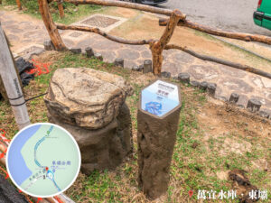
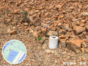
13. 📍 Distance Post M019 《II》

Distance Post M019 《II》
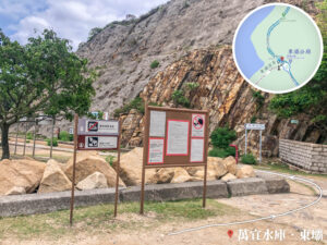
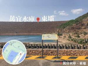
14. 📍 High Island Reservoir – Notice Board

High Island Reservoir – Notice Board
15. 📍 High Island Geo Trail 《I》

Hexagonal Rock Columns
16. 📍 High Island Geo Trail 《II》

Looking up at the East Dam
17. 📍 High Island Geo Trail 《III》

S-shaped Rock Columns (S 形岩柱)
18. 📍 High Island Geo Trail 《IV》

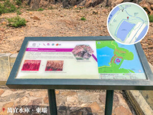
Breakwater – Information Board
19. 📍 High Island Geo Trail 《V》

Danger: Deep Water Notice
Beyond the rock formations, the High Island Geo Trail also features a vast lake where you can enjoy a scenic walk along its edge.
20. 📍 High Island Geo Trail 《VI》
Short – Trig Pillar
21. 📍 High Island Wooden Boardwalk
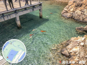
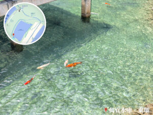
Koi under the Boardwalk
22. 📍 Kwun Mun Monument Cave (Sea Cave)

Kwun Mun Monument Cave (Sea Cave) – Panorama
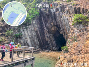
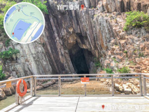

Kwun Mun Monument Cave (Sea Cave)
23. 📍 High Island Geo Trail 《VII》
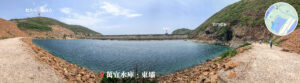
East Dam, The Vast Lake
24. 📍 High Island Geo Trail 《VIII》

Anchor-shaped Breakwater
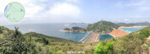
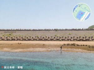
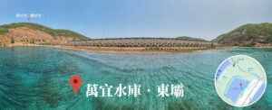
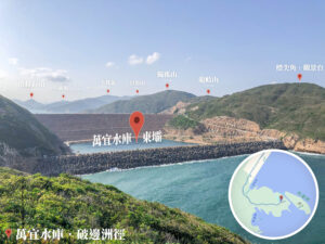
25. 📍 High Island Reservoir – East Dam
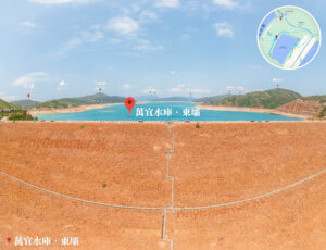


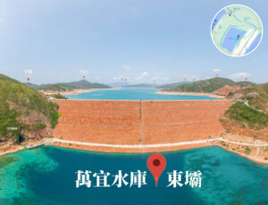
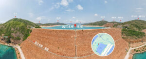
High Island Reservoir – East Dam

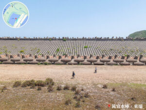
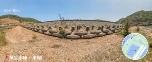


Breakwater, Anchor-shaped Dolos Wall
Route Breakdown
🏁
Finish
《Drumstick Bay (Chicken Leg Wan) → Kim Chu Wan → Po Pin Chau》
26. 📍 High Island Reservoir – Breakwater 《I》
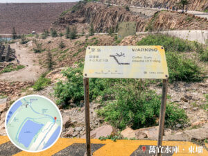
Cofferdam Notice Board
27. 📍 High Island Reservoir – Breakwater 《I》


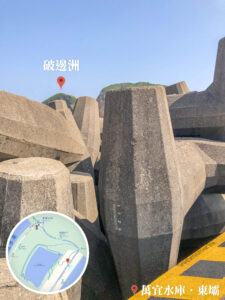
Anchor-shaped Dolos Wall
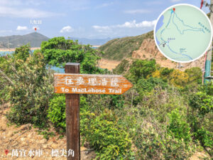
28. 📍 Po Pin Chau Trail, Entrance

Po Pin Chau Path, Entrance
29. 📍 Po Pin Chau Path 《I》

Po Pin Chau Path 《I》
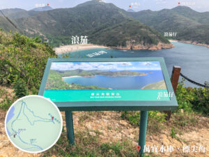
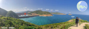
30. 📍 Drumstick Bay (Chicken Leg Wan)

Drumstick Bay (Chicken Leg Wan)
31. 📍 Po Pin Chau Path 《II》

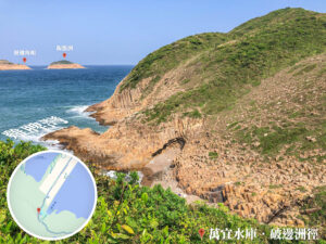
Looking Down at Kim Chu Wan 《I》
32. 📍 Po Pin Chau Path 《III》

Po Pin Chau Path 《III》
33. 📍 Po Pin Chau Path 《IV》

Po Pin Chau Path 《IV》
34. 📍 Heart of Hong Kong, Kim Chu Wan

Heart of Hong Kong, Kim Chu Wan 《I》


Heart of Hong Kong, Kim Chu Wan 《II》
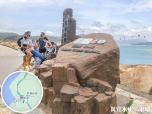
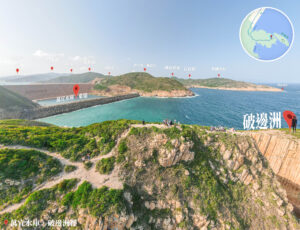
35. 📍 Po Pin Chau
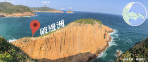
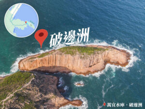
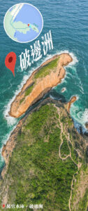
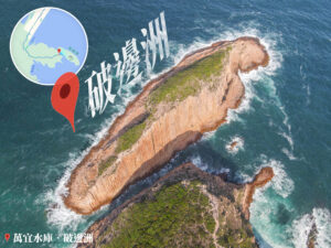
Po Pin Chau
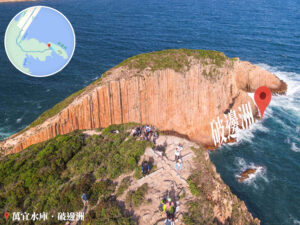
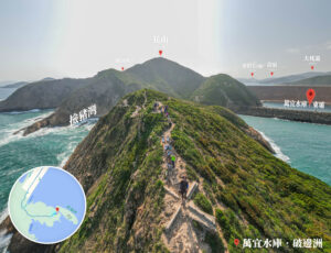
Po Pin Chau, The Cross
36. 📍 Po Pin Chau Path 《V》 | Return
Looking Back East Dam
37. 📍 Po Pin Chau Path 《VI》 | Return

Fa Shan Au (花山坳)
38. 📍 Finish: East Dam Pavilion / Sai Kung Man Yee Road / West Dam

East Dam Pavilion 《II》

Sai Kung, Man Yee Road
