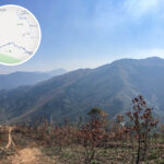
🐮【Ngau Tam Shan (牛潭山)】 is a mountain peak located in the northwestern New Territories of Hong Kong. Standing at an altitude of 337 meters, it is situated between Yuen Long New Town and the Fanling / Sheung Shui New Town. It was originally named “Ao Tam Shan” (鰲潭山), derived from a small stream named “Ao Tam” located on Lung Tam Shan (the eastern peak on the main ridge of Kai Kung Leng) to its south. Along its ridge, the eastern and western halves of the mountain are split between North District and Yuen Long District, and it lies entirely outside the boundaries of any country park. —
—
📌 Quick Facts
Item Details 🏞️ Mountain Name Ngau Tam Shan (Ancient Name: Ao Tam Shan / 鼇潭山) 📍 Location Northwestern New Territories, Hong Kong; situated between Yuen Long and Fanling / Sheung Shui 📏 Altitude Approx. 337 meters 🧭 Geographic Coordinates 22°28′51.62″N, 114°5′22.29″E 🗺️ Administrative District The mountain ridge is shared by North District and Yuen Long District 🚫 Country Park Boundaries Does not belong to any country park area 🚶♂️ Hiking Difficulty Moderate to high; hiking with experienced companions is recommended 🧭 Neighboring Peaks Kai Kung Leng, Ki Lun Shan 🏞️ Scenic Features Open panoramic views; overlooks Kwu Tung Reservoir and the New Territories plains 🛣️ Trail Access Can be accessed via Kwu Tung Reservoir, Ki Lun Shan Pass, or Siu Lo Tin 🏘️ Surrounding Areas Ngau Tam Mei, Tsiu Keng, Cheung Lek 🚌 Transportation Minibuses 50A, 57K, and Bus 76K (Starting from Kwu Tung Market is recommended) — Due to Ngau Tam Shan’s relatively secluded location, its lack of official country park status, and limited transport access, it sees very few hikers on weekdays. The mountain paths are overgrown with heavy vegetation, and certain sections are steep and covered in loose gravel, requiring extra caution against slipping when descending. Common hiking routes start from Kwu Tung or Cheung Lek. There are no supply stations along the way, so hikers must bring adequate water and provisions. It is highly recommended for experienced hikers only. —
🧭 Hiking Trails & Geographical Features
Ngau Tam Shan is frequently combined with Ki Lun Shan (Kirin Hill) and Kai Kung Leng to form popular hiking routes:
- The starting point is usually Kwu Tung Market, passing by Kwu Tung Reservoir.
- The mountain pass between Ngau Tam Shan and Ki Lun Shan is known as Ki Lun Shan Pass (Kirin Hill Pass).
- The summit features a small trigonometrical station popularly nicknamed Siu Lo Tin (Little Lo Tin), while Ngau Tam Shan itself was historically called Tai Lo Tin (Great Lo Tin)—a Daoist term referring to the highest realm of heaven.
— Ngau Tam Shan possesses a wealth of historical and military significance. Relics of military fortifications, such as machine gun pillboxes and trenches, can still be found scattered across the mountain. These ruins are partly linked to defensive installations built by the British Army on the northern hills of the New Territories after 1949. Standing at the peak of Ngau Tam Shan offers an expansive, unobstructed view that stretches across Kwu Tung Reservoir, the fish ponds of Mai Po, Kai Kung Leng, and even towards Futian in Shenzhen. In the right season, hikers can also witness fields of swaying silvergrass. —
🌄 Landscape & Cultural Significance
- The summit views are incredibly open, looking directly down upon the Kwu Tung Plain and its heart-shaped reservoir.
- Machine Gun Posts and other military relics are visible along the trail, reflecting its historical role in regional defense.
- The ancient Lung Tam Kwun Yam Temple sits nearby; traditional lore suggests that Daoist altars were once erected on the summit to perform rituals, which likely explains the name “Tai Lo Tin.”
—
🚶♂️ Hiking Recommendations
- While Ngau Tam Shan is not exceptionally high, the trails are overgrown because it is not an official country park trail. It is highly recommended to hike with an experienced companion.
- There are no amenities along the path; ensure you carry plenty of food and water, and wear long trousers to prevent scratches from dense brush.
- Autumn and winter are the best seasons for this hike to avoid intense heat and mosquitoes.
—
🌄 Scenic & Natural Highlights
- Kwu Tung Reservoir:
- With a capacity of about 50,000 cubic meters, it is one of the smallest reservoirs in Hong Kong.
- Famously dubbed the “Heart-Shaped Reservoir,” it has become a hot spot for photography in recent years.
- Summit Vistas:
- Overlooks areas including Sheung Shui, Lok Ma Chau, and Mai Po.
- The scenery features wide open grasslands, reeds, and unique rock formations.
- Humanitarian Heritage:
- A weathered machine gun pillbox sits on the hillside, standing as a silent witness to past military defenses.
- Legends of a Daoist ritual altar on the summit correspond directly with its title “Tai Lo Tin.”
—
🚍 Transportation Information
Starting Point Transport Options Kwu Tung Market Bus 76K (Ching Ho Estate ↔ Long Ping Estate) / Minibus 50A (Sheung Shui Station ↔ Kam Tsin)
Ending Point Transport Options Pang Uk, Tsiu Keng Minibus 57K (Sheung Shui Station ↔ Tong Kung Leng / Tsiu Keng); alternatively, walk out to Fan Kam Road for more transit connections. —
🧠 Trivia & Extra Insights
- Because of its remote setting and inconvenient access, the mountain remains beautifully quiet with minimal foot traffic.
- Though the slopes are not overwhelmingly steep, the overgrown trails and complex unmapped side-paths make it unsuitable for beginners.
- The nearby Lung Tam Kwun Yam Temple is deeply tied to local folklore, reinforcing the spiritual connotations of the mountain’s heavenly nicknames.
📍 Geographic Location & Landform
- Situated in the northwestern New Territories, sandwiched right between Yuen Long New Town and the Fanling / Sheung Shui New Town.
- Altitude: 337 meters, placing it as a medium-height peak.
- Its dividing ridge cleanly separates the administrative boundaries of Yuen Long District and North District.
- It is not part of any Country Park, meaning it lacks official trail maintenance and public facilities.
—
📜 Historical Lore & Etymology Evolution
- Ancient Name “Ao Tam Shan” (鼇潭山): Named after the “Ao Tam” stream on the southern slopes of Lung Tam Shan. Historical texts like the Da Qing Yi Tong Zhi and the Xinan County Gazetteer record it as one of the sub-peaks of Kwai Kok Shan (掛角山).
- Origin of “Tai Lo Tin”: Derived from Daoist terminology representing the highest heaven. While the small marker on this summit is called “Siu Lo Tin,” the name “Tai Lo Tin” is more commonly used nowadays to describe the main peak of Kai Kung Leng.
- Place Name Culture & Folk Beliefs: The presence of the Lung Tam Kwun Yam Temple and its historical rituals on the summit heavily influenced these celestial place names over the generations.
Name Variations Origin & Explanation Ao Tam Shan (鼇潭山) Original name, taken from the stream on the eastern peak of neighboring Kai Kung Leng. Kwai Kok Shan (掛角山) Recorded in imperial gazetteers describing “two peaks jutting up like horns.” Tai Lo Tin (大羅天) A Daoist term for the highest celestial domain; previously used as a colloquial name for this summit. Siu Lo Tin (小羅天) A common hikers’ term for the secondary sub-peak marker leading to the main summit. 📚 According to the Xinan County Gazetteer, the Ngau Tam Shan area was historically “abundant in cassia trees,” home to a legendary rock formation called the “Fairy’s Dressing Table Rock,” and even hosted a Song Dynasty academy at its foothills, highlighting its deep cultural roots. —
🥾 Hiking Routes & Difficulty Breakdown
🔹 Route Option 1: Kwu Tung Market → Kwu Tung Reservoir → Ki Lun Shan → Ngau Tam Shan → Tsiu Keng Pang Uk
- Distance: Approx. 6.5 km
- Duration: Approx. 4 hours
- Difficulty: ⭐️⭐️⭐️☆☆ (Moderate)
- Highlights: Offers lovely panoramic overviews of the scenic Kwu Tung Reservoir.
🔹 Route Option 2: Ngau Tam Shan → Gwo Bui Path → Kai Kung Leng
- Distance: Approx. 10.9 km
- Duration: Approx. 7 hours
- Difficulty: ⭐️⭐️⭐️⭐️☆ (Demanding)
- Highlights: High-intensity challenge requiring excellent physical stamina and keen navigation skills.
Important Notices:
- The trails feature heavy, uncut brush with very little canopy shade; wear long pants and plan your trek during autumn or winter.
- Since these are completely unofficial trails with numerous splitting paths, never hike this area alone or without experienced companions.
- During traditional ancestral festival seasons, be aware that paths may be impacted by seasonal hillfires or ritual clearance.
—
🌄 Landscape & Key Highlights
- The summit delivers beautiful views of the wide Kwu Tung Plain and its iconic heart-shaped reservoir.
- Wild flora and tall reeds line the paths, creating excellent opportunities for landscape photography.
- An impressive, historic Machine Gun Post sits along the descent, carrying substantial historical value.
- The summit marker column once featured graffiti reading “Tai Lo Tin,” but has since been updated to its standard title, “Ngau Tam Shan.”
—
🧠 Trivia & Extra Insights
- Because of its remote setting and inconvenient access, the mountain remains beautifully quiet with minimal foot traffic.
- Though the slopes are not overwhelmingly steep, the overgrown trails and complex unmapped side-paths make it unsuitable for beginners.
- The nearby Lung Tam Kwun Yam Temple is deeply tied to local folklore, reinforcing the spiritual connotations of the mountain’s heavenly nicknames.
—